
1963 Map of Hanalei
USGS Topo · Published 1966About this map
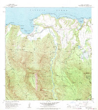
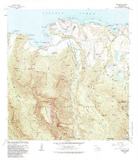
Hanalei sits along the northern shores of Kauai, where the massive Hanalei River flows from the interior peaks of the Halelea Forest Reserve into the wide waters of Hanalei Bay. This mid-century survey captures a landscape defined by coastal agriculture and early ranching, centered around the Princeville Ranch and the nearby Landing Strip. The map illustrates the sophisticated water management of the era, from the Kalihiwai Reservoir and various water tanks to a specific Fish Pond and numerous gaging stations monitoring the island's heavy rainfall. Inland, the terrain rises sharply toward the iconic Namolokama Mtn and Hihimanu, revealing a network of ridges and deep valleys cut by the Lumahai River and Kalihiwai River. Local life is anchored by recreational spaces like Waioli Beach Park and the rural dwellings at the Hanalei Homesteads.
Find a feature on this map
66 named features on this map. Tap any name to fly to it.
Don’t see what you’re looking for? This feature index may not catch every label — zoom into the map to look around manually.
Map Details
Editions of this 1963 Hanalei Map
2 editions found
Other maps of this area

1954 · Kauai
USGS Topo · 1:250,000

1963 · Anahola
USGS Topo · 1:24,000

1963 · Kapaa
USGS Topo · 1:24,000

1965 · Waimea Canyon
USGS Topo · 1:24,000

1965 · Haena
USGS Topo · 1:24,000

1965 · Waialeale
USGS Topo · 1:24,000

1967 · Kauai
USGS Topo · 1:250,000

1970 · Kauai
USGS Topo · 1:250,000

1978 · Kapaa
USGS Topo · 1:24,000
1983 · Hanalei
USGS Topo · 1:24,000