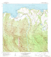
1963 Map of Hanalei
USGS Topo · Published 1971About this map
Hanalei serves as the focal point for this north shore Kauai landscape, situated where the Hanalei River meets the expansive Hanalei Bay. The settlement pattern reflects a mix of early agricultural development and early ranching, exemplified by the Princeville Ranch and the Hanalei Homesteads south of the town center. Local history is anchored by the Waioli Church and the activity around Hanalei Landing, while the interior remains dominated by the protected lands of the Halelea Forest Reserve. The drainage network is particularly intricate, with the Waioli Stream and Waipa Stream carving deep valleys between ridges like Mamalahoa. Along the coast, the presence of a Landing Strip and various Gaging Stations indicates the mid-century infrastructure supporting both the local community and environmental monitoring in this tropical environment.
Find a feature on this map
70 named features on this map. Tap any name to fly to it.
Don’t see what you’re looking for? This feature index may not catch every label — zoom into the map to look around manually.
Map Details
Editions of this 1963 Hanalei Map
2 editions found
Other maps of this area

1954 · Kauai
USGS Topo · 1:250,000

1963 · Anahola
USGS Topo · 1:24,000

1963 · Kapaa
USGS Topo · 1:24,000

1963 · Hanalei
USGS Topo · 1:24,000

1965 · Waimea Canyon
USGS Topo · 1:24,000

1965 · Haena
USGS Topo · 1:24,000

1965 · Waialeale
USGS Topo · 1:24,000

1967 · Kauai
USGS Topo · 1:250,000

1970 · Kauai
USGS Topo · 1:250,000

1978 · Kapaa
USGS Topo · 1:24,000