
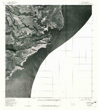
1978 Map of Kapaa
USGS Topo · Published 1981About this map
The coastal settlement of Kapaa and the community of Hanamaulu occupy the eastern shores of Kauai in this late 1970s orthophotoquad. This unique format combines aerial imagery with traditional topographic labels, offering a photographic record of the land use patterns along the Pacific Ocean. The imagery reveals a landscape shaped by water management and agriculture, centered on the Wailua River as it winds toward the coast. Farther inland, the Kapaia Reservoir and the drainage of Kealia Stream define the transition from the coastal plain to the more complex interior terrain. The dense pattern of fields and irrigation infrastructure visible from the air provides a clear view of the island's mid-century rural development and the established residential footprints of the eastern shore during this era.
Find a feature on this map
6 named features on this map. Tap any name to fly to it.
Don’t see what you’re looking for? This feature index may not catch every label — zoom into the map to look around manually.
Map Details
Editions of this 1978 Kapaa Map
This is the sole edition of this map. No revisions or reprints were ever made.
Other maps of this area

1954 · Kauai
USGS Topo · 1:250,000

1963 · Anahola
USGS Topo · 1:24,000

1963 · Lihue
USGS Topo · 1:24,000

1963 · Kapaa
USGS Topo · 1:24,000

1963 · Koloa
USGS Topo · 1:24,000

1963 · Hanalei
USGS Topo · 1:24,000

1965 · Waialeale
USGS Topo · 1:24,000

1967 · Kauai
USGS Topo · 1:250,000

1970 · Kauai
USGS Topo · 1:250,000
1978 · Lihue
USGS Topo · 1:24,000