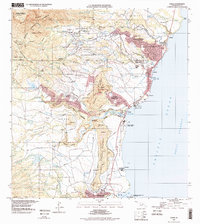
1996 Map of Kapaa
USGS Topo · Published 1998About this map
Kapaa and the surrounding homesteads of eastern Kauai are depicted here just before the turn of the millennium, showing a landscape where residential expansion meets protected forest reserves. The Wailua River serves as a central artery, leading inland toward Wailua Falls and the secluded Fern Grotto within the Wailua River State Park. Along the coast, the transition from industrial and plantation roots to recreation is evident at Ahukini Recreation Pier State Park and Ahukini Landing.
Find a feature on this map
75 named features on this map. Tap any name to fly to it.
Don’t see what you’re looking for? This feature index may not catch every label — zoom into the map to look around manually.
Map Details
Editions of this 1996 Kapaa Map
This is the sole edition of this map. No revisions or reprints were ever made.
Other maps of this area

1954 · Kauai
USGS Topo · 1:250,000

1963 · Anahola
USGS Topo · 1:24,000

1963 · Lihue
USGS Topo · 1:24,000

1963 · Kapaa
USGS Topo · 1:24,000

1963 · Koloa
USGS Topo · 1:24,000

1963 · Hanalei
USGS Topo · 1:24,000

1965 · Waialeale
USGS Topo · 1:24,000

1967 · Kauai
USGS Topo · 1:250,000

1970 · Kauai
USGS Topo · 1:250,000

1978 · Kapaa
USGS Topo · 1:24,000