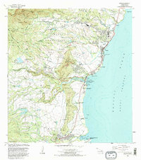
1983 Map of Kapaa
USGS Topo · Published 1984About this map
Sleeping Giant (Nonou Mountain) dominates the center of this coastal landscape, separating the interior Wailua Homesteads from the developed shoreline of Kapaa and Waipouli. The coastal region is a complex mix of ancient Hawaiian cultural sites and modern development. Several significant heiau, including Poliahu Heiau, Malae Heiau, and the Hauola City of Refuge, are preserved alongside the Wailua River, reflecting the area's deep historical importance.
Find a feature on this map
78 named features on this map. Tap any name to fly to it.
Don’t see what you’re looking for? This feature index may not catch every label — zoom into the map to look around manually.
Map Details
Editions of this 1983 Kapaa Map
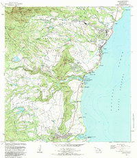
2 editions found
Other maps of this area

1954 · Kauai
USGS Topo · 1:250,000

1963 · Anahola
USGS Topo · 1:24,000

1963 · Lihue
USGS Topo · 1:24,000

1963 · Kapaa
USGS Topo · 1:24,000

1963 · Koloa
USGS Topo · 1:24,000

1963 · Hanalei
USGS Topo · 1:24,000

1965 · Waialeale
USGS Topo · 1:24,000

1967 · Kauai
USGS Topo · 1:250,000

1970 · Kauai
USGS Topo · 1:250,000

1978 · Kapaa
USGS Topo · 1:24,000