
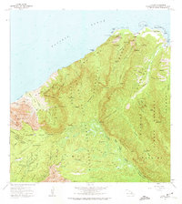
1965 Map of Haena
USGS Topo · Published 1967About this map
Ka Ulu a Paoa Heiau and the Lohiaus House (Site) anchor the coastal culture of Kauai's North Shore in the mid-1960s. This survey illustrates the transition from the ancient sites and natural wonders like Haena Dry Cave to modern infrastructure such as the Powerhouse on the Wainiha River. The coastal settlements of Haena and Wainiha are shown at a time when the Kalalau Trail provided the primary access along the cliffs of the Na Pali Coast State Park. Inland, the high-altitude landscape of the Na Pali-Kona Forest Reserve is defined by the Kokee Air Force Station and Kokee Lodge. The map traces the intricate drainage of the Alakai Swamp and numerous hanging waterfalls, including the spectacular Hanakapiai Falls and Moloa Falls, providing a record of the island's hydrological network before the era of widespread development.
Find a feature on this map
116 named features on this map. Tap any name to fly to it.
Don’t see what you’re looking for? This feature index may not catch every label — zoom into the map to look around manually.
Map Details
Editions of this 1965 Haena Map
2 editions found
Other maps of this area

1954 · Kauai
USGS Topo · 1:250,000

1963 · Hanalei
USGS Topo · 1:24,000

1965 · Waimea Canyon
USGS Topo · 1:24,000

1965 · Makaha Point
USGS Topo · 1:24,000

1965 · Waialeale
USGS Topo · 1:24,000

1967 · Kauai
USGS Topo · 1:250,000

1970 · Kauai
USGS Topo · 1:250,000
1983 · Hanalei
USGS Topo · 1:24,000
1983 · Haena
USGS Topo · 1:24,000
1983 · Waialeale
USGS Topo · 1:24,000