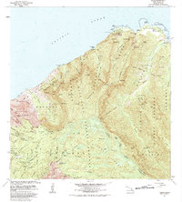
1983 Map of Haena
USGS Topo · Published 1983About this map
The coastal settlement of Haena and the dramatic North Shore of Kauai are documented here during the early 1980s. This survey illustrates the intricate relationship between traditional Hawaiian sites and modern infrastructure, featuring Ka Ulu a Paoa Heiau and the Lohiau's House (Site) near the Haena Dry Cave and Waikanaloa Wet Cave. The map tracks the interior transition from the beach at Kee Beach to the high-elevation Alakai Swamp Preserve. Significant land use includes the Kokee Air Force Station on the ridge and established recreation spots like Camp Sloggett (YWCA) and Kawaikoi Camp. The landscape is defined by the deep valleys of the Wainiha River and Hanakapiai Stream, which cut through the Na Pali-Kona Forest Reserve toward the sea.
Find a feature on this map
106 named features on this map. Tap any name to fly to it.
Don’t see what you’re looking for? This feature index may not catch every label — zoom into the map to look around manually.
Map Details
Editions of this 1983 Haena Map
This is the sole edition of this map. No revisions or reprints were ever made.
Other maps of this area

1954 · Kauai
USGS Topo · 1:250,000

1963 · Hanalei
USGS Topo · 1:24,000

1965 · Waimea Canyon
USGS Topo · 1:24,000

1965 · Haena
USGS Topo · 1:24,000

1965 · Makaha Point
USGS Topo · 1:24,000

1965 · Waialeale
USGS Topo · 1:24,000

1967 · Kauai
USGS Topo · 1:250,000

1970 · Kauai
USGS Topo · 1:250,000
1983 · Hanalei
USGS Topo · 1:24,000
1983 · Waialeale
USGS Topo · 1:24,000