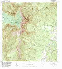
1983 Map of Waialeale
USGS Topo · Published 1984About this map
The massive volcanic peak of Waialeale and the adjacent Kawaikini summit dominate this interior Kauai landscape, serving as the central watershed for the island. In this 1983 edition, the intricate hydrologic network is visible through the many streams radiating from the high peaks, including the Hanalei River and the North Fork Wailua River. Of particular interest for researchers of island infrastructure is the series of industrial water features, such as the Upper Powerhouse, Lower Powerhouse, and various aqueduct and ditch systems that divert water for power and agriculture. The map also delineates the transition from the high-elevation Alakai Swamp to the dramatic depths of Olokele Canyon. This survey captures the remote interior during a period of ongoing hydrological management, evidenced by the numerous gaging stations and rain gages positioned across the mountains.
Find a feature on this map
83 named features on this map. Tap any name to fly to it.
Don’t see what you’re looking for? This feature index may not catch every label — zoom into the map to look around manually.
Map Details
Editions of this 1983 Waialeale Map
2 editions found
Other maps of this area

1954 · Kauai
USGS Topo · 1:250,000

1963 · Anahola
USGS Topo · 1:24,000

1963 · Lihue
USGS Topo · 1:24,000

1963 · Hanapepe
USGS Topo · 1:24,000

1963 · Kapaa
USGS Topo · 1:24,000

1963 · Koloa
USGS Topo · 1:24,000

1963 · Hanalei
USGS Topo · 1:24,000

1965 · Waimea Canyon
USGS Topo · 1:24,000

1965 · Haena
USGS Topo · 1:24,000

1965 · Waialeale
USGS Topo · 1:24,000