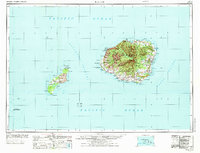
1970 Map of Kauai
USGS Topo · Published 1974About this map
Kauai and Niihau Island appear here during a period of established conservation and specialized military use. The interior of the Garden Isle is dominated by massive protected areas like the Lihue-Koloa Forest Reserve and the Na Pali-Kona Forest Reserve, framing the dramatic Waimea Canyon. Along the western coast, the Pacific Missile Range Facility at PMRF Barking Sands highlights the island's strategic role during the Cold War era.
Find a feature on this map
87 named features on this map. Tap any name to fly to it.
Don’t see what you’re looking for? This feature index may not catch every label — zoom into the map to look around manually.
Map Details
Editions of this 1970 Kauai Map
2 editions found

Other maps of this area

1954 · Oahu
USGS Topo · 1:250,000

1954 · Kauai
USGS Topo · 1:250,000

1961 · Oahu
USGS Topo · 1:250,000

1963 · Anahola
USGS Topo · 1:24,000

1963 · Lihue
USGS Topo · 1:24,000

1963 · Kekaha
USGS Topo · 1:24,000

1963 · Hanapepe
USGS Topo · 1:24,000

1963 · Kapaa
USGS Topo · 1:24,000

1963 · Koloa
USGS Topo · 1:24,000

1963 · Hanalei
USGS Topo · 1:24,000