Old Maps of Kilauea, Hawaii for Academic Research
Study the evolution of Kilauea with 10 high-resolution historic maps. Whether you're teaching, researching, or modeling changes in land use, these maps provide essential visual documentation of urban, environmental, and geographic change.
- Analyze long-term change: Track patterns in development, transportation, and natural features.
- Ideal for environmental or urban studies: Support academic projects with primary historical map data.
- Use in the classroom or lab: Educators and researchers rely on these maps to bring historical context to life.
These maps are a powerful tool for teaching, research, and visualizing how Kilauea has changed over the decades.
Kilauea, HI maps
(10)- 1954 Map of Kauai
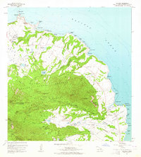
 1954 Kauai1954 Print · USGSKauai and Niihau are shown during a period of transition in the early fifties as plantation-era infrastructure began to change. Researchers can trace the Kilauea Sugar Plantation Railroad, the Anahola Settlement, and remote sites on Niihau like Puuwai.
 - 1963 Map of Anahola, 1964 Print
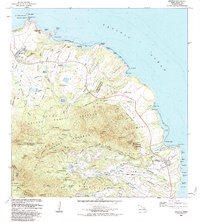
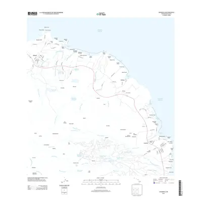
 1963 Anahola1964 Print · USGSNortheastern Kauai in the early sixties shows a landscape defined by plantation-era water engineering and traditional settlements. Trace local history through the Hawaiian Homes tracts and Anahola village, or locate the old Kilauea Quarry and Spalding Monument.2 unique versions available
 - 1967 Map of Kauai
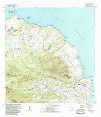
 1967 Kauai1967 Print · USGSThe Garden Isle and Niihau are shown here in the mid-sixties, capturing the island's transition from plantation roots to a more modern infrastructure. Genealogists can trace family connections in Moloaa Settlement or find coastal landmarks like Nonopapa and Kilauea Point Light.
 - 1970 Map of Kauai, 1974 Print
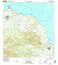
 1970 Kauai1974 Print · USGSThe islands of Kauai and Niihau are shown during the early 1970s, capturing the balance between military expansion and preserved wilderness. Researchers can trace the layout of Niihau's elusive villages like Puwai or explore Kauai's industrial landscape at Koloa Mill and Port Allen.2 unique versions available
 - 1983 Map of Anahola, 1984 Print
 1983 Anahola1984 Print · USGSKauai's northeast coast in the early eighties shows a landscape of vital water infrastructure and agricultural heritage. Researchers can trace the Koolau Ditch system, locate the Kapinao Heiau, and explore the settled Hawaiian Homes tracts near Anahola.
 - 1984 Map of Anahola, 1986 Print
 1984 Anahola1986 Print · USGSThe windward coast of Kauai is captured here in the mid-eighties, showing the intersection of traditional Hawaiian land divisions and modern infrastructure. Genealogists and historians can trace the foundations of Kilauea and Anahola, find the Kilauea Sch, and locate cultural sites like Kapinao Heiau.
 - 1996 Map of Anahola, 1998 Print
 1996 Anahola1998 Print · USGSThe northern shore of Kauai in the late twentieth century shows a landscape of deep-rooted land divisions and vital water systems. Genealogists and researchers can trace family lands in Anahola and the Hawaiian Homesteads or locate landmarks like Kilauea Point Light Station.
 - 2013 Map of Anahola, 2013 Print
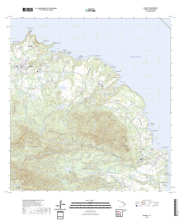
 2013 Anahola2013 Print · USGSCovers Kilauea, including Anahola, Kauai County, and other nearby areas
 - 2017 Map of Anahola, 2017 Print
 2017 Anahola2017 Print · USGSCovers Kilauea, including Anahola, Kauai County, and other nearby areas
 - 2024 Map of Anahola, 2024 Print
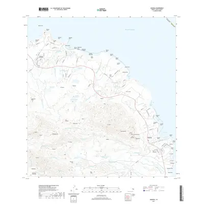
 2024 Anahola2024 Print · USGSCoastal Kauai is mapped in the modern era, revealing a landscape where traditional settlements and complex irrigation networks meet the sea. Researchers can trace local heritage through sites like the Anahola Hawaiian Cem and the Kanehu Reservoir Number One.
End of results
Showing maps 1-10 of 10
Frequently asked questions
- What are the different types of historical maps available for Kilauea?
- What is the oldest map of Kilauea?
- Where can I purchase historical maps of Kilauea for my home or office?
- Where can I download high-res historical maps of Kilauea?
- Are there historical topographic maps available for Kilauea?
- Is there historical aerial imagery available for Kilauea?
- Where are historical maps of Kilauea sourced from?