Old Maps of Keawakapu, Maui County for Hiking & Exploration
Hike through history with 9 historic maps of Keawakapu. Explore old trails, ghost towns, and forgotten backroads — perfect for outdoor adventurers and local explorers.
- Rediscover forgotten places: Map out old mining camps, roads, and footpaths that no longer exist on modern maps.
- Layer with modern tools: Combine with LiDAR or satellite views to plan hikes through historical terrain.
- Made for exploration: Popular among hikers, overlanders, and local history lovers.
Use these maps to find adventure and explore the hidden past of Keawakapu.
Keawakapu, Maui County maps
(9)- 1954 Map of Maui
 1954 Maui1954 Print · USGSThe central Hawaiian Islands are shown during the mid-fifties, detailing the agricultural and coastal infrastructure of Maui, Lanai, and Molokai. Genealogists and researchers can trace plantation-era history at Haliimaile Camp, locate old harbors like Kaumalapau Harbor, or explore the early bounds of Haleakala National Park.
 - 1954 Map of Makena, 1956 Print
 1954 Makena1956 Print · USGSCoastal Maui in the mid-fifties reveals a landscape of ranching outposts, traditional land divisions, and remote shorelines. Genealogists and historians can trace family sites at Ulupalakua Ranch, Keawalai Church, and the Ulupalakua School.3 unique versions available
 - 1966 Map of Maui
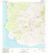
 1966 Maui1966 Print · USGSThe central islands of Maui, Molokai, Lanai, and Kahoolawe are shown in detail during the mid-1960s as plantation life and early tourism coexisted. Genealogists and researchers can trace family locations in old plantation towns like Puunene, the harbor at Lahaina, and Hoolehua on Molokai.
 - 1974 Map of Maui
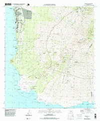
 1974 Maui1974 Print · USGSMid-century Hawaii is captured here through the detailed landscapes of Maui, Molokai, Lanai, and Kahoolawe as they appeared in the 1970s. Researchers can trace the layout of island hubs like Lahaina and Lanai City alongside remote landmarks like Wainapanapa Cave.2 unique versions available
 - 1983 Map of Makena, 1984 Print
 1983 Makena1984 Print · USGSMaui's southwestern coast and volcanic uplands are captured here during the early eighties development boom. Researchers can trace land grants in the Kanaio Homesteads, locate the Keawalai Church at Makena, or explore the protected shoreline of La Perouse Bay.
 - 1995 Map of Makena, 1999 Print
 1995 Makena1999 Print · USGSCoastal Maui and the slopes of Haleakalā are captured here in the mid-1990s, revealing a landscape of volcanic fields and historic homesteads. Genealogists and researchers can locate Kanaio Church, the Ulupalakua Cemetery, and family lands in the Kanaio Homesteads.
 - 2013 Map of Makena, 2013 Print
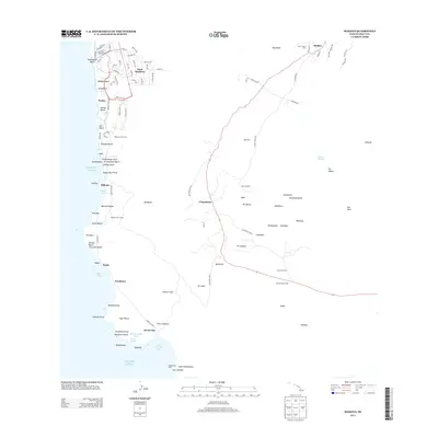 2013 Makena2013 Print · USGSCovers Keawakapu, including Wailea, Kanahena, and other nearby areas
 - 2017 Map of Makena, 2017 Print
 2017 Makena2017 Print · USGSCovers Keawakapu, including Wailea, Kanahena, and other nearby areas
 - 2024 Map of Makena, 2024 Print
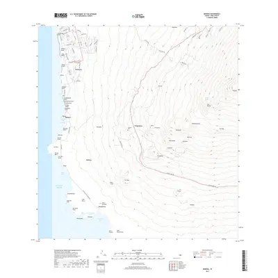
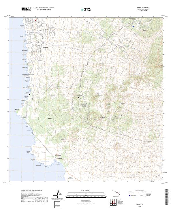 2024 Makena2024 Print · USGSCoastal Maui in the contemporary era reveals a mix of resort development and deep-rooted community history on the slopes of Haleakalā. Trace family sites at Keawala'i Congregational Church Cem or follow the coast to the lava fields of Cape Kina'u.
End of results
Showing maps 1-9 of 9
Frequently asked questions
- What are the different types of historical maps available for Keawakapu?
- What is the oldest map of Keawakapu?
- Where can I purchase historical maps of Keawakapu for my home or office?
- Where can I download high-res historical maps of Keawakapu?
- Are there historical topographic maps available for Keawakapu?
- Is there historical aerial imagery available for Keawakapu?
- Where are historical maps of Keawakapu sourced from?