1900s (20th Century) Maps of Keomuku, Hawaii
Explore 7 historic maps of Keomuku from the 1900s (20th Century). These maps offer a rare glimpse into what life looked like during the 1900s — showing old roads, neighborhoods, homes, and landmarks that have changed or disappeared over time.
Whether you're researching your family's past, planning a metal detecting trip, or studying how Keomuku's landscape evolved across the 1900s, these high-resolution maps are a powerful tool for exploring the history of this region.
- Focus on a specific era: All maps on this page are from the 1900s, giving you a focused view of this time period.
- See what’s changed: Compare century-old streets, trails, and buildings to today's modern landscape using overlays and satellite layers.
- Research with precision: Use these maps for genealogy, historical research, land use analysis, or educational projects.
- View, download, or print: Maps are fully viewable online in high resolution, and can be downloaded or printed for your own records.
Start exploring Keomuku's history through authentic maps from the 1900s. This is your window into the past.
Keomuku, HI maps
(7)- 1923 Map of Island of Lanai
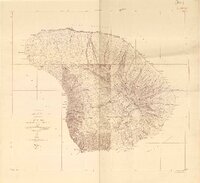 1923 Island of Lanai1923 Print · USGSLanai in the early twenties reveals a landscape of deep gulches and emerging inland settlement just as the pineapple era began. Trace coastal landmarks like Keomuku PO and Halepalaoa Landing or explore the harbor at Kaumalapau Harbor.2 unique versions available
 - 1925 Map of Island of Lanai
 1925 Island of Lanai1925 Print · USGSLanai is mapped here during the mid-twenties, showing the island's transition into a centralized plantation economy. Genealogists and historians can trace the early layout of Lanai City, the coastal Keomuku P O, and the ancient Kaa Fishpond.
 - 1954 Map of Maui
 1954 Maui1954 Print · USGSThe central Hawaiian Islands are shown during the mid-fifties, detailing the agricultural and coastal infrastructure of Maui, Lanai, and Molokai. Genealogists and researchers can trace plantation-era history at Haliimaile Camp, locate old harbors like Kaumalapau Harbor, or explore the early bounds of Haleakala National Park.
 - 1966 Map of Maui
 1966 Maui1966 Print · USGSThe central islands of Maui, Molokai, Lanai, and Kahoolawe are shown in detail during the mid-1960s as plantation life and early tourism coexisted. Genealogists and researchers can trace family locations in old plantation towns like Puunene, the harbor at Lahaina, and Hoolehua on Molokai.
 - 1974 Map of Maui
 1974 Maui1974 Print · USGSMid-century Hawaii is captured here through the detailed landscapes of Maui, Molokai, Lanai, and Kahoolawe as they appeared in the 1970s. Researchers can trace the layout of island hubs like Lahaina and Lanai City alongside remote landmarks like Wainapanapa Cave.2 unique versions available
 - 1984 Map of Lanai North
 1984 Lanai North1984 Print · USGSThe northern coast of Lanai in the mid-1980s reveals a landscape of isolated beaches and deep gulches. Researchers can trace the maritime history of Shipwreck Beach and locate the inland settlements of Lanai City and Koele near the island's heart.
 - 1992 Map of Haalelepaakai, 2000 Print
 1992 Haalelepaakai2000 Print · USGSLana'i City and the surrounding highlands are captured here in the early nineties as the island's landscape transitioned toward modern conservation. Researchers can trace historical sites from the Shrine (Buddhist Cem) to coastal Naha Fishpond and Halepalaoa Landing.
End of results
Showing maps 1-7 of 7
Top cities near Keomuku
Frequently asked questions
- What are the different types of historical maps available for Keomuku?
- What is the oldest map of Keomuku?
- Where can I purchase historical maps of Keomuku for my home or office?
- Where can I download high-res historical maps of Keomuku?
- Are there historical topographic maps available for Keomuku?
- Is there historical aerial imagery available for Keomuku?
- Where are historical maps of Keomuku sourced from?