Old Maps of Pu‘unoa, Lahaina for Academic Research
Study the evolution of Pu‘unoa with 9 high-resolution historic maps. Whether you're teaching, researching, or modeling changes in land use, these maps provide essential visual documentation of urban, environmental, and geographic change.
- Analyze long-term change: Track patterns in development, transportation, and natural features.
- Ideal for environmental or urban studies: Support academic projects with primary historical map data.
- Use in the classroom or lab: Educators and researchers rely on these maps to bring historical context to life.
These maps are a powerful tool for teaching, research, and visualizing how Pu‘unoa has changed over the decades.
Pu‘unoa, Lahaina maps
(9)- 1954 Map of Maui
 1954 Maui1954 Print · USGSThe central Hawaiian Islands are shown during the mid-fifties, detailing the agricultural and coastal infrastructure of Maui, Lanai, and Molokai. Genealogists and researchers can trace plantation-era history at Haliimaile Camp, locate old harbors like Kaumalapau Harbor, or explore the early bounds of Haleakala National Park.
 - 1956 Map of Lahaina, 1959 Print
 1956 Lahaina1959 Print · USGSCoastal Maui in the mid-fifties is defined by its bustling sugar and pineapple industries and complex water networks. Genealogists and historians can trace the foundations of Lahaina through the Sugar Mill, Hanakaöo Cemetery, and Lahainaluna High School.2 unique versions available
 - 1966 Map of Maui
 1966 Maui1966 Print · USGSThe central islands of Maui, Molokai, Lanai, and Kahoolawe are shown in detail during the mid-1960s as plantation life and early tourism coexisted. Genealogists and researchers can trace family locations in old plantation towns like Puunene, the harbor at Lahaina, and Hoolehua on Molokai.
 - 1974 Map of Maui
 1974 Maui1974 Print · USGSMid-century Hawaii is captured here through the detailed landscapes of Maui, Molokai, Lanai, and Kahoolawe as they appeared in the 1970s. Researchers can trace the layout of island hubs like Lahaina and Lanai City alongside remote landmarks like Wainapanapa Cave.2 unique versions available
 - 1978 Map of Lahaina, 1981 Print
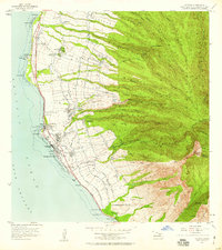
 1978 Lahaina1981 Print · USGSThe West Maui coast comes into sharp focus during the late 1970s, capturing the early modern footprint of the islands. Trace the layout of Lahaina against the agricultural grid and high landmarks like Lihau and Puu Mahanalua Nui.
 - 1992 Map of Lahaina, 1999 Print
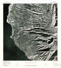
 1992 Lahaina1999 Print · USGSThe West Maui coastline in the early nineties showcases the transition from agricultural infrastructure to coastal development. Researchers can trace land divisions and local landmarks like Mala Wharf, the Hanakaoo Cemetery, and the Mill Stack near Lahaina.
 - 2013 Map of Lahaina, 2013 Print
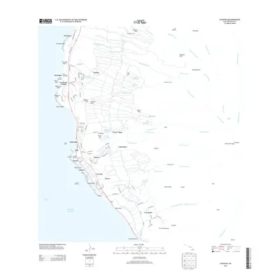 2013 Lahaina2013 Print · USGSCovers Pu‘unoa, including Lahaina, Honokowai, and other nearby areas
 - 2017 Map of Lahaina, 2017 Print
 2017 Lahaina2017 Print · USGSCovers Pu‘unoa, including Lahaina, Honokowai, and other nearby areas
 - 2024 Map of Lahaina, 2024 Print
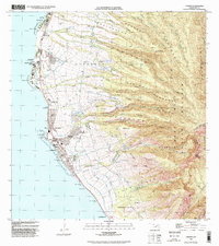
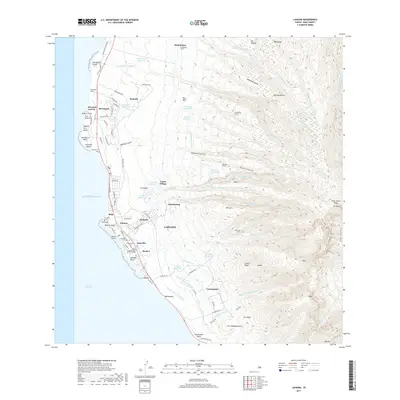
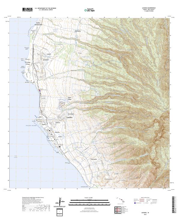 2024 Lahaina2024 Print · USGSThe West Maui coast comes into focus in this contemporary survey, showing the transition from the bustling streets of Lahaina to the high slopes of Puukukui. Genealogists can trace family heritage through local sites like Hale Aloha Cem and Lahainaluna.
End of results
Showing maps 1-9 of 9
Frequently asked questions
- What are the different types of historical maps available for Pu‘unoa?
- What is the oldest map of Pu‘unoa?
- Where can I purchase historical maps of Pu‘unoa for my home or office?
- Where can I download high-res historical maps of Pu‘unoa?
- Are there historical topographic maps available for Pu‘unoa?
- Is there historical aerial imagery available for Pu‘unoa?
- Where are historical maps of Pu‘unoa sourced from?