Old Maps of Regina, Idaho for Genealogy
Trace your family roots with 13 historic maps of Regina. These high-res maps reveal old neighborhoods, homesites, landmarks, and streets — helping you uncover where your ancestors lived and how the area evolved over time.
- Explore historic neighborhoods: Identify where your relatives may have lived in the 1800s or 1900s.
- Compare maps over time: Trace the changes in streets, buildings, and landmarks for multi-generational research.
- Perfect for genealogy & ancestry research: Used by family historians and researchers to map out lineage and migration.
These maps are an incredible resource for exploring your personal connection to Regina's past.
Regina, ID maps
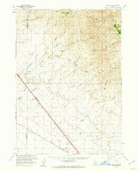
(13)- 1892 Map of Mountain Home
 1892 Mountain Home1892 Print · USGSElmore County's high desert and foothills are captured in the late nineteenth century as the railroad begins to reshape the Idaho territory. Genealogists and historians can trace early transit routes through Mountain Home and Cleft or follow the Boise River near Smith Prairie.
 - 1893 Map of Mountain Home
 1893 Mountain Home1893 Print · USGSElmore County during the frontier era of the late nineteenth century centers on the vital rail connection through the high desert. Genealogists and historians can trace the early layout of Mountain Home and Cleft along the Oregon Short Line Union Pacific Railroad.4 unique versions available
 - 1955 Map of Hailey, 1968 Print
 1955 Hailey1968 Print · USGSCentral Idaho in the mid-fifties reveals a landscape transitioning from deep-rooted silver mining to a burgeoning outdoor economy. Researchers can trace the legacy of the Union Pacific line, the remote Triumph Mine, and original airfield layouts at Mountain Home Air Force Base.4 unique versions available
 - 1959 Map of Hailey
 1959 Hailey1959 Print · USGSThe Sawtooth range and high desert plains of Southern Idaho are captured here during a period of mining and military growth. Genealogists and historians can locate mining sites like Triumph Mine, early settlements such as Idaho City, and the Mountain Home Air Force Base.2 unique versions available
 - 1960 Map of Mayfield, 1962 Print
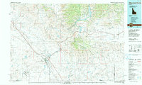
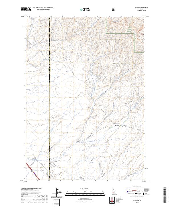
 1960 Mayfield1962 Print · USGSElmore County's ranching and rail landscape is preserved here during the early sixties, showing the transition from the high desert to the national forest. Researchers can locate the Regina (Site) and trace the Union Pacific railroad past historic sites like Seven L Ranch and the local cemetery.3 unique versions available
 - 1962 Map of Hailey
 1962 Hailey1962 Print · USGSCentral Idaho in the early sixties showcases a landscape of high-altitude ranching and mining at the foot of the Sawtooth Mountains. Genealogists and historians can trace the rail-and-river economy through the Union Pacific Railroad corridor and explore old mining sites like the Triumph Mine or Silver Star Queens Mine.
 - 1990 Map of Mountain Home, 1991 Print
 1990 Mountain Home1991 Print · USGSElmore County underwent significant expansion in the 1990s as military and transit networks matured between the mountains and the Snake River Plain. Researchers can trace the legacy of regional development through sites like Reclamation Village, the Union Pacific line, and Mountain Home Air Force Base.2 unique versions available
 - 1990 Map of Mayfield, 1991 Print
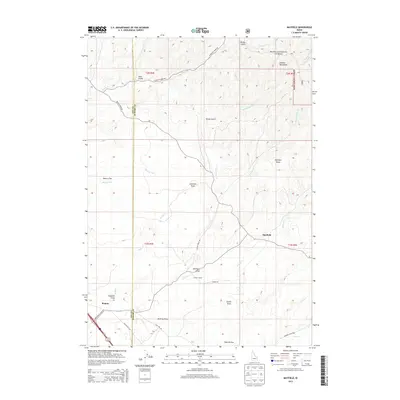
 1990 Mayfield1991 Print · USGSThe high Idaho desert meets the foothills of the Danskin Mountains in the 1990s as modern utility lines cross over old ranching grounds. Genealogists and local historians can trace the small settlements of Mayfield and Regina or locate the rural cemetery near Indian Creek.
 - 2011 Map of Mayfield, 2011 Print
 2011 Mayfield2011 Print · USGSCovers Regina, including Ada County, Elmore County, and other nearby areas
 - 2013 Map of Mayfield, 2013 Print
 2013 Mayfield2013 Print · USGSCovers Regina, including Ada County, Elmore County, and other nearby areas
 - 2017 Map of Mayfield, 2017 Print
 2017 Mayfield2017 Print · USGSCovers Regina, including Ada County, Elmore County, and other nearby areas
 - 2020 Map of Mayfield, 2020 Print
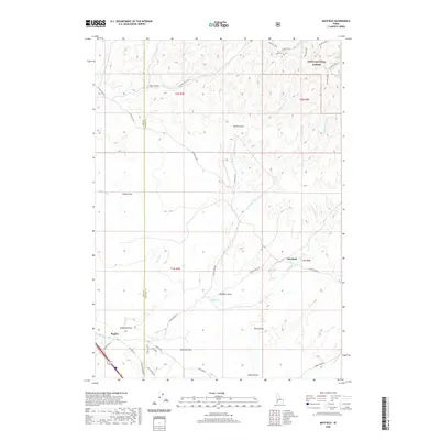 2020 Mayfield2020 Print · USGSCovers Regina, including Ada County, Elmore County, and other nearby areas
 - 2023 Map of Mayfield, 2023 Print
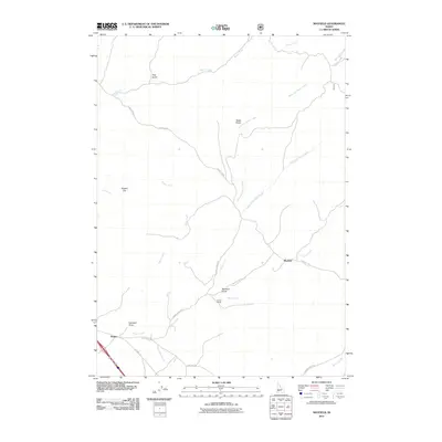
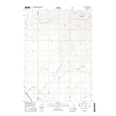
 2023 Mayfield2023 Print · USGSThe high desert interface between Ada and Elmore counties is captured here in the early 2020s, showing the transition from sagebrush flats to national forest. Researchers can trace local history at Mayfield and Regina, or locate the Mayfield Cem and old routes like Old Hwy 30.
End of results
Showing maps 1-13 of 13
Top cities near Regina
Frequently asked questions
- What are the different types of historical maps available for Regina?
- What is the oldest map of Regina?
- Where can I purchase historical maps of Regina for my home or office?
- Where can I download high-res historical maps of Regina?
- Are there historical topographic maps available for Regina?
- Is there historical aerial imagery available for Regina?
- Where are historical maps of Regina sourced from?