Old Maps of Orvin, Bonneville County for Academic Research
Study the evolution of Orvin with 11 high-resolution historic maps. Whether you're teaching, researching, or modeling changes in land use, these maps provide essential visual documentation of urban, environmental, and geographic change.
- Analyze long-term change: Track patterns in development, transportation, and natural features.
- Ideal for environmental or urban studies: Support academic projects with primary historical map data.
- Use in the classroom or lab: Educators and researchers rely on these maps to bring historical context to life.
These maps are a powerful tool for teaching, research, and visualizing how Orvin has changed over the decades.
Orvin, Bonneville County maps
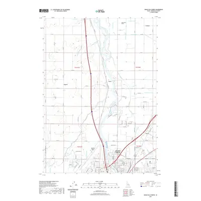
(11)- 1948 Map of Idaho Falls North, 1962 Print
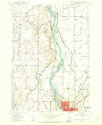 1948 Idaho Falls North1962 Print · USGSIdaho Falls and the surrounding Bonneville County farmlands are seen here just after the war, when irrigation transformed the valley. Genealogists can locate family landmarks like the Coltman Ward Church, St Leon Grange, and rural sites like Payne and Orvin.4 unique versions available
 - 1949 Map of Idaho Falls North
 1949 Idaho Falls North1949 Print · USGSNorth of Idaho Falls in the late 1940s, the Snake River powered a growing agricultural and transit hub. Researchers can trace the development of rural life through the Coltman Ward Church, Sage Creek School, and the vast network of the Great Western Canal.
 - 1949 Map of Roberts, 1959 Print
 1949 Roberts1959 Print · USGSThe Upper Snake River Plain comes alive in the late 1940s, showing a landscape defined by industrial irrigation and rail-side settlements. Genealogists and historians can trace the foundations of local communities at Lewisville Cem, Grant Sch, and Oakland Valley.
 - 1955 Map of Idaho Falls, 1963 Print
 1955 Idaho Falls1963 Print · USGSThe Snake River Plain and its surrounding volcanic peaks are captured in the late fifties, showing the region's unique mix of nuclear research and high-desert ranching. Trace the industrial footprint of the National Reactor Testing Station or find old mining sites like Empire Mine.5 unique versions available
 - 1958 Map of Idaho Falls
 1958 Idaho Falls1958 Print · USGSEastern Idaho in the late fifties showcases the rapid expansion of agricultural and scientific outposts across its volcanic plains. Researchers can locate remote sites like Atomic City, mineral interests at White Knob Mine, and the cultural grounds of St Marys Mission.2 unique versions available
 - 1980 Map of Circular Butte
 1980 Circular Butte1980 Print · USGSEastern Idaho at the start of the eighties shows a landscape of federal research and agricultural expansion. Trace the growth of nuclear history at the Idaho National Engineering Laboratory and early settlements like Monteview, Terreton, and Sage Junction.
 - 2010 Map of Idaho Falls North, 2010 Print
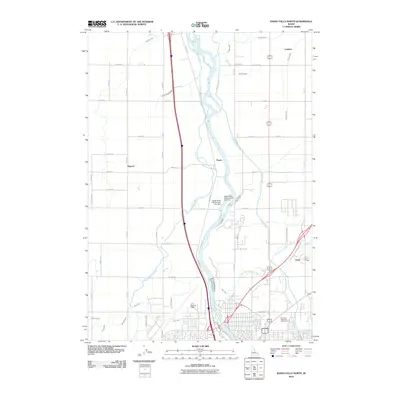 2010 Idaho Falls North2010 Print · USGSCovers Orvin, including Idaho Falls, North Idaho Falls, and other nearby areas
 - 2013 Map of Idaho Falls North, 2013 Print
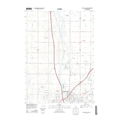 2013 Idaho Falls North2013 Print · USGSCovers Orvin, including Idaho Falls, North Idaho Falls, and other nearby areas
 - 2017 Map of Idaho Falls North, 2017 Print
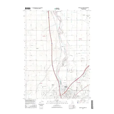 2017 Idaho Falls North2017 Print · USGSCovers Orvin, including Idaho Falls, North Idaho Falls, and other nearby areas
 - 2020 Map of Idaho Falls North, 2020 Print
 2020 Idaho Falls North2020 Print · USGSCovers Orvin, including Idaho Falls, North Idaho Falls, and other nearby areas
 - 2023 Map of Idaho Falls North, 2023 Print
 2023 Idaho Falls North2023 Print · USGSNorth of Idaho Falls in the early 2020s, the landscape remains a testament to the region's irrigation history. Trace the intricate canal network from the Snake River to rural hubs like Coltman, Osgood, and the Idaho Falls Regional Airport.
End of results
Showing maps 1-11 of 11
Frequently asked questions
- What are the different types of historical maps available for Orvin?
- What is the oldest map of Orvin?
- Where can I purchase historical maps of Orvin for my home or office?
- Where can I download high-res historical maps of Orvin?
- Are there historical topographic maps available for Orvin?
- Is there historical aerial imagery available for Orvin?
- Where are historical maps of Orvin sourced from?