Old Maps of Syringa, Idaho
Explore 13 old maps of Syringa, spanning from 1924 to today. These high-resolution historic maps reveal how streets, neighborhoods, landmarks, and natural features evolved over time — perfect for genealogy, metal detecting, research, and local history exploration.
What you can do with these maps:
- See how Syringa changed over time: Compare historical maps to modern-day views to trace roads, homesites, rail lines & more.
- View detailed metadata: Each map includes creators, publishers, year, scale, and archive source.
- Overlay maps with satellite & LiDAR: Visualize the past alongside modern tools to explore terrain & human change.
- Trusted historical sources: Maps sourced from the USGS, Library of Congress, and other archives.
- Access maps your way: View online, download high-res files, or order prints for personal or research use.
Start exploring old maps of Syringa to uncover forgotten places, hidden landmarks, and the deep history beneath your feet.
Syringa, ID maps
(13)- 1924 Map of Weippe
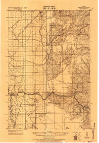 1924 Weippe1924 Print · USGSNorth-central Idaho in the early 1920s is captured here, from the prairie settlements to the deep river canyons of the Clearwater. Genealogists can trace early homesteaders like G.W. Ford or locate long-gone post offices at Tahoe and Lowell.
 - 1956 Map of Hamilton, 1970 Print
 1956 Hamilton1970 Print · USGSThe Bitterroot Valley and surrounding high country are captured here during the mid-fifties, showing the region's transition into a modern forest-and-rail hub. Genealogists and historians can trace family-named sites and early infrastructure from Fort Missoula to towns like Stevensville and Darby along the Northern Pacific line.2 unique versions available
 - 1959 Map of Hamilton
 1959 Hamilton1959 Print · USGSThe Bitterroot Valley and surrounding wilderness are captured in the late fifties, showing a landscape defined by forestry and river-based settlement. Researchers can trace the Lolo Trail or locate historical points like Fort Missoula and the Fred Burr Reservoir.
 - 1960 Map of Hamilton
 1960 Hamilton1960 Print · USGSThe Bitterroot Valley and surrounding high country are captured here during the late fifties, showing the region's transition into a modern forest and rail corridor. Researchers can trace the path of the Northern Pacific through Missoula or locate landmarks like Fort Missoula and Lake Como.
 - 1964 Map of Hamilton
 1964 Hamilton1964 Print · USGSThe Bitterroot Valley and its surrounding peaks are captured in detail during the mid-1960s, showing the early infrastructure of the Northern Rockies. Genealogists and historians can trace family roots in Hamilton and Stevensville or follow the historic Lolo Trail and Nez Perce Trail.
 - 1966 Map of Syringa, 1968 Print
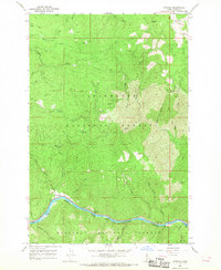 1966 Syringa1968 Print · USGSThe Clearwater River valley in the mid-1960s reveals a rugged landscape of forestry work centers and river navigation. Genealogists and researchers can locate the settlement of Syringa, the Smith Mine, and historic landmarks like the Smith Creek Work Center.2 unique versions available
 - 1981 Map of Kooskia
 1981 Kooskia1981 Print · USGSNorthern Idaho in the early eighties shows a landscape of deep river canyons and high forest ridges. Researchers can locate remote mining sites like Hemlock Mine, the mountain settlement of Lowell, and the Kooskia National Fish Hatchery.
 - 1994 Map of Syringa, 1997 Print
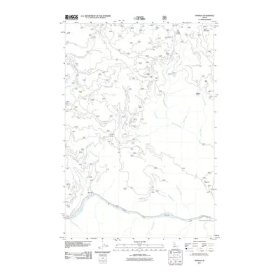
 1994 Syringa1997 Print · USGSThe confluence of the Lochsa River and Selway River is frozen in time in the 1990s as they form the Clearwater. Trace the river's path past the Syringa settlement, through Indian Rapids, and along the historic Pierce Tochsa Ranger Trail.
 - 2011 Map of Syringa, 2011 Print
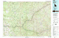
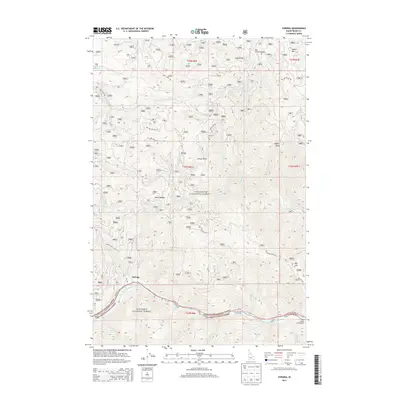
 2011 Syringa2011 Print · USGSCovers Syringa, including Idaho County, United States, and other nearby areas
 - 2013 Map of Syringa, 2013 Print
 2013 Syringa2013 Print · USGSCovers Syringa, including Idaho County, United States, and other nearby areas
 - 2017 Map of Syringa, 2017 Print
 2017 Syringa2017 Print · USGSCovers Syringa, including Idaho County, United States, and other nearby areas
 - 2020 Map of Syringa, 2020 Print
 2020 Syringa2020 Print · USGSCovers Syringa, including Idaho County, United States, and other nearby areas
 - 2024 Map of Syringa, 2024 Print
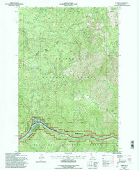
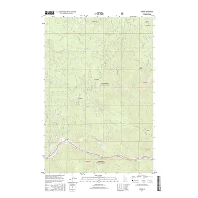
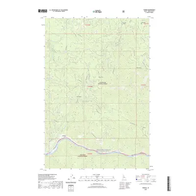
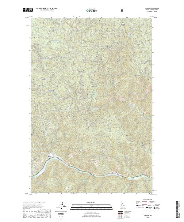 2024 Syringa2024 Print · USGSThe settlement of Syringa sits along the Middle Fork Clearwater River in this recent survey of Idaho's national forest lands. Trace the river's course past Big Hill Rapids or follow forest roads to landmarks like Jungle Point and Smith Saddle.
End of results
Showing maps 1-13 of 13
Top cities near Syringa
Frequently asked questions
- What are the different types of historical maps available for Syringa?
- What is the oldest map of Syringa?
- Where can I purchase historical maps of Syringa for my home or office?
- Where can I download high-res historical maps of Syringa?
- Are there historical topographic maps available for Syringa?
- Is there historical aerial imagery available for Syringa?
- Where are historical maps of Syringa sourced from?