Old Maps of Rose Lake, Idaho for Metal Detecting
Plan your next treasure hunt with 13 historic maps of Rose Lake. Find old homesites, ghost towns, trails, and gathering spots that may be lost to time — perfect for identifying promising metal detecting locations.
- Locate forgotten sites: Uncover places like long-lost settlements, abandoned rail lines, or gathering spots.
- Plan better hunts: Use map overlays combined with LiDAR or satellite views to narrow in on historically rich areas.
- Made for detectorists: Thousands of hobbyists use these maps to discover relics, coins, and hidden history.
Use these historic maps to boost your research and find new opportunities beneath the surface of Rose Lake.
Rose Lake, ID maps
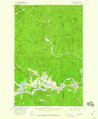
(13)- 1909 Map of Cataldo, 1954 Print
 1909 Cataldo1954 Print · USGSShoshone County was at its mining peak during the first decade of the 1900s, defined by the river-and-rail economy of the Idaho Panhandle. Genealogists can trace family roots through the silver and lead districts at Kellogg and Wardner, or find remote landmarks like Magee Ranch and the Old Mission.
 - 1911 Map of Cataldo
 1911 Cataldo1911 Print · USGSThe Idaho Panhandle's mining and timber country is documented here in the early twentieth century, showing the rail-linked settlements of the Coeur d'Alene River valley. Genealogists can trace family sites at Old Mission, Kellogg, and Magee Ranch.2 unique versions available
 - 1955 Map of Spokane, 1965 Print
 1955 Spokane1965 Print · USGSInland Empire life in the fifties and sixties centers on the growth of Spokane and the heavy mining industry of northern Idaho. Trace mid-century landmarks like Fairchild Air Force Base, the Bunker Hill Mine, and early campuses such as Gonzaga University.2 unique versions available
 - 1957 Map of Kingston, 1959 Print
 1957 Kingston1959 Print · USGSThe river valley between Kootenai and Shoshone counties is captured here in the late fifties, showing the vital transport links along the Coeur d'Alene River. Researchers can trace local landmarks like the Cataldo Mission, Canyon School, and the Union Pacific Railroad line.3 unique versions available
 - 1958 Map of Spokane
 1958 Spokane1958 Print · USGSThe Inland Empire is shown at a mid-century peak of industrial and military activity, from the rail hubs of Spokane to the deep silver mines of northern Idaho. Researchers can trace the sprawling rail lines of the Union Pacific RR or locate landmarks like Fairchild Air Force Base and the Bunker Hill Smelter & Mine.
 - 1985 Map of Rose Lake
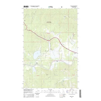
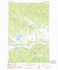 1985 Rose Lake1985 Print · USGSNorth Idaho's river-cut valley and forested peaks are documented here in the mid-1980s as resource management and recreation shaped the land. Researchers can trace the winding Coeur D'alene River past Mission Flats, locate Rose Lake, and find high points like Wall Peak.
 - 1987 Map of Coeur D'Alene
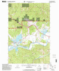
 1987 Coeur D'Alene1987 Print · USGSNorthern Idaho in the late eighties shows a landscape of deep-water lakes and heavy industry where the timber and mining economies meet growing valley settlements. Genealogists and historians can trace the footprints of the Sunshine Mine, the rail sidings at Corbin Junction, and the historic Old Mission State Park.3 unique versions available
 - 1996 Map of Rose Lake, 1999 Print
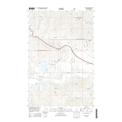
 1996 Rose Lake1999 Print · USGSThe Kootenai County back-country comes into focus in the mid-1990s as it follows the river through the heart of the national forest. Researchers can trace the water-bound geography of Rose Lake and Bull Run Lake or locate early industrial sites like the local Sawmill.
 - 2011 Map of Rose Lake, 2011 Print
 2011 Rose Lake2011 Print · USGSCovers Rose Lake, including Canyon, Kootenai County, and other nearby areas
 - 2013 Map of Rose Lake, 2013 Print
 2013 Rose Lake2013 Print · USGSCovers Rose Lake, including Canyon, Kootenai County, and other nearby areas
 - 2017 Map of Rose Lake, 2017 Print
 2017 Rose Lake2017 Print · USGSCovers Rose Lake, including Canyon, Kootenai County, and other nearby areas
 - 2020 Map of Rose Lake, 2020 Print
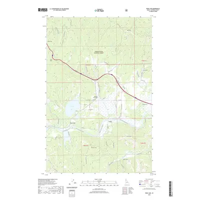 2020 Rose Lake2020 Print · USGSCovers Rose Lake, including Canyon, Kootenai County, and other nearby areas
 - 2024 Map of Rose Lake, 2024 Print
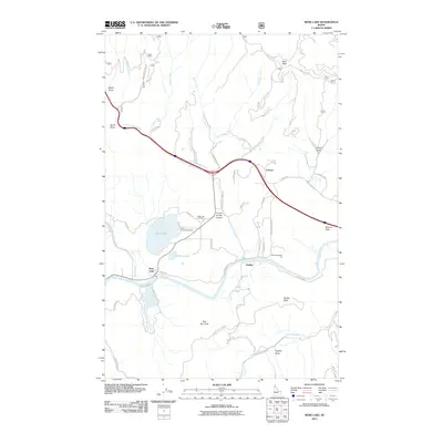
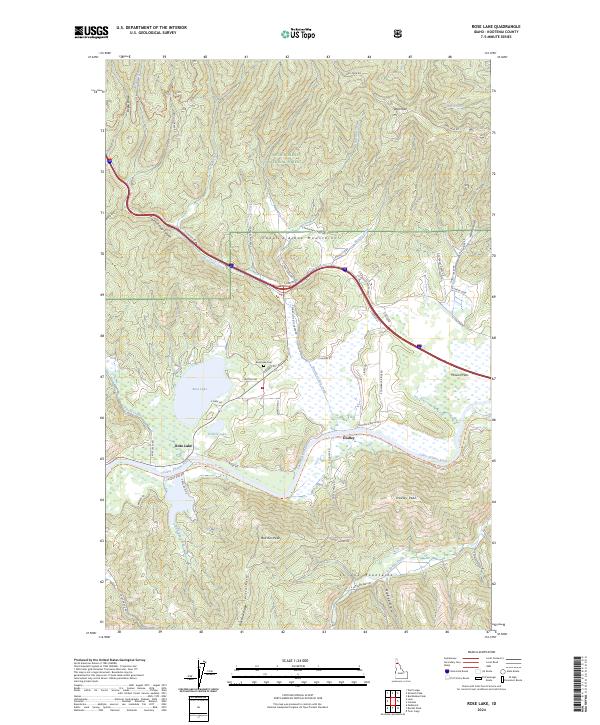 2024 Rose Lake2024 Print · USGSThe river valley and mountain peaks of Kootenai County are shown here in modern detail. Researchers can trace the path of the Trail Of The Coeur D' Alene's Trl and locate local landmarks like the Rose Lake Cem and the settlement of Dudley.
End of results
Showing maps 1-13 of 13
Top cities near Rose Lake
Frequently asked questions
- What are the different types of historical maps available for Rose Lake?
- What is the oldest map of Rose Lake?
- Where can I purchase historical maps of Rose Lake for my home or office?
- Where can I download high-res historical maps of Rose Lake?
- Are there historical topographic maps available for Rose Lake?
- Is there historical aerial imagery available for Rose Lake?
- Where are historical maps of Rose Lake sourced from?