Old Maps of Cass County, Illinois
Explore 139 old maps of Cass County, spanning from 1909 to today. These high-resolution historic maps reveal how streets, neighborhoods, landmarks, and natural features evolved over time — perfect for genealogy, metal detecting, research, and local history exploration.
What you can do with these maps:
- See how Cass County changed over time: Compare historical maps to modern-day views to trace roads, homesites, rail lines & more.
- View detailed metadata: Each map includes creators, publishers, year, scale, and archive source.
- Overlay maps with satellite & LiDAR: Visualize the past alongside modern tools to explore terrain & human change.
- Trusted historical sources: Maps sourced from the USGS, Library of Congress, and other archives.
- Access maps your way: View online, download high-res files, or order prints for personal or research use.
Start exploring old maps of Cass County to uncover forgotten places, hidden landmarks, and the deep history beneath your feet.
Cass County, IL maps
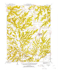
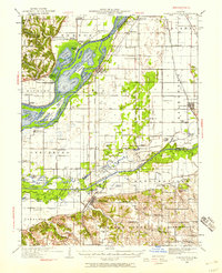
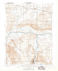
(139)- 1909 Map of Tallula
 1909 Tallula1909 Print · USGSCentral Illinois at the turn of the century shows a landscape defined by the Sangamon River and a dense rail network. Researchers can trace the early footprints of Pleasant Plains, Tallula, and Berlin, as well as several smaller stops along the Chicago and Alton RR.3 unique versions available
 - 1923 Map of Rushville, 1958 Print
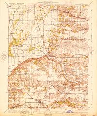
 1923 Rushville1958 Print · USGSSchuyler County's agricultural and social landscape is captured here in the early 1920s, centered on the rail terminus at Rushville. Genealogists and historians can trace numerous rural schools and churches, including Muley School, Ebenezer Church, and Pokeberry School.
 - 1926 Map of Beardstown
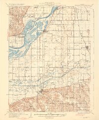
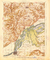 1926 Beardstown1926 Print · USGSThe Illinois River valley and its surrounding bluffs are shown in the mid-1920s, centered on the river hub of Beardstown. Genealogists can trace family ties to dozens of local landmarks, from Griggs Chapel and Mt Zion Church to rural schools like Good Hope School and Biren School.2 unique versions available
 - 1926 Map of Rushville
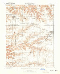
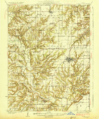 1926 Rushville1926 Print · USGSSchuyler and Brown counties appear in the mid-1920s as a landscape of small farmsteads and rural social hubs. Genealogists and historians can trace an extraordinary density of local institutions, from White Frame School to the Ebenezer Church and the rails of the Chicago Burlington and Quincy.2 unique versions available
 - 1928 Map of Meredosia, 1958 Print
 1928 Meredosia1958 Print · USGSThe Illinois River valley in the late 1920s was a bustling corridor of river locks, pumping stations, and rail lines. Genealogists and local historians can trace family roots through numerous rural landmarks like Ham Sch, Reich Landing, and the Perry Spring's Sta rail stop.2 unique versions available
 - 1929 Map of Arenzville, 1969 Print
 1929 Arenzville1969 Print · USGSThe fertile bottomlands of Cass and Morgan Counties are seen here in the late twenties, defined by a dense grid of family farms and rural schools. Genealogists can locate specific landmarks like the Neelyville PO, St Peters Ch, and Jersey College Sch.2 unique versions available
 - 1930 Map of Chandlerville
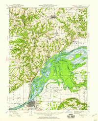
 1930 Chandlerville1930 Print · USGSThe confluence of the Illinois and Sangamon rivers defines this Depression-era landscape of floodplains and island farms. Genealogists can trace family footprints across Grand Island or locate rural landmarks like Mt Olive Ch and the Chicago and Illinois Midland RR.2 unique versions available
 - 1931 Map of Meredosia
 1931 Meredosia1931 Print · USGSThe Illinois River valley in the late twenties is captured here at a peak of rail and river activity. Genealogists can trace family roots through numerous country schools like Sand Ridge Sch and the important La Grange Locks complex.2 unique versions available
 - 1932 Map of Arenzville
 1932 Arenzville1932 Print · USGSThe bluffs and bottomlands of Cass and Morgan Counties are meticulously documented here in the early thirties. Local historians can trace family roots through dozens of rural landmarks, including Jersey College Sch, Bethel Chapel, and the settlement of Joy Prairie.
 - 1932 Map of Chandlerville
 1932 Chandlerville1932 Print · USGSIn the 1930s, the Illinois River valley was a labyrinth of sloughs and landings centered around the Sangamon confluence. Genealogists can trace family roots through numerous rural schools like Blackjack Sch or explore old river sites like Snicarte and Matanzas Beach.2 unique versions available
 - 1932 Map of Virginia, 1965 Print
 1932 Virginia1965 Print · USGSCentral Illinois farm country and the Sangamon river breaks are captured here in the early 1930s as the rail and road network matured. Researchers can locate dozens of country schools and churches, from Brush College Sch and Zion Ch to the old settlement of Old Princeton.2 unique versions available
 - 1933 Map of Petersburg, 1969 Print
 1933 Petersburg1969 Print · USGSThe Menard County landscape in the early thirties is a bustling network of prairie rail towns and riverside settlements. Genealogists and historians can trace family roots through numerous sites like Rose Hill Sch, Old Concord Cem, and the Indian Creek Mine.
 - 1936 Map of Virginia
 1936 Virginia1936 Print · USGSCentral Illinois during the mid-thirties shows a landscape of busy rail towns and rural school districts centered on Virginia and Ashland. Researchers can trace old family schoolhouses like Science Hill Sch and country churches such as Eckman Chapel.2 unique versions available
 - 1938 Map of Petersburg
 1938 Petersburg1938 Print · USGSPetersburg and the Sangamon River valley are captured here in the late 1930s, showing a landscape defined by rail-stop hamlets and country schools. Researchers can trace family history through sites like Atterbury P O, the Verbrugge Mine, and Reavis Spring Sch.2 unique versions available
 - 1940 Map of Tallula, 1956 Print
 1940 Tallula1956 Print · USGSCentral Illinois during the late thirties and early forties reveals a landscape of river-bluff history and active rail towns. Genealogists can trace family connections in Tallula, Salisbury, and Berlin, or locate the historic New Salem State Park.2 unique versions available
 - 1944 Map of Beardstown, 1959 Print
 1944 Beardstown1959 Print · USGSBeardstown and the Illinois River valley are shown here in the mid-forties, capturing a landscape of shifting river channels and rural school districts. Genealogists can trace family names through landmarks like Griggs Chapel, McClung School, and Sheldons Grove.2 unique versions available
 - 1948 Map of Quincy
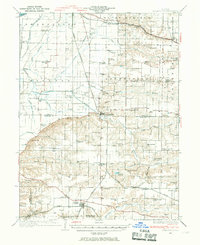
 1948 Quincy1948 Print · USGSThe Mississippi and Illinois River valleys are captured at a post-war crossroads as rail and river travel met the expanding highway system. Genealogists can trace family settlements from Quincy to Hannibal and smaller towns like Vandalia and Jerseyville.2 unique versions available
 - 1956 Map of Quincy, 1967 Print
 1956 Quincy1967 Print · USGSThe river and rail corridors of the Illinois-Missouri border are documented here during the mid-1950s. Researchers can trace historic river landings and regional transit hubs from Quincy and Hannibal to smaller settlements like Meredosia and Roodhouse.3 unique versions available
 - 1958 Map of Burlington, 1968 Print
 1958 Burlington1968 Print · USGSThe tri-state river country of Iowa, Illinois, and Missouri is captured here in the mid-fifties, dominated by the Mississippi River and major rail lines. Genealogists and historians can trace the development of river towns like Keokuk or locate the sprawling Iowa Army Ammunition Plant.4 unique versions available
 - 1958 Map of Peoria, 1969 Print
 1958 Peoria1969 Print · USGSCentral Illinois thrived as a hub of education and transport during the late sixties, as the new interstate system began to reshape the prairie. Genealogists and historians can trace local landmarks like Springdale Cem, Bradley University, and the sprawling grounds of Chanute AFB.4 unique versions available
 - 1958 Map of Decatur, 1971 Print
 1958 Decatur1971 Print · USGSCentral Illinois in the mid-twentieth century shows a landscape defined by industrial rail hubs and the creation of large reservoirs. Researchers can trace historic corridors like the Penn Central or locate landmarks such as Lincoln Log Cabin State Park and Lake Springfield.3 unique versions available
 - 1961 Map of Burlington
 1961 Burlington1961 Print · USGSThe tri-state borderlands along the Mississippi River are captured here during the late fifties and early sixties, showing the vital river-and-rail economy of Iowa, Illinois, and Missouri. Genealogists and historians can trace the development of major hubs like Galesburg and Macomb alongside landmark sites such as the Iowa Ordnance Plant and the historic river town of Nauvoo.
 - 1961 Map of Peoria
 1961 Peoria1961 Print · USGSCentral Illinois thrived at the intersection of river trade and rail power during the late fifties. Genealogists and local historians can trace the rail networks of the Illinois Central and Wabash, alongside landmarks like Chanute AFB and Weldon Springs State Park.
 - 1961 Map of Decatur
 1961 Decatur1961 Print · USGSCentral Illinois in the late fifties was a bustling corridor of rail lines and prairie commerce centered on the state capital. Genealogists and historians can trace the intricate connections between Springfield, Decatur, and dozens of smaller settlements like Nokomis and Arcola.2 unique versions available
 - 1963 Map of Burlington
 1963 Burlington1963 Print · USGSThe tri-state river country of the Mississippi and Illinois valleys comes alive in this mid-century survey. Genealogists and historians can trace the industrial and academic growth of the region, from the Iowa Ordnance Plant to campuses like Knox College and Western Illinois University.
Showing maps 1-25 of 139
Top cities of Cass County
- Beardstown historical maps
- Virginia historical maps
- Ashland historical maps
- Bluff Springs historical maps
- Chandlerville historical maps
- Hagener historical maps
See more
Frequently asked questions
- What are the different types of historical maps available for Cass County?
- What is the oldest map of Cass County?
- Where can I purchase historical maps of Cass County for my home or office?
- Where can I download high-res historical maps of Cass County?
- Are there historical topographic maps available for Cass County?
- Is there historical aerial imagery available for Cass County?
- Where are historical maps of Cass County sourced from?