Old Maps of Oakland, Illinois
Explore 12 old maps of Oakland, spanning from 1936 to today. These high-resolution historic maps reveal how streets, neighborhoods, landmarks, and natural features evolved over time — perfect for genealogy, metal detecting, research, and local history exploration.
What you can do with these maps:
- See how Oakland changed over time: Compare historical maps to modern-day views to trace roads, homesites, rail lines & more.
- View detailed metadata: Each map includes creators, publishers, year, scale, and archive source.
- Overlay maps with satellite & LiDAR: Visualize the past alongside modern tools to explore terrain & human change.
- Trusted historical sources: Maps sourced from the USGS, Library of Congress, and other archives.
- Access maps your way: View online, download high-res files, or order prints for personal or research use.
Start exploring old maps of Oakland to uncover forgotten places, hidden landmarks, and the deep history beneath your feet.
Oakland, IL maps
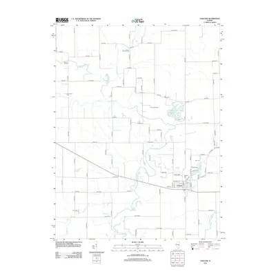
(12)- 1936 Map of Oakland
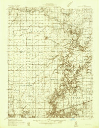 1936 Oakland1936 Print · USGSColes and Douglas Counties in the mid-1930s exhibit a landscape deeply connected by the Embarrass River and the Pennsylvania railroad. Genealogists can trace hundreds of small family landmarks, from Patsy Mitchell Cem to the scores of local schoolhouses like Boneset Sch and Seven Hickory Sch.5 unique versions available
 - 1942 Map of Oakland
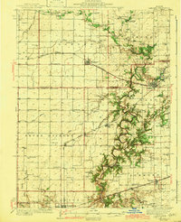 1942 Oakland1942 Print · USGSCentral Illinois prairie life is captured here in the early 1940s as the rail-and-river economy flourished. You can trace family roots at the Patsy Mitchell Cem or locate old schoolhouses like Jack Oak Sch and Seven Hickory Sch.2 unique versions available
 - 1958 Map of Decatur, 1971 Print
 1958 Decatur1971 Print · USGSCentral Illinois in the mid-twentieth century shows a landscape defined by industrial rail hubs and the creation of large reservoirs. Researchers can trace historic corridors like the Penn Central or locate landmarks such as Lincoln Log Cabin State Park and Lake Springfield.3 unique versions available
 - 1961 Map of Decatur
 1961 Decatur1961 Print · USGSCentral Illinois in the late fifties was a bustling corridor of rail lines and prairie commerce centered on the state capital. Genealogists and historians can trace the intricate connections between Springfield, Decatur, and dozens of smaller settlements like Nokomis and Arcola.2 unique versions available
 - 1982 Map of Oakland, 1983 Print
 1982 Oakland1983 Print · USGSThe rail-and-river landscape of the Illinois prairie is captured here in the early eighties. Genealogists and local historians can trace family plots at Pleasant Grove Cem and Rosedale Cem or locate old crossings like Barnett Bridge.
 - 1985 Map of Decatur
 1985 Decatur1985 Print · USGSCentral Illinois farming and rail hubs thrive in the mid-1980s as Decatur anchors a sprawling network of track and timber. Trace the paths of the Sangamon River and the Illinois Central Gulf RR through old towns like Cerro Gordo and Bement.2 unique versions available
 - 1998 Map of Oakland, 2003 Print
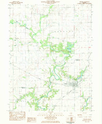
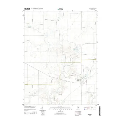
 1998 Oakland2003 Print · USGSThe Embarras River valley near the Coles and Douglas county line is captured here in the late 1990s as it winds past Oakland. Genealogists and researchers can locate several family burial grounds like Rosedale Cem and Berry Cem or trace the grounds of the Prairie Observatory.
 - 2012 Map of Oakland, 2012 Print
 2012 Oakland2012 Print · USGSCovers Oakland, including Coles County, Douglas County, and other nearby areas
 - 2015 Map of Oakland, 2015 Print
 2015 Oakland2015 Print · USGSCovers Oakland, including Coles County, Douglas County, and other nearby areas
 - 2018 Map of Oakland, 2018 Print
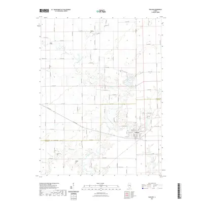
 2018 Oakland2018 Print · USGSCovers Oakland, including Coles County, Douglas County, and other nearby areas
 - 2021 Map of Oakland, 2021 Print
 2021 Oakland2021 Print · USGSCovers Oakland, including Coles County, Douglas County, and other nearby areas
 - 2024 Map of Oakland, 2024 Print
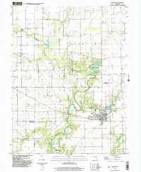
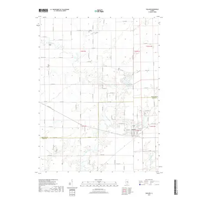
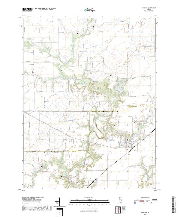 2024 Oakland2024 Print · USGSEastern Illinois farm country at the Coles and Douglas county line is documented here in recent detail. Researchers can locate family landmarks and burial sites including the Hoagland Historical Cem, Old Negro Cem, and Rosedale Cem along the Embarras River.
End of results
Showing maps 1-12 of 12
Top cities near Oakland
- Charleston historical maps
- Villa Grove historical maps
- Newman historical maps
- Kansas historical maps
- Ashmore historical maps
- Westfield historical maps
See more
Frequently asked questions
- What are the different types of historical maps available for Oakland?
- What is the oldest map of Oakland?
- Where can I purchase historical maps of Oakland for my home or office?
- Where can I download high-res historical maps of Oakland?
- Are there historical topographic maps available for Oakland?
- Is there historical aerial imagery available for Oakland?
- Where are historical maps of Oakland sourced from?