Old Maps of Inverness, Illinois for Genealogy
Trace your family roots with 39 historic maps of Inverness. These high-res maps reveal old neighborhoods, homesites, landmarks, and streets — helping you uncover where your ancestors lived and how the area evolved over time.
- Explore historic neighborhoods: Identify where your relatives may have lived in the 1800s or 1900s.
- Compare maps over time: Trace the changes in streets, buildings, and landmarks for multi-generational research.
- Perfect for genealogy & ancestry research: Used by family historians and researchers to map out lineage and migration.
These maps are an incredible resource for exploring your personal connection to Inverness's past.
Inverness, IL maps
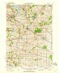
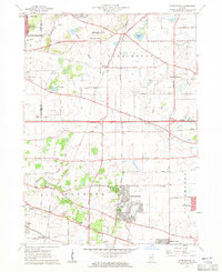
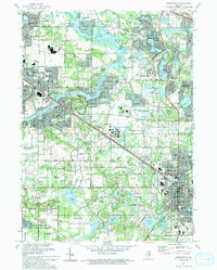
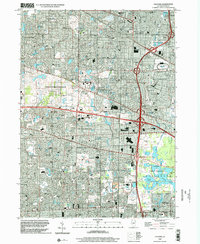
(39)- 1923 Map of Barrington
 1923 Barrington1923 Print · USGSNorthwest of Chicago in the early twenties, these townships were a network of farm-to-market roads and lakefront resorts. Trace the early boundaries of the Cook County Forest Preserve and find long-gone rural landmarks like Speeck Resort or Quentins Corners.4 unique versions available
 - 1935 Map of Barrington, 1958 Print
 1935 Barrington1958 Print · USGSNortheastern Illinois appears here in the decades following the first World War as rural townships began to shift toward a suburban future. Genealogists can trace family roots through numerous district schools and local landmarks like St Johns Church, Lake Zurich, and Fox River Grove.
 - 1953 Map of Palatine, 1955 Print
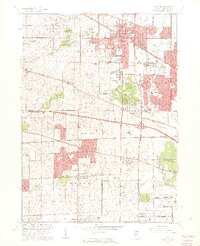
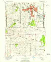 1953 Palatine1955 Print · USGSMid-century Cook County comes to life in the early 1950s as the rail corridor drives development between Palatine and Arlington Heights. Genealogists and local historians can trace early school sites like Sunderlage Sch and rural landmarks such as Mount Hope Cem and the Radio Station (WGN).
 - 1954 Map of Rockford
 1954 Rockford1954 Print · USGSThe Rock River valley and the Illinois-Wisconsin borderlands are captured here in the mid-1950s during a period of robust industrial and agricultural activity. Genealogists and historians can trace rail-era corridors like the Illinois Central RR and locate landmarks from Big Foot Prairie to Lake Geneva.
 - 1955 Map of Rockford
 1955 Rockford1955 Print · USGSThe Rock River valley and southern Wisconsin dairy country are shown here in the mid-fifties as the region's manufacturing centers grew. Genealogists and historians can trace the paths of the Chicago and North Western RR and Illinois Central RR through hubs like Rockford and Beloit.
 - 1958 Map of Rockford, 1974 Print
 1958 Rockford1974 Print · USGSNorthern Illinois and southern Wisconsin are shown here in the mid-twentieth century as rail-dependent industrial towns began to interface with growing lakefront communities. Genealogists can trace family roots through settlements like Saylesville and Tess Corners or locate historical landmarks like the Rockford Ordnance Depot.4 unique versions available
 - 1960 Map of Lake Zurich, 1962 Print
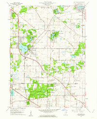 1960 Lake Zurich1962 Print · USGSSoutheastern Lake County transitioned from rural farming to suburban communities during the early sixties. Genealogists and local researchers can locate family plots at Fairfield Cem or Cady Cem and trace old rail lines through Lake Zurich.4 unique versions available
 - 1960 Map of Barrington, 1962 Print
 1960 Barrington1962 Print · USGSThe Fox River valley and the emerging suburban corridors of Cook and Lake Counties are captured here at the dawn of the 1960s. Researchers can locate family landmarks such as Evergreen Cem, St Ann Sch, and the rail lines of the Chicago and North Western.4 unique versions available
 - 1961 Map of Streamwood, 1962 Print
 1961 Streamwood1962 Print · USGSThe developing suburbs of the Chicago fringe are seen here in the early sixties as townships like Hanover and Barrington evolve. Researchers can trace the legacy of local institutions like Mission Chapel, New Era Sch, and the Drive-in Theater.5 unique versions available
 - 1961 Map of Palatine, 1962 Print
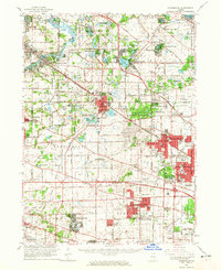
 1961 Palatine1962 Print · USGSNorthwestern Cook County undergoes a dramatic post-war transformation as suburban villages like Hoffman Estates and Rolling Meadows expand. Genealogists and local historians can trace family roots through St Michael Cemetery or locate the U S Military Reservation and the iconic Arlington Park Race Track.5 unique versions available
 - 1961 Map of Barrington, 1965 Print
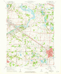
 1961 Barrington1965 Print · USGSThe northwest Chicago suburbs were in the midst of a massive post-war building boom in the early sixties. Genealogists and local historians can trace the early footprints of Hoffman Estates and Inverness, or locate landmarks like Arlington Park Racetrack and St Michael Cemetery.
 - 1963 Map of Rockford
 1963 Rockford1963 Print · USGSThe mid-century industrial corridor along the Rock River is shown here during a period of rapid post-war growth. Researchers can trace the extensive rail lines of the Chicago and North Western or locate local landmarks like the Rockford Ordnance Depot and Holy Hill.
 - 1981 Map of Elgin
 1981 Elgin1981 Print · USGSNorthern Illinois and southern Wisconsin are shown in the early eighties as suburban growth meets glacial terrain. Trace the paths of the Milwaukee Road through Harvard or explore the wetlands of Volo Bog State Natural Area.
 - 1993 Map of Lake Zurich
 1993 Lake Zurich1993 Print · USGSThe Lake-Cook county border area is shown during its early 1990s suburban transformation. Genealogists and historians can trace family markers at Fairfield Cem and locate historic community hubs like the Long Grove Ch and Quentin Corners.2 unique versions available
 - 1993 Map of Barrington
 1993 Barrington1993 Print · USGSNorthern Illinois riverside towns and residential enclaves are shown in the early nineties as they expanded around the Fox River. Researchers can trace the rail corridor and locate White Cem, St Ann Sch, and Lake Barrington.
 - 1993 Map of Palatine, 1994 Print
 1993 Palatine1994 Print · USGSThe northwest suburbs of Chicago are seen in a period of high suburban density during the early nineties. Genealogists and local historians can locate early cemeteries like Hillside Cem and Salem Cem alongside landmarks like Arlington Park Raceway.
 - 1993 Map of Streamwood, 1994 Print
 1993 Streamwood1994 Print · USGSSuburban Cook County is captured here in the early nineties during its era of rapid residential growth. Genealogists and local historians can trace the development of Streamwood and Hoffman Estates or find local landmarks like Union Cem and Poplar Creek Theater.
 - 1998 Map of Lake Zurich, 2001 Print
 1998 Lake Zurich2001 Print · USGSLake and Cook counties are shown here during their late-1990s suburban growth, balancing new residential expansion with expansive forest preserves. Genealogists and local researchers can locate landmarks like Fairfield Cem, Mt St Joseph Childrens Home, and Quentin Corners.
 - 1998 Map of Palatine, 2002 Print
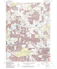
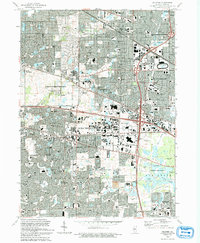
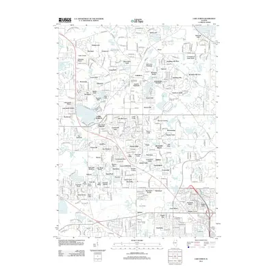
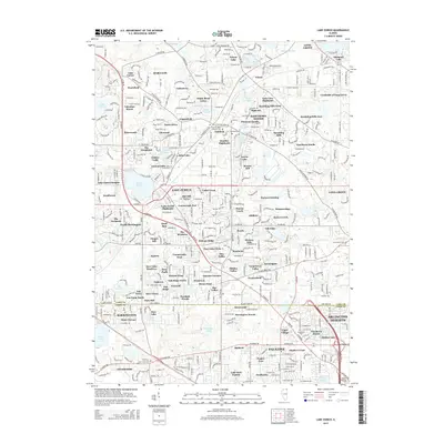
 1998 Palatine2002 Print · USGSSuburban development defines this Cook County landscape in the late 1990s as towns like Schaumburg and Palatine reached their modern forms. Trace the growth of local institutions and recreation at the Arlington Park Raceway and William Rainey Harper College.
 - 2012 Map of Palatine, 2012 Print
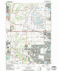
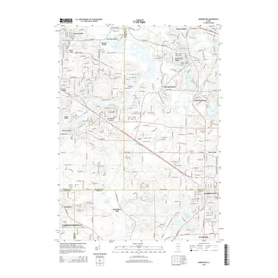
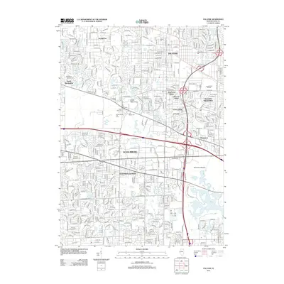 2012 Palatine2012 Print · USGSCovers Inverness, including Schaumburg, Arlington Heights, and other nearby areas
 - 2012 Map of Barrington, 2012 Print
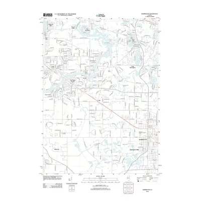 2012 Barrington2012 Print · USGSCovers Inverness, including Carpentersville, Cary, and other nearby areas
 - 2012 Map of Streamwood, 2012 Print
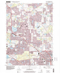
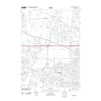 2012 Streamwood2012 Print · USGSCovers Inverness, including Elgin, Schaumburg, and other nearby areas
 - 2012 Map of Lake Zurich, 2012 Print
 2012 Lake Zurich2012 Print · USGSCovers Inverness, including Arlington Heights, Palatine, and other nearby areas
 - 2015 Map of Lake Zurich, 2015 Print
 2015 Lake Zurich2015 Print · USGSCovers Inverness, including Arlington Heights, Palatine, and other nearby areas
 - 2015 Map of Barrington, 2015 Print
 2015 Barrington2015 Print · USGSCovers Inverness, including Carpentersville, Cary, and other nearby areas
Showing maps 1-25 of 39
Top cities near Inverness
- Chicago historical maps
- Elgin historical maps
- Waukegan historical maps
- Schaumburg historical maps
- Arlington Heights historical maps
- Palatine historical maps
See more
Top neighborhoods of Inverness
Frequently asked questions
- What are the different types of historical maps available for Inverness?
- What is the oldest map of Inverness?
- Where can I purchase historical maps of Inverness for my home or office?
- Where can I download high-res historical maps of Inverness?
- Are there historical topographic maps available for Inverness?
- Is there historical aerial imagery available for Inverness?
- Where are historical maps of Inverness sourced from?