Old Maps of Altamont, Illinois for Metal Detecting
Plan your next treasure hunt with 21 historic maps of Altamont. Find old homesites, ghost towns, trails, and gathering spots that may be lost to time — perfect for identifying promising metal detecting locations.
- Locate forgotten sites: Uncover places like long-lost settlements, abandoned rail lines, or gathering spots.
- Plan better hunts: Use map overlays combined with LiDAR or satellite views to narrow in on historically rich areas.
- Made for detectorists: Thousands of hobbyists use these maps to discover relics, coins, and hidden history.
Use these historic maps to boost your research and find new opportunities beneath the surface of Altamont.
Altamont, IL maps
(21)- 1941 Map of St. Elmo, 1958 Print
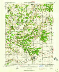 1941 St. Elmo1958 Print · USGSThe Illinois counties of Fayette, Shelby, and Effingham are mapped here in the early 1940s at the height of their rail-and-refinery era. Genealogists and historians can trace numerous country schools like Martin Box Sch and churches like Crums Chapel near the Carter Refinery.2 unique versions available
 - 1945 Map of St. Elmo
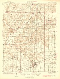 1945 St. Elmo1945 Print · USGSFayette and Effingham counties are seen here in the 1940s at a peak of rail and river industry. Genealogists and historians can trace family locations near Saint Elmo, locate the Carter Refinery, or find rural landmarks like Crums Chapel and Meyers Cem.2 unique versions available
 - 1950 Map of Effingham, 1958 Print
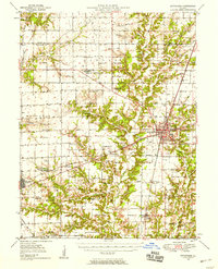 1950 Effingham1958 Print · USGSEffingham and the surrounding townships are shown at a mid-century peak of rail activity and rural development. Genealogists can trace family roots through numerous sites like Wolf Creek Cemetery, St Marys Church, and the settlement at Shumway.4 unique versions available
 - 1951 Map of Effingham
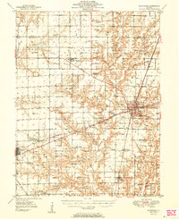 1951 Effingham1951 Print · USGSIn the decade after the war, central Illinois thrived as a rail and agricultural crossroads. Genealogists and historians can locate dozens of country landmarks like Ewington Cem, St Pauls Ch, and the many schools of Summit and Liberty townships.2 unique versions available
 - 1958 Map of Decatur, 1971 Print
 1958 Decatur1971 Print · USGSCentral Illinois in the mid-twentieth century shows a landscape defined by industrial rail hubs and the creation of large reservoirs. Researchers can trace historic corridors like the Penn Central or locate landmarks such as Lincoln Log Cabin State Park and Lake Springfield.3 unique versions available
 - 1961 Map of Decatur
 1961 Decatur1961 Print · USGSCentral Illinois in the late fifties was a bustling corridor of rail lines and prairie commerce centered on the state capital. Genealogists and historians can trace the intricate connections between Springfield, Decatur, and dozens of smaller settlements like Nokomis and Arcola.2 unique versions available
 - 1982 Map of Altamont West
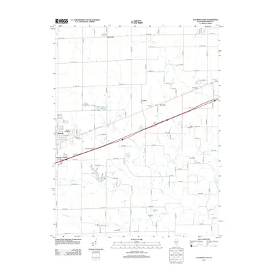
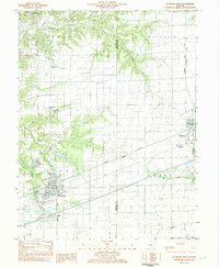 1982 Altamont West1982 Print · USGSFayette County at the start of the 1980s shows a landscape where industrial rail lines and rural tradition meet. Genealogists can locate several remote burial sites and schools, including Maplewood Cem, Rhodes Cem, and the Bethlehem Sch.
 - 1985 Map of Altamont East, 1986 Print
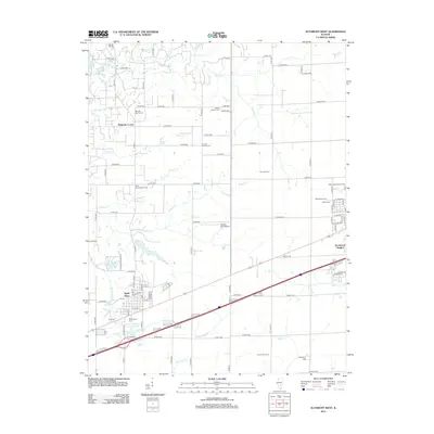
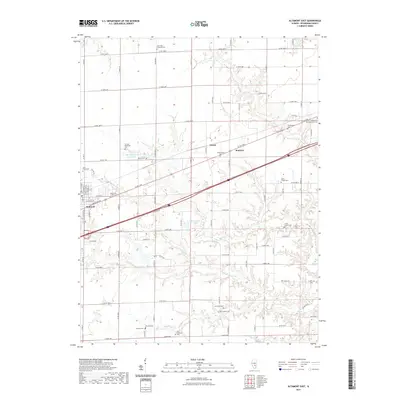
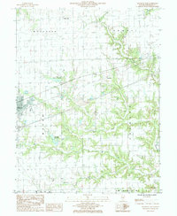 1985 Altamont East1986 Print · USGSThe eastern outskirts of Altamont are captured here in the mid-1980s as the rail and road network shaped this Effingham County landscape. Researchers can trace the CONRAIL line and find smaller settlements like Dexter, Keptown, and Brockett along with the local Altamont Reservoir.
 - 1986 Map of Effingham
 1986 Effingham1986 Print · USGSCentral Illinois during the mid-eighties was a hub of rail travel and water recreation centered on the new reservoirs. Genealogists and historians can trace the rural landscape between Mattoon and Effingham, locating landmarks like St Paul Ch and Eagle Creek State Park.2 unique versions available
 - 1998 Map of Altamont West, 2003 Print
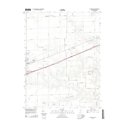
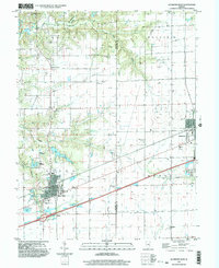 1998 Altamont West2003 Print · USGSFayette County at the end of the millennium shows a landscape defined by the oil industry and deep-rooted rural communities. Researchers can trace family history at St Pauls Cem, locate St Bonaventure Ch, or study the extent of the Loudon Field.
 - 1998 Map of Altamont East, 2003 Print
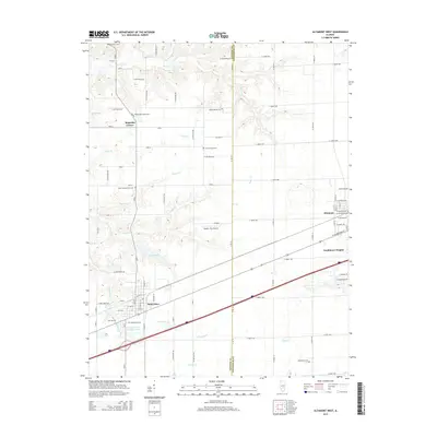
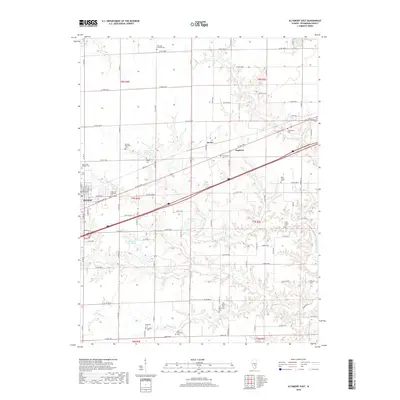
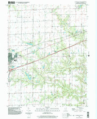 1998 Altamont East2003 Print · USGSEffingham County comes into focus at the turn of the millennium as the city of Altamont expands alongside its vital water infrastructure. Researchers can trace the layout of Altamont and identify outlying locales like Dexter and Blue Point.
 - 2012 Map of Altamont East, 2012 Print
 2012 Altamont East2012 Print · USGSCovers Altamont, including Dexter, Keptown, and other nearby areas
 - 2012 Map of Altamont West, 2012 Print
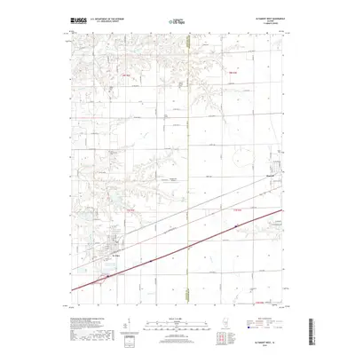
 2012 Altamont West2012 Print · USGSCovers Altamont, including Saint Elmo, St. Elmo, and other nearby areas
 - 2015 Map of Altamont East, 2015 Print
 2015 Altamont East2015 Print · USGSCovers Altamont, including Dexter, Keptown, and other nearby areas
 - 2015 Map of Altamont West, 2015 Print
 2015 Altamont West2015 Print · USGSCovers Altamont, including Saint Elmo, St. Elmo, and other nearby areas
 - 2018 Map of Altamont West, 2018 Print
 2018 Altamont West2018 Print · USGSCovers Altamont, including Saint Elmo, St. Elmo, and other nearby areas
 - 2018 Map of Altamont East, 2018 Print
 2018 Altamont East2018 Print · USGSCovers Altamont, including Dexter, Keptown, and other nearby areas
 - 2021 Map of Altamont East, 2021 Print
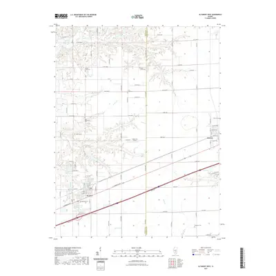
 2021 Altamont East2021 Print · USGSCovers Altamont, including Dexter, Keptown, and other nearby areas
 - 2021 Map of Altamont West, 2021 Print
 2021 Altamont West2021 Print · USGSCovers Altamont, including Saint Elmo, St. Elmo, and other nearby areas
 - 2024 Map of Altamont West, 2024 Print
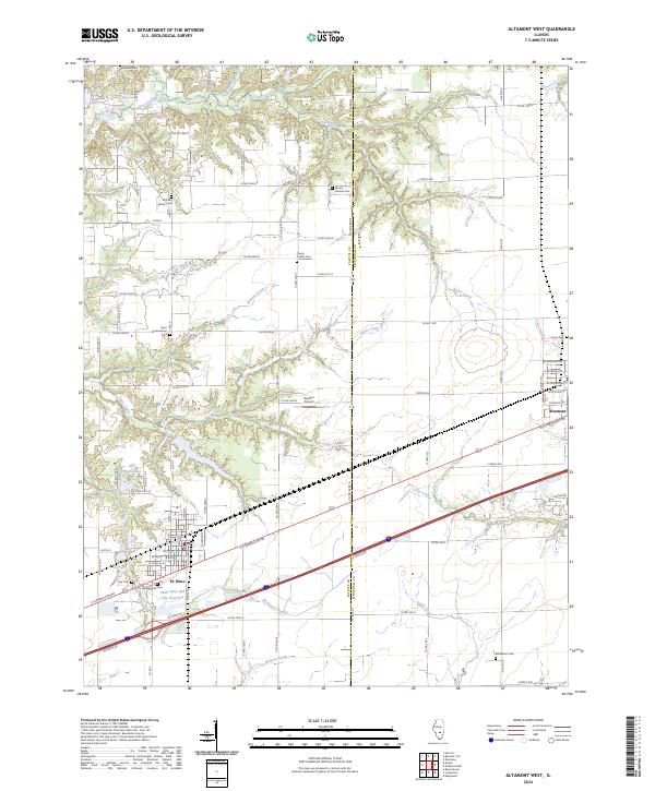 2024 Altamont West2024 Print · USGSThe borderlands of Fayette and Effingham counties are mapped here during the twenty-first century, centered on the growing community of St. Elmo. Researchers can locate several rural burial grounds like Mount Moriah Cem and Crums Chapel Cem near the banks of Watson Creek.
 - 2024 Map of Altamont East, 2024 Print
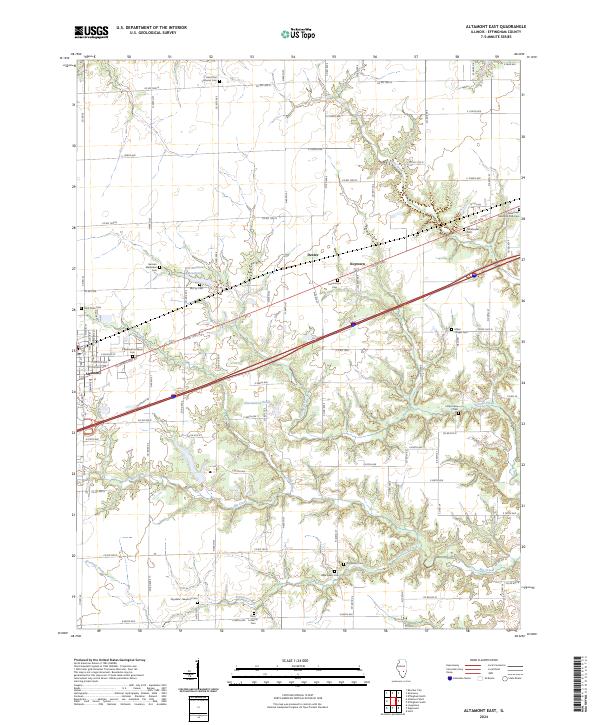 2024 Altamont East2024 Print · USGSEffingham County and the village of Altamont are documented here in 2024, showing a landscape rich with legacy churchyards and rural cemeteries. Researchers can trace deep family roots through sites like German Methodist Cem, Little Prairie Cem, and the Arborcrest Memorial Park Cem.
End of results
Showing maps 1-21 of 21
Top cities near Altamont
- Effingham historical maps
- Avena historical maps
- St. Elmo historical maps
- Saint Elmo historical maps
- La Clede historical maps
- Watson historical maps
See more
Top neighborhoods of Altamont
Frequently asked questions
- What are the different types of historical maps available for Altamont?
- What is the oldest map of Altamont?
- Where can I purchase historical maps of Altamont for my home or office?
- Where can I download high-res historical maps of Altamont?
- Are there historical topographic maps available for Altamont?
- Is there historical aerial imagery available for Altamont?
- Where are historical maps of Altamont sourced from?