Old Maps of Hardin County, Illinois for Academic Research
Study the evolution of Hardin County with 82 high-resolution historic maps. Whether you're teaching, researching, or modeling changes in land use, these maps provide essential visual documentation of urban, environmental, and geographic change.
- Analyze long-term change: Track patterns in development, transportation, and natural features.
- Ideal for environmental or urban studies: Support academic projects with primary historical map data.
- Use in the classroom or lab: Educators and researchers rely on these maps to bring historical context to life.
These maps are a powerful tool for teaching, research, and visualizing how Hardin County has changed over the decades.
Hardin County, IL maps
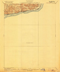
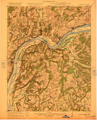
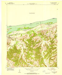
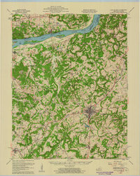
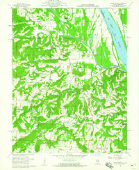
(82)- 1916 Map of Shawneetown
 1916 Shawneetown1916 Print · USGSThe Illinois-Kentucky borderlands thrived as a river-and-rail corridor during the early twentieth century. Genealogists and historians can trace the foundations of local life through dozens of rural schools and industrial sites like Saline Mines, Caseyville, and Westwood Cemetery.5 unique versions available
 - 1916 Map of Fords Ferry
 1916 Fords Ferry1916 Print · USGSThe Illinois-Kentucky borderlands along the Ohio River come alive in this survey from the mid-1910s. Genealogists can trace the rural school system through Double Box School and Love School or locate early commerce at Fraileys Store.2 unique versions available
 - 1916 Map of Golconda
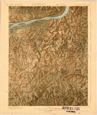
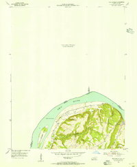
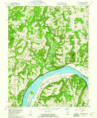
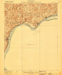 1916 Golconda1916 Print · USGSSouthern Illinois river life is frozen in time during this mid-1910s survey of the Ohio River frontier. Researchers can trace the early development of Golconda and Elizabethtown, or locate rural landmarks like Miller Cem and Cavins Store.
 - 1916 Map of Equality
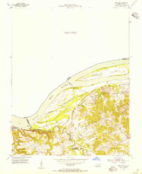
 1916 Equality1916 Print · USGSSouthern Illinois before the First World War shows a landscape defined by the Saline River and industrial outposts. Genealogists and historians can trace family locations near Loves Store, explore the site of the Illinois Furnace, or locate vanished schoolhouses like Pisgah School.4 unique versions available
 - 1920 Map of Goloonda
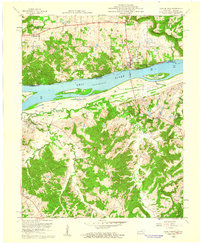
 1920 Goloonda1920 Print · USGSThe Ohio River bottomlands of Livingston County are captured here just after the Great War, when river ferries and rural schoolhouses still anchored local life. Genealogists and researchers can trace family lands near Berry Ferry, Mt Pisgah Church, or the many district schools like Trimble School.
 - 1921 Map of Fords Ferry
 1921 Fords Ferry1921 Print · USGSCrittenden County in the early twenties shows a landscape of river-dependent commerce and small rural hamlets connected by the Illinois Central. Genealogists can trace family footprints through dozens of local landmarks like Shelby Store, Hurricane Church, and the Seminary School.
 - 1921 Map of Golconda
 1921 Golconda1921 Print · USGSThe Ohio River valley at the start of the 1920s reveals a bustling corridor of small river towns and rural school districts spanning Illinois and Kentucky. Genealogists and historians can trace family roots through dozens of local landmarks like Berrys Ferry, Cammens Store, and the Bethel Church.3 unique versions available
 - 1925 Map of Cave In Rock
 1925 Cave In Rock1925 Print · USGSCrittenden County's river-and-rail landscape is captured here in the mid-1920s, during a time of thriving rural school districts and mining operations. Researchers can trace ancestral locations near Fords Ferry, the Franklin Mines, or Hurricane Church.3 unique versions available
 - 1949 Map of Paducah
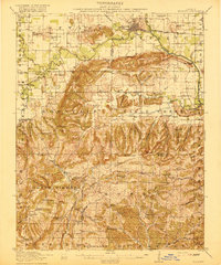
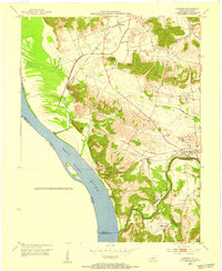
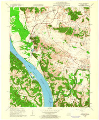
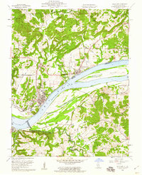
 1949 Paducah1949 Print · USGSThe confluence of the Ohio, Mississippi, Tennessee, and Cumberland rivers at the close of the 1940s reveals a region bound by water and rail. Researchers can trace historic river landings, timberlands in the Shawnee National Forest, and the coal-mining infrastructure around West Frankfort and Herrin.2 unique versions available
 - 1950 Map of Paducah
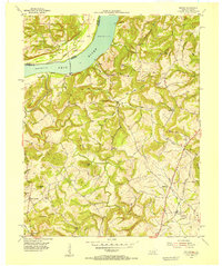
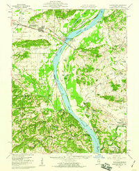
 1950 Paducah1950 Print · USGSThe confluence of the great midwestern rivers defines this mid-century landscape at the intersection of Illinois, Kentucky, and Missouri. Genealogists and historians can trace the rail-and-river economy through the hubs of Paducah, Cairo, and Metropolis or locate family roots near the Wildcat Hills.
 - 1953 Map of Dekoven, 1954 Print
 1953 Dekoven1954 Print · USGSWestern Kentucky coal and river culture meet in the early fifties along the Ohio River. Researchers can trace the rail networks of the West Kentucky Coal Company and locate old sites like Caseyville, Dekoven, and St Ambrose Ch.
 - 1954 Map of Paducah
 1954 Paducah1954 Print · USGSSouthern Illinois and Western Kentucky intersect at the great river confluences during this mid-century era of rail and river industry. Genealogists and historians can trace family roots and commerce through river towns like Cairo, Metropolis, and Golconda, or along the tracks of the Illinois Central Railroad.2 unique versions available
 - 1954 Map of Repton, 1955 Print
 1954 Repton1955 Print · USGSCrittenden County, Kentucky, and the Illinois borderlands appear here in the mid-fifties, centered on the river-and-rail corridor. Researchers can trace old family sites and rural schools like Browns Sch near the Illinois Central or visit the riverside history of Fords Ferry.3 unique versions available
 - 1954 Map of Cave In Rock, 1955 Print
 1954 Cave In Rock1955 Print · USGSCrittenden County sat at a crossroads of river travel and rural industry in the mid-fifties, with the Ohio River shaping its northern border. Genealogists can locate family sites near Tolu or trace connections at the Hebron Sch and the Cave in Rock Ferry.
 - 1954 Map of Shetlerville, 1955 Print
 1954 Shetlerville1955 Print · USGSLivingston County, Kentucky, and Pope County, Illinois, meet at a sweeping bend in the river during the mid-fifties. Genealogists and local historians can trace the paths around Carrsville or locate Loves Cem and the winding Givens Foot Trail.
 - 1954 Map of Rosiclare, 1955 Print
 1954 Rosiclare1955 Print · USGSThe Ohio River corridor near the Illinois-Kentucky border comes to life in this mid-fifties survey of the river valley. Genealogists and local historians can trace the foundations of Carrsville and locate family landmarks such as Barnett Chapel and the Elizabethtown Ferry.
 - 1958 Map of Cave In Rock, 1960 Print
 1958 Cave In Rock1960 Print · USGSThe Ohio River frontier comes alive in the late fifties, showing the vital ferry connection between Illinois and Kentucky. Genealogists and local historians can trace family landmarks like Dunn Spring Cem, Peters Creek Sch, and the industrial grounds of the Alco Mine.2 unique versions available
 - 1958 Map of Cave In Rock, 1960 Print
 1958 Cave In Rock1960 Print · USGSThe Ohio River valley and Crittenden County high ground are captured here in the late fifties, showcasing a landscape of river ferries and rail-line towns. Local historians can trace family sites at Freedom Ch, follow the Illinois Central tracks through Crayne, or locate the old Fords Ferry crossing.
 - 1959 Map of Herod, 1960 Print
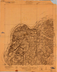
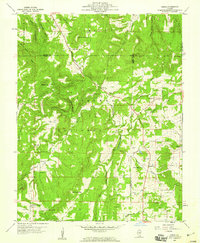 1959 Herod1960 Print · USGSSouthern Illinois in the late fifties is captured here at the intersection of industry and the Shawnee National Forest. Researchers can trace old family names at Wallace Cem, locate forgotten sites like Empire Mine, or find rural landmarks such as One Horse Gap.3 unique versions available
 - 1959 Map of Dekoven, 1960 Print
 1959 Dekoven1960 Print · USGSThe riverfront and rail corridors of Union County were bustling during the late fifties, defined by the Ohio River border. Researchers can trace historic family locations at Bells Mines, the Odd Fellows Cem, and the rural community of Henshaw.3 unique versions available
 - 1959 Map of Shawneetown, 1960 Print
 1959 Shawneetown1960 Print · USGSSouthern Illinois and western Kentucky meet along the Ohio River in the late 1950s, a period defined by river commerce and coal mining. Researchers can trace the dual centers of Old Shawneetown and New Shawneetown or locate family sites like Zion Ch and Saline Mines.2 unique versions available
 - 1959 Map of Saline Mines, 1960 Print
 1959 Saline Mines1960 Print · USGSSouthern Illinois during the late fifties reveals a landscape shaped by river commerce and intensive mineral extraction. Researchers can trace dozens of family-named cemeteries and rural sites like the Hole Mine, Saline Landing, and Shewmaker Sch.3 unique versions available
 - 1959 Map of Equality, 1960 Print
 1959 Equality1960 Print · USGSSouthern Illinois during the late fifties reveals a landscape of transition between the industrial river valleys and the wooded heights of the Shawnee National Forest. Researchers can locate deep-rooted community sites like Equality, the Salt Wells, and remote locations such as One Horse Gap.2 unique versions available
 - 1959 Map of Shetlerville, 1960 Print
 1959 Shetlerville1960 Print · USGSThe riverfront and timberlands of the Ohio Valley are captured here in the late fifties, showing the interplay of the Ohio River and the Shawnee National Forest. Researchers can locate old family burial sites like Twitchell Cem and trace the legacy of mining at the Baker Mine and Parkinson Mine.3 unique versions available
 - 1959 Map of Rosiclare, 1960 Print
 1959 Rosiclare1960 Print · USGSThe Illinois-Kentucky river border thrived on the Ohio River at the end of the 1950s, bridging industrial mining with rural forest life. Researchers can find numerous extraction sites like the Rosiclare Mine and family landmarks such as Dixon Cem and Barnett Chapel.2 unique versions available
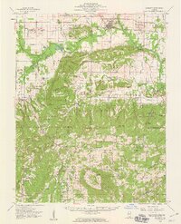
Showing maps 1-25 of 82
Top cities of Hardin County
Frequently asked questions
- What are the different types of historical maps available for Hardin County?
- What is the oldest map of Hardin County?
- Where can I purchase historical maps of Hardin County for my home or office?
- Where can I download high-res historical maps of Hardin County?
- Are there historical topographic maps available for Hardin County?
- Is there historical aerial imagery available for Hardin County?
- Where are historical maps of Hardin County sourced from?