Old Maps of Makanda, Illinois
Explore 42 old maps of Makanda, spanning from 1922 to today. These high-resolution historic maps reveal how streets, neighborhoods, landmarks, and natural features evolved over time — perfect for genealogy, metal detecting, research, and local history exploration.
What you can do with these maps:
- See how Makanda changed over time: Compare historical maps to modern-day views to trace roads, homesites, rail lines & more.
- View detailed metadata: Each map includes creators, publishers, year, scale, and archive source.
- Overlay maps with satellite & LiDAR: Visualize the past alongside modern tools to explore terrain & human change.
- Trusted historical sources: Maps sourced from the USGS, Library of Congress, and other archives.
- Access maps your way: View online, download high-res files, or order prints for personal or research use.
Start exploring old maps of Makanda to uncover forgotten places, hidden landmarks, and the deep history beneath your feet.
Makanda, IL maps
(42)- 1922 Map of Carbondale
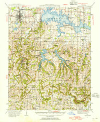
 1922 Carbondale1922 Print · USGSSouthern Illinois in the early 1920s is captured here at the height of its rail-driven rural development. Genealogists can trace family connections through dozens of named rural sites like Stone School, Cottage Home Church, and the Illinois Central corridor.3 unique versions available
 - 1924 Map of Alto Pass
 1924 Alto Pass1924 Print · USGSSouthern Illinois at the peak of the rail era shows a landscape of river ferries and ridge-top settlements. Genealogists can trace family footprints across dozens of local landmarks like Rattlesnake Ferry, Goodbread Church, and Worthen School.2 unique versions available
 - 1941 Map of Carbondale, 1955 Print
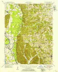
 1941 Carbondale1955 Print · USGSSouthern Illinois was undergoing a transformation in the early 1940s as new reservoirs reshaped the topography near Carbondale. Researchers can trace rural life through dozens of named sites like Clemmenstown School and South County Line Church.2 unique versions available
 - 1947 Map of Alto Pass, 1954 Print
 1947 Alto Pass1954 Print · USGSSouthern Illinois in the late 1940s is defined by the high ridges of the Shawnee Hills and the sweeping Mississippi floodplains. Researchers can trace rural life through sites like Dutch Ridge Church, the Macedonia School, and the river crossing at Rattlesnake Ferry.2 unique versions available
 - 1947 Map of Cobden, 1970 Print
 1947 Cobden1970 Print · USGSSouthern Illinois fruit and timber country is well-documented in the late 1940s, showing the ridge-top settlements of the Shawnee National Forest. Trace the old rail lines through Alto Pass and Mountain Glen or locate family sites like Lyerle Chapel and Rendleman School.3 unique versions available
 - 1948 Map of Cobden
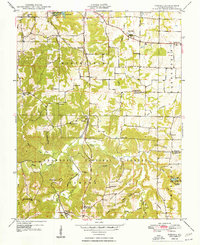
 1948 Cobden1948 Print · USGSSouthern Illinois hill country appears in the late 1940s as a region of dense forests and vital rail corridors. Genealogists can locate family names and rural landmarks like Jerusalem Church, Rendleman School, and the Bald Knob Lookout Tower.2 unique versions available
 - 1948 Map of Pomona
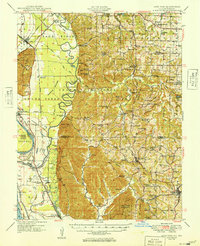
 1948 Pomona1948 Print · USGSJackson County settlement and the timbered ridges of the southern Illinois hills are captured here just after the war. Local researchers can trace family roots at County Farm, locate the Bostick Cem, or follow the winding Mobile and Ohio RR through Pomona.5 unique versions available
 - 1949 Map of Alto Pass
 1949 Alto Pass1949 Print · USGSSouthern Illinois river life and hill country are captured here shortly after the war, showing the Mississippi corridor in detail. You can trace old river crossings like Rattlesnake Ferry and locate rural landmarks such as Bald Knob, Lyerle Chapel, and the Hickory Ridge School.
 - 1949 Map of Paducah
 1949 Paducah1949 Print · USGSThe confluence of the Ohio, Mississippi, Tennessee, and Cumberland rivers at the close of the 1940s reveals a region bound by water and rail. Researchers can trace historic river landings, timberlands in the Shawnee National Forest, and the coal-mining infrastructure around West Frankfort and Herrin.2 unique versions available
 - 1950 Map of Paducah
 1950 Paducah1950 Print · USGSThe confluence of the great midwestern rivers defines this mid-century landscape at the intersection of Illinois, Kentucky, and Missouri. Genealogists and historians can trace the rail-and-river economy through the hubs of Paducah, Cairo, and Metropolis or locate family roots near the Wildcat Hills.
 - 1954 Map of Paducah
 1954 Paducah1954 Print · USGSSouthern Illinois and Western Kentucky intersect at the great river confluences during this mid-century era of rail and river industry. Genealogists and historians can trace family roots and commerce through river towns like Cairo, Metropolis, and Golconda, or along the tracks of the Illinois Central Railroad.2 unique versions available
 - 1961 Map of Paducah
 1961 Paducah1961 Print · USGSThe Lower Ohio Valley at mid-century is a landscape defined by its great rivers and newly formed reservoirs. Researchers can trace the riverfronts of Paducah and Metropolis, or locate smaller settlements like Old Shawneetown and Cave in Rock along the banks.2 unique versions available
 - 1964 Map of Paducah
 1964 Paducah1964 Print · USGSThe river-and-rail corridor of Southern Illinois and Western Kentucky is captured here during the height of the mid-century industrial era. Genealogists and researchers can trace local landmarks across several counties, from the rail yards of Paducah to the waters of Crab Orchard Lake and Kentucky Reservoir.2 unique versions available
 - 1966 Map of Carbondale, 1967 Print
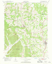
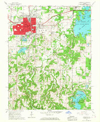 1966 Carbondale1967 Print · USGSCarbondale and its surrounding forests and lakes are captured here in the mid-sixties as the university and recreation areas expanded. Genealogists can trace family names at Snider Hill Cem or locate historic sites like Attucks Sch and Boskydell.4 unique versions available
 - 1966 Map of Makanda, 1967 Print
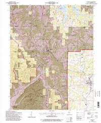
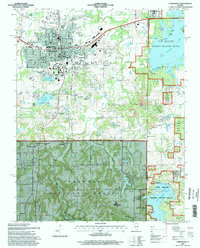
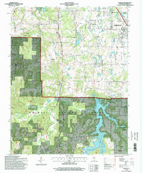
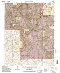
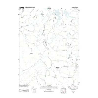
 1966 Makanda1967 Print · USGSSouthern Illinois at the height of the mid-century shows a landscape of dense forests and rural settlements at the edge of the Ozarks. Trace family history through dozens of landmarks like Evergreen Cem, Water Valley, and the Stone Fort at Giant City State Park.3 unique versions available
 - 1984 Map of Carbondale, 1985 Print
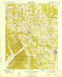
 1984 Carbondale1985 Print · USGSSouthern Illinois in the mid-1980s was a crossroads of major rail lines and vast conservation lands centered on Carbondale. Local researchers can trace the development of Southern Illinois University, the Menard Correctional Center, and the many shorelines of Crab Orchard Lake.
 - 1986 Map of Carbondale
 1986 Carbondale1986 Print · USGSSouthern Illinois and the Mississippi River valley are captured in the mid-eighties as a landscape of diverse water systems and conservation lands. Researchers can trace the development of Southern Illinois University or locate landmarks like Fort Gage and St Marys Seminary.
 - 1987 Map of Paducah, 1988 Print
 1987 Paducah1988 Print · USGSThe Lower Ohio Valley and the Illinois Ozarks come alive in this late twentieth-century regional survey. Genealogists and local historians can trace river-town roots and state park landmarks from Metropolis to Cape Girardeau and Trail of Tears State Park.
 - 1996 Map of Cobden, 1998 Print
 1996 Cobden1998 Print · USGSSouthern Illinois in the mid-nineties shows a landscape shaped by forest conservation and the Illinois Central Gulf railroad. Trace family sites like Mount Tabor Cem or the rural community of Alto Pass near Bald Knob.
 - 1996 Map of Carbondale, 1998 Print
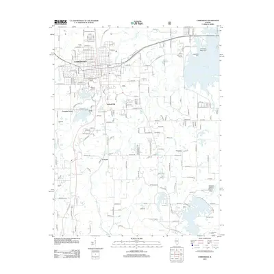
 1996 Carbondale1998 Print · USGSSouthern Illinois at the close of the twentieth century shows the expanding footprint of the university alongside its surrounding wildlands. Local historians can trace the Illinois Central Railroad through Boskydell and Makanda, or locate landmarks like Oakland Cem and Attucks Sch.
 - 1996 Map of Pomona, 1998 Print
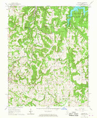
 1996 Pomona1998 Print · USGSSouthern Illinois in the mid-nineties shows a landscape of deep forests and rural outposts nestled between growing regional hubs. Researchers can locate family landmarks like the Worthen Sch Cem, trace the Illinois Central Railroad, or find the Pomona Natural Bridge.
 - 1996 Map of Makanda, 1998 Print
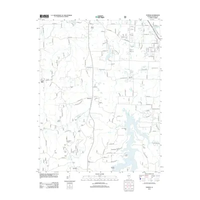
 1996 Makanda1998 Print · USGSSouthern Illinois in the mid-nineties shows a landscape deeply defined by conservation and recreation within the Shawnee National Forest. Researchers can trace rural lineages through numerous family sites like Kelley Cem and Evergreen Cem or locate the historic Stone Fort.
 - 2012 Map of Cobden, 2012 Print
 2012 Cobden2012 Print · USGSCovers Makanda, including Cobden, Alto Pass, and other nearby areas
 - 2012 Map of Pomona, 2012 Print
 2012 Pomona2012 Print · USGSCovers Makanda, including Carbondale, Murphysboro, and other nearby areas
 - 2012 Map of Carbondale, 2012 Print
 2012 Carbondale2012 Print · USGSCovers Makanda, including Carbondale, Carterville, and other nearby areas
Showing maps 1-25 of 42
Top cities near Makanda
- Carbondale historical maps
- Marion historical maps
- Herrin historical maps
- Murphysboro historical maps
- Carterville historical maps
- Anna historical maps
See more
Frequently asked questions
- What are the different types of historical maps available for Makanda?
- What is the oldest map of Makanda?
- Where can I purchase historical maps of Makanda for my home or office?
- Where can I download high-res historical maps of Makanda?
- Are there historical topographic maps available for Makanda?
- Is there historical aerial imagery available for Makanda?
- Where are historical maps of Makanda sourced from?