Old Maps of Hermon, Illinois
Explore 15 old maps of Hermon, spanning from 1925 to today. These high-resolution historic maps reveal how streets, neighborhoods, landmarks, and natural features evolved over time — perfect for genealogy, metal detecting, research, and local history exploration.
What you can do with these maps:
- See how Hermon changed over time: Compare historical maps to modern-day views to trace roads, homesites, rail lines & more.
- View detailed metadata: Each map includes creators, publishers, year, scale, and archive source.
- Overlay maps with satellite & LiDAR: Visualize the past alongside modern tools to explore terrain & human change.
- Trusted historical sources: Maps sourced from the USGS, Library of Congress, and other archives.
- Access maps your way: View online, download high-res files, or order prints for personal or research use.
Start exploring old maps of Hermon to uncover forgotten places, hidden landmarks, and the deep history beneath your feet.
Hermon, IL maps
(15)- 1925 Map of Galesburg, 1968 Print
 1925 Galesburg1968 Print · USGSGalesburg and the surrounding Knox County townships appear here as a thriving rail and agricultural center between the world wars. Researchers can trace dozens of rural school sites and early landmarks like Lake Bracken, Orange Chapel, and the East Galesburg Randall PO.2 unique versions available
 - 1927 Map of Galesburg
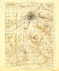 1927 Galesburg1927 Print · USGSKnox County is captured in the mid-twenties at its peak as a Midwestern rail hub centered on Galesburg. Local historians can trace dozens of rural school sites like Log City School or explore the early footprints of Knoxville and Abingdon.3 unique versions available
 - 1958 Map of Burlington, 1968 Print
 1958 Burlington1968 Print · USGSThe tri-state river country of Iowa, Illinois, and Missouri is captured here in the mid-fifties, dominated by the Mississippi River and major rail lines. Genealogists and historians can trace the development of river towns like Keokuk or locate the sprawling Iowa Army Ammunition Plant.4 unique versions available
 - 1961 Map of Burlington
 1961 Burlington1961 Print · USGSThe tri-state borderlands along the Mississippi River are captured here during the late fifties and early sixties, showing the vital river-and-rail economy of Iowa, Illinois, and Missouri. Genealogists and historians can trace the development of major hubs like Galesburg and Macomb alongside landmark sites such as the Iowa Ordnance Plant and the historic river town of Nauvoo.
 - 1963 Map of Burlington
 1963 Burlington1963 Print · USGSThe tri-state river country of the Mississippi and Illinois valleys comes alive in this mid-century survey. Genealogists and historians can trace the industrial and academic growth of the region, from the Iowa Ordnance Plant to campuses like Knox College and Western Illinois University.
 - 1982 Map of De Long, 1983 Print
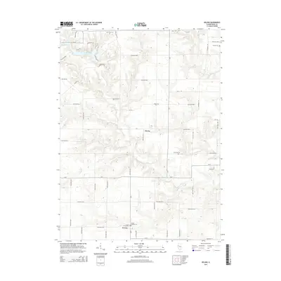
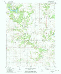 1982 De Long1983 Print · USGSKnox County land use in the early eighties shows a mix of rural recreation and traditional farming communities. Researchers can trace family history at Haynes Cem, locate the Good Samaritan Retreat, or study the settlement patterns around DeLong and Hermon.
 - 1985 Map of Galesburg, 1986 Print
 1985 Galesburg1986 Print · USGSWestern Illinois in the mid-eighties was a landscape of riverfront forests and industrial rail hubs. Genealogists and historians can trace the growth of Galesburg and Monmouth alongside rural landmarks like Stronghurst and the coal operations of the Strip Mine near Canton.2 unique versions available
 - 1989 Map of Galesburg
 1989 Galesburg1989 Print · USGSWestern Illinois in the late eighties reveals a landscape of industrial rail hubs and riverfront timberland. Genealogists and historians can trace the routes of the Atchison Topeka and Santa Fe RR through small towns like Stronghurst, London Mills, and Middle Grove (Middlepoint).
 - 1990 Map of Burlington
 1990 Burlington1990 Print · USGSThe tri-state confluence of Iowa, Illinois, and Missouri is mapped here at the end of the twentieth century. Genealogists and historians can trace the riverfront heritage of Burlington, Keokuk, and Fort Madison, or locate sites like the Battle of Athens State Historic Site.2 unique versions available
 - 1998 Map of De Long, 2001 Print
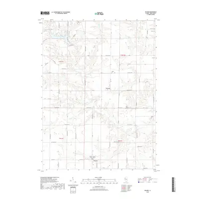
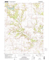 1998 De Long2001 Print · USGSKnox County, Illinois, is captured here in the late twentieth century, showing a landscape shaped by agricultural townships and small creek-side settlements. Genealogists can locate family names at Haynes Cem or Ferguson Cem, and trace the path of the Old Railroad Grade.
 - 2012 Map of DeLong, 2012 Print
 2012 DeLong2012 Print · USGSCovers Hermon, including Lake Bracken, DeLong, and other nearby areas
 - 2015 Map of DeLong, 2015 Print
 2015 DeLong2015 Print · USGSCovers Hermon, including Lake Bracken, DeLong, and other nearby areas
 - 2018 Map of DeLong, 2018 Print
 2018 DeLong2018 Print · USGSCovers Hermon, including Lake Bracken, DeLong, and other nearby areas
 - 2021 Map of DeLong, 2021 Print
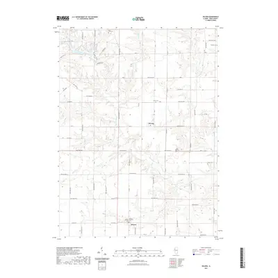 2021 DeLong2021 Print · USGSCovers Hermon, including Lake Bracken, DeLong, and other nearby areas
 - 2024 Map of DeLong, 2024 Print
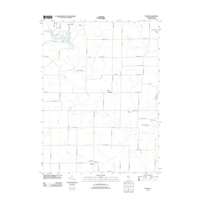
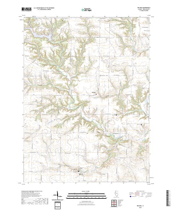 2024 DeLong2024 Print · USGSKnox County, Illinois, remains a quintessential Midwestern agricultural landscape in this modern era, defined by its rural villages and creek-side cemeteries. Genealogists can trace family names at the Elias Bragg Cem, Harper Cem, and the dual grounds in Hermon.
End of results
Showing maps 1-15 of 15
Top cities near Hermon
- Galesburg historical maps
- Abingdon historical maps
- Bushnell historical maps
- Knoxville historical maps
- Avon historical maps
- East Galesburg historical maps
See more
Frequently asked questions
- What are the different types of historical maps available for Hermon?
- What is the oldest map of Hermon?
- Where can I purchase historical maps of Hermon for my home or office?
- Where can I download high-res historical maps of Hermon?
- Are there historical topographic maps available for Hermon?
- Is there historical aerial imagery available for Hermon?
- Where are historical maps of Hermon sourced from?