
1925 Map of Galesburg
USGS Topo · Published 1968About this map
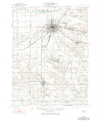
Galesburg serves as a dense railroad hub in this central Illinois landscape, where the Chicago Burlington And Quincy and the Atchison Topeka And Santa Fe lines intersect with numerous branch routes. The surrounding countryside is defined by an incredibly dense network of rural school districts, with named institutions like Atchison School, Thirlwell School, and Heller School appearing in nearly every section of the township grid. South of the city, the Knox County Country Club and Lake Bracken represent early 20th-century recreational development alongside Camp Shaubena. Further exploration reveals smaller outlying communities like Abingdon and Knoxville, along with specialized points of interest such as the Town Hall in Orange township and the East Galesburg Randall PO. This survey preserves the exact rail-and-road configuration before mid-century modernizations altered the local infrastructure.
Find a feature on this map
81 named features on this map. Tap any name to fly to it.
Don’t see what you’re looking for? This feature index may not catch every label — zoom into the map to look around manually.
Map Details
Editions of this 1925 Galesburg Map
2 editions found
Other maps of this area

1912 · Canton
USGS Topo · 1:62,500

1915 · Avon
USGS Topo · 1:62,500

1916 · Good Hope
USGS Topo · 1:62,500

1918 · Good Hope
USGS Topo · 1:62,500

1921 · Monmouth
USGS Topo · 1:62,500

1923 · Monmouth
USGS Topo · 1:62,500

1923 · Alexis
USGS Topo · 1:62,500

1925 · Alexis
USGS Topo · 1:62,500

1927 · Galesburg
USGS Topo · 1:62,500

1931 · Galva
USGS Topo · 1:48,000