
1916 Map of Good Hope
USGS Topo · Published 1965About this map
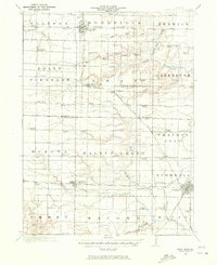
Agricultural development across the border of Warren and McDonough counties is captured in detail by surveyor C.W. Goodlove. The landscape is defined by a dense network of country schoolhouses, such as the colorfully named Mud College, Sugarloaf School, and Chattanooga School, reflecting the era's decentralized rural education system. The Chicago Burlington and Quincy railroad serves as a primary transit corridor, linking settlements like Bushnell and Good Hope to the wider region. In the northern reaches of the map, the terrain is etched by the intricate branches of Negro Creek and Swan Creek, where small-scale farming operations and family-held tracts like Farmers are clustered. The presence of the Presbyterian School and the Town Hall in Greenbush highlights the social and civic hubs that anchored these prairie communities during the early twentieth century.
Find a feature on this map
87 named features on this map. Tap any name to fly to it.
Don’t see what you’re looking for? This feature index may not catch every label — zoom into the map to look around manually.
Map Details
Editions of this 1916 Good Hope Map
2 editions found
Other maps of this area

1912 · Macomb
USGS Topo · 1:62,500

1913 · Colchester
USGS Topo · 1:62,500

1914 · Macomb
USGS Topo · 1:62,500

1915 · Avon
USGS Topo · 1:62,500

1918 · Vermont
USGS Topo · 1:62,500

1918 · La Harpe
USGS Topo · 1:62,500

1918 · Good Hope
USGS Topo · 1:62,500

1921 · Vermont
USGS Topo · 1:62,500

1921 · Monmouth
USGS Topo · 1:62,500

1923 · Monmouth
USGS Topo · 1:62,500