
1918 Map of Vermont
USGS Topo · Published 1918About this map
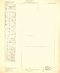
The Fourth Principal Meridian serves as a stark vertical divide on this preliminary edition, highlighting the townships of Mound, Salem, and Eldorado. In this agricultural landscape of West Central Illinois, small rural settlements and a dense network of one-room schools define the social geography. At the northern edge, New Philadelphia sits along the Toledo Peoria and Western line, while further south, Adair is positioned on the Chicago Burlington and Quincy railroad.
Find a feature on this map
20 named features on this map. Tap any name to fly to it.
Don’t see what you’re looking for? This feature index may not catch every label — zoom into the map to look around manually.
Map Details
Editions of this 1918 Vermont Map
2 editions found
Other maps of this area

1912 · Canton
USGS Topo · 1:62,500

1912 · Macomb
USGS Topo · 1:62,500

1914 · Macomb
USGS Topo · 1:62,500

1915 · Avon
USGS Topo · 1:62,500

1916 · Good Hope
USGS Topo · 1:62,500

1918 · Good Hope
USGS Topo · 1:62,500

1921 · Vermont
USGS Topo · 1:62,500

1923 · Rushville
USGS Topo · 1:62,500

1925 · Havana
USGS Topo · 1:62,500

1926 · Beardstown
USGS Topo · 1:62,500