Old Maps of Bensons Highland Addition, Normal for Genealogy
Trace your family roots with 15 historic maps of Bensons Highland Addition. These high-res maps reveal old neighborhoods, homesites, landmarks, and streets — helping you uncover where your ancestors lived and how the area evolved over time.
- Explore historic neighborhoods: Identify where your relatives may have lived in the 1800s or 1900s.
- Compare maps over time: Trace the changes in streets, buildings, and landmarks for multi-generational research.
- Perfect for genealogy & ancestry research: Used by family historians and researchers to map out lineage and migration.
These maps are an incredible resource for exploring your personal connection to Bensons Highland Addition's past.
Bensons Highland Addition, Normal maps
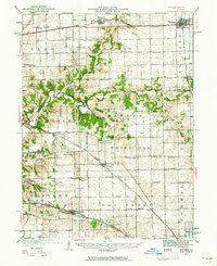
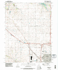
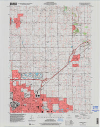
(15)- 1926 Map of Normal, 1966 Print
 1926 Normal1966 Print · USGSCovers Bensons Highland Addition, including Bloomington, Normal, and other nearby areas2 unique versions available
 - 1927 Map of Danvers, 1961 Print
 1927 Danvers1961 Print · USGSCovers Bensons Highland Addition, including Bloomington, Normal, and other nearby areas
 - 1930 Map of Danvers
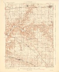 1930 Danvers1930 Print · USGSCovers Bensons Highland Addition, including Bloomington, Normal, and other nearby areas2 unique versions available
 - 1930 Map of Normal
 1930 Normal1930 Print · USGSCovers Bensons Highland Addition, including Bloomington, Normal, and other nearby areas2 unique versions available
 - 1958 Map of Peoria, 1969 Print
 1958 Peoria1969 Print · USGSCovers Bensons Highland Addition, including Peoria, Champaign, and other nearby areas4 unique versions available
 - 1961 Map of Peoria
 1961 Peoria1961 Print · USGSCovers Bensons Highland Addition, including Peoria, Champaign, and other nearby areas
 - 1963 Map of Peoria
 1963 Peoria1963 Print · USGSCovers Bensons Highland Addition, including Peoria, Champaign, and other nearby areas
 - 1970 Map of Danvers SE, 1972 Print
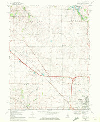 1970 Danvers SE1972 Print · USGSCovers Bensons Highland Addition, including Bloomington, Normal, and other nearby areas2 unique versions available
 - 1981 Map of Normal East
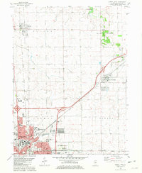 1981 Normal East1981 Print · USGSCovers Bensons Highland Addition, including Bloomington, Normal, and other nearby areas
 - 1985 Map of Peoria
 1985 Peoria1985 Print · USGSCovers Bensons Highland Addition, including Peoria, Bloomington, and other nearby areas
 - 1985 Map of Fairbury
 1985 Fairbury1985 Print · USGSCovers Bensons Highland Addition, including Bloomington, Normal, and other nearby areas2 unique versions available
 - 1989 Map of Peoria
 1989 Peoria1989 Print · USGSCovers Bensons Highland Addition, including Peoria, Bloomington, and other nearby areas
 - 1990 Map of Peoria
 1990 Peoria1990 Print · USGSCovers Bensons Highland Addition, including Peoria, Champaign, and other nearby areas
 - 1995 Map of Normal West, 1996 Print
 1995 Normal West1996 Print · USGSCovers Bensons Highland Addition, including Bloomington, Normal, and other nearby areas
 - 1998 Map of Normal East, 2000 Print
 1998 Normal East2000 Print · USGSCovers Bensons Highland Addition, including Bloomington, Normal, and other nearby areas
End of results
Showing maps 1-15 of 15
Frequently asked questions
- What are the different types of historical maps available for Bensons Highland Addition?
- What is the oldest map of Bensons Highland Addition?
- Where can I purchase historical maps of Bensons Highland Addition for my home or office?
- Where can I download high-res historical maps of Bensons Highland Addition?
- Are there historical topographic maps available for Bensons Highland Addition?
- Is there historical aerial imagery available for Bensons Highland Addition?
- Where are historical maps of Bensons Highland Addition sourced from?