Old Maps of Greenview, Illinois
Explore 23 old maps of Greenview, spanning from 1933 to today. These high-resolution historic maps reveal how streets, neighborhoods, landmarks, and natural features evolved over time — perfect for genealogy, metal detecting, research, and local history exploration.
What you can do with these maps:
- See how Greenview changed over time: Compare historical maps to modern-day views to trace roads, homesites, rail lines & more.
- View detailed metadata: Each map includes creators, publishers, year, scale, and archive source.
- Overlay maps with satellite & LiDAR: Visualize the past alongside modern tools to explore terrain & human change.
- Trusted historical sources: Maps sourced from the USGS, Library of Congress, and other archives.
- Access maps your way: View online, download high-res files, or order prints for personal or research use.
Start exploring old maps of Greenview to uncover forgotten places, hidden landmarks, and the deep history beneath your feet.
Greenview, IL maps
(23)- 1933 Map of Petersburg, 1969 Print
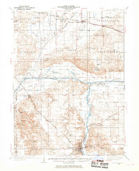 1933 Petersburg1969 Print · USGSThe Menard County landscape in the early thirties is a bustling network of prairie rail towns and riverside settlements. Genealogists and historians can trace family roots through numerous sites like Rose Hill Sch, Old Concord Cem, and the Indian Creek Mine.
 - 1938 Map of Petersburg
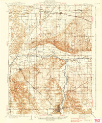 1938 Petersburg1938 Print · USGSPetersburg and the Sangamon River valley are captured here in the late 1930s, showing a landscape defined by rail-stop hamlets and country schools. Researchers can trace family history through sites like Atterbury P O, the Verbrugge Mine, and Reavis Spring Sch.2 unique versions available
 - 1948 Map of Mason City, 1963 Print
 1948 Mason City1963 Print · USGSCentral Illinois farming and rail life are at the forefront of this late 1940s survey. Genealogists and local historians can trace family-named sites like Johnson Valley Mine and North Sangamon Ch, alongside a dense network of rural schools.2 unique versions available
 - 1949 Map of Mason City
 1949 Mason City1949 Print · USGSCentral Illinois rail hubs and prairie farmsteads are captured here just after the war, showing the intersection of three major railroads. Genealogists can locate family landmarks like Honey Heart School, Johnson Valley Mine, and the Irish Grove Church.2 unique versions available
 - 1958 Map of Peoria, 1969 Print
 1958 Peoria1969 Print · USGSCentral Illinois thrived as a hub of education and transport during the late sixties, as the new interstate system began to reshape the prairie. Genealogists and historians can trace local landmarks like Springdale Cem, Bradley University, and the sprawling grounds of Chanute AFB.4 unique versions available
 - 1961 Map of Peoria
 1961 Peoria1961 Print · USGSCentral Illinois thrived at the intersection of river trade and rail power during the late fifties. Genealogists and local historians can trace the rail networks of the Illinois Central and Wabash, alongside landmarks like Chanute AFB and Weldon Springs State Park.
 - 1963 Map of Peoria
 1963 Peoria1963 Print · USGSCentral Illinois thrived as a rail and highway crossroads during the early sixties, centered on the bustling Illinois River valley. Genealogists and historians can trace the mid-century layout of Peoria, locate the grounds of Chanute Air Force Base, and follow historic lines like the Toledo Peoria and Western Railway.
 - 1971 Map of Petersburg, 1973 Print
 1971 Petersburg1973 Print · USGSMenard County in the early 1970s is defined by the winding Sangamon River and a dense network of early Illinois railroads. Family historians can trace numerous rural burial grounds like Rose Hill Cemetery and Baker Prairie Cem near the town of Petersburg.
 - 1980 Map of Greenview
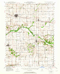
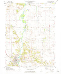
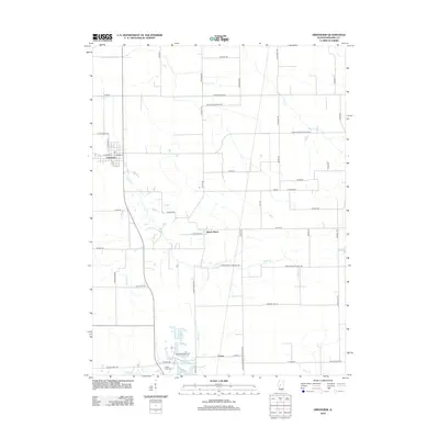
 1980 Greenview1980 Print · USGSThe Menard County prairie is captured here in the 1980s, centered on the rail hub of Greenview and the surrounding farmland. Researchers can trace rural lineages at Sugar Grove Cem or locate industrial sites like the large Quarry near Indian Point.
 - 1985 Map of Lincoln
 1985 Lincoln1985 Print · USGSMid-century Illinois comes to life in this survey of Logan and Mason counties as the interstate era reshapes the prairie. Genealogists and historians can trace rail-town development from San Jose to Kenney or locate landmarks like Rose Hill Cem and Funks Grove.
 - 1989 Map of Lincoln
 1989 Lincoln1989 Print · USGSCentral Illinois in the late eighties remains a landscape of productive prairie and vital river arteries. Genealogists and local historians can trace rural family landmarks like Rose Hill Cem, identify early aviation at Logan County Airport, or follow the Illinois Central Gulf Railroad through towns like Atlanta and Lincoln.
 - 1990 Map of Peoria
 1990 Peoria1990 Print · USGSCentral Illinois at the start of the nineties reveals a landscape of industrial river towns and sprawling university campuses. Researchers can trace the legacy of major institutions like Chanute Air Force Base and the University of Illinois alongside regional landmarks such as Sand Ridge State Forest.
 - 1998 Map of Greenview, 2000 Print
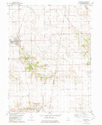
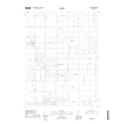
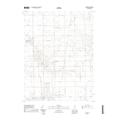
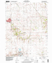 1998 Greenview2000 Print · USGSMenard County agricultural lands and small settlements are captured here in the late nineties, showcasing the region's enduring rural character. Genealogists can trace family landmarks like Sugar Grove Cem or explore the sites of Greenview and Indian Point.
 - 2012 Map of Petersburg, 2012 Print
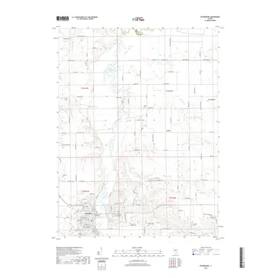
 2012 Petersburg2012 Print · USGSCovers Greenview, including Petersburg, Curtis, and other nearby areas
 - 2012 Map of Greenview, 2012 Print
 2012 Greenview2012 Print · USGSCovers Greenview, including Sweet Water, Culver, and other nearby areas
 - 2015 Map of Petersburg, 2015 Print
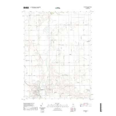
 2015 Petersburg2015 Print · USGSCovers Greenview, including Petersburg, Curtis, and other nearby areas
 - 2015 Map of Greenview, 2015 Print
 2015 Greenview2015 Print · USGSCovers Greenview, including Sweet Water, Culver, and other nearby areas
 - 2018 Map of Greenview, 2018 Print
 2018 Greenview2018 Print · USGSCovers Greenview, including Sweet Water, Culver, and other nearby areas
 - 2018 Map of Petersburg, 2018 Print
 2018 Petersburg2018 Print · USGSCovers Greenview, including Petersburg, Curtis, and other nearby areas
 - 2021 Map of Petersburg, 2021 Print
 2021 Petersburg2021 Print · USGSCovers Greenview, including Petersburg, Curtis, and other nearby areas
 - 2021 Map of Greenview, 2021 Print
 2021 Greenview2021 Print · USGSCovers Greenview, including Sweet Water, Culver, and other nearby areas
 - 2024 Map of Petersburg, 2024 Print
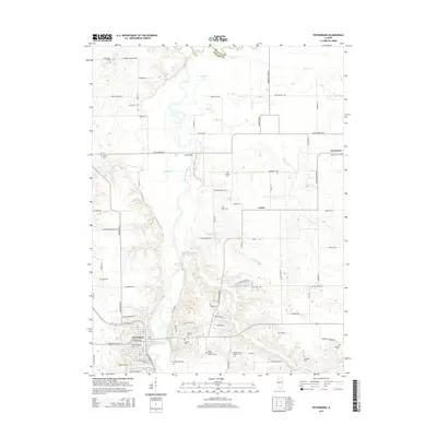
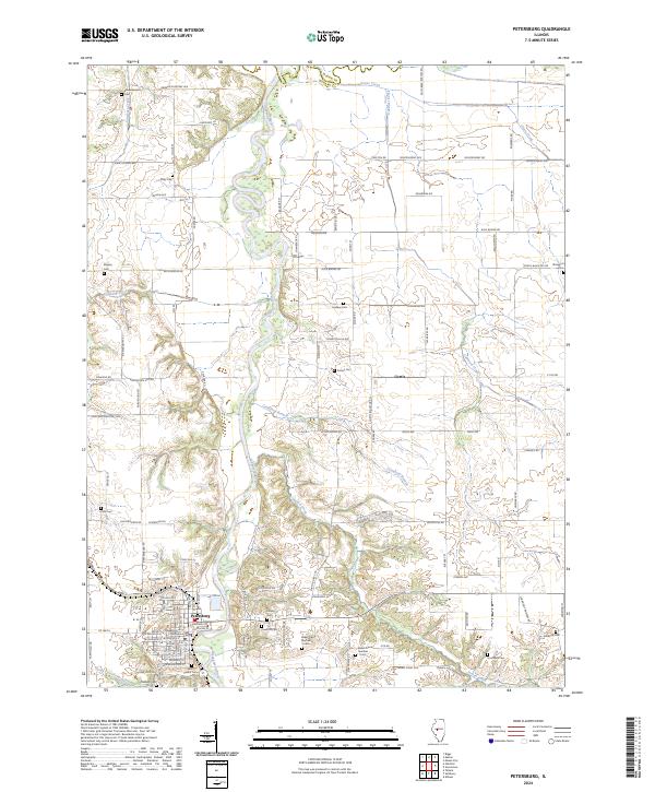 2024 Petersburg2024 Print · USGSPetersburg and the surrounding Menard County countryside are shown here in modern detail along the winding Sangamon River. Genealogists can trace numerous family-named burial sites, including Schoeneweiss Cem, Hornback Cem, and Kirby Cem.
 - 2024 Map of Greenview, 2024 Print
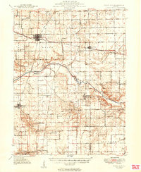
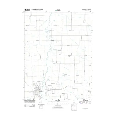
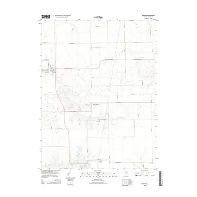
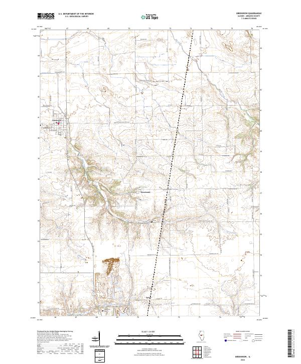 2024 Greenview2024 Print · USGSIn this modern survey of Menard County, the settlement at Greenview and the surrounding prairie terrain are captured in high detail. Researchers can locate early family landmarks such as Sugar Grove Cem or trace the rural roads leading to Sweetwater and Culver.
End of results
Showing maps 1-23 of 23
Top cities near Greenview
- Springfield historical maps
- Sherman historical maps
- Riverton historical maps
- Mason City historical maps
- Petersburg historical maps
- Athens historical maps
See more
Frequently asked questions
- What are the different types of historical maps available for Greenview?
- What is the oldest map of Greenview?
- Where can I purchase historical maps of Greenview for my home or office?
- Where can I download high-res historical maps of Greenview?
- Are there historical topographic maps available for Greenview?
- Is there historical aerial imagery available for Greenview?
- Where are historical maps of Greenview sourced from?