Old Maps of Perry County, Illinois
Explore 101 old maps of Perry County, spanning from 1910 to today. These high-resolution historic maps reveal how streets, neighborhoods, landmarks, and natural features evolved over time — perfect for genealogy, metal detecting, research, and local history exploration.
What you can do with these maps:
- See how Perry County changed over time: Compare historical maps to modern-day views to trace roads, homesites, rail lines & more.
- View detailed metadata: Each map includes creators, publishers, year, scale, and archive source.
- Overlay maps with satellite & LiDAR: Visualize the past alongside modern tools to explore terrain & human change.
- Trusted historical sources: Maps sourced from the USGS, Library of Congress, and other archives.
- Access maps your way: View online, download high-res files, or order prints for personal or research use.
Start exploring old maps of Perry County to uncover forgotten places, hidden landmarks, and the deep history beneath your feet.
Perry County, IL maps
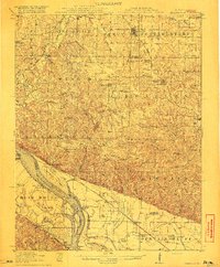
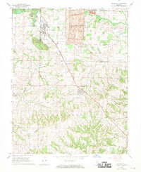
(101)- 1910 Map of Herrin
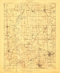 1910 Herrin1910 Print · USGSSouthern Illinois thrived at the height of its rail-and-coal era, with this 1910 survey capturing a landscape of growing towns and industrial spurs. Genealogists and historians can trace family roots through localized sites like Dewmaine, Old Duquoin, and the Oak Grove School.2 unique versions available
 - 1910 Map of Murphysboro
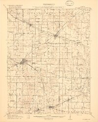
 1910 Murphysboro1910 Print · USGSSouthern Illinois at the turn of the century shows a landscape of busy rail junctions and tight-knit rural school districts. Genealogists can trace family footprints at Sutter Church, Sodom School, and the early township centers of Oraville and Vergennes.2 unique versions available
 - 1914 Map of Coulterville, 1965 Print
 1914 Coulterville1965 Print · USGSSouthern Illinois during the height of the steam era reveals a landscape of thriving rail hubs and rural school districts. Genealogists and local historians can trace the foundations of Sparta, Coulterville, and Steeleville alongside dozens of named country schools like Brick School and Temple School.
 - 1916 Map of Campbell Hill, 1953 Print
 1916 Campbell Hill1953 Print · USGSThe Mississippi River borderlands in the early twentieth century are captured here during a peak era of rail-and-river commerce. Genealogists can trace family names through dozens of rural schools like Oak School and settlements like Shiloh Hill or Wine Hill.3 unique versions available
 - 1917 Map of Coulterville
 1917 Coulterville1917 Print · USGSSouthern Illinois during the early twentieth century was defined by its coal-belt junctions and a dense grid of rural schoolhouses. Genealogists and historians can trace family locations near landmarks like Lost Prairie School, the Illinois Central rail lines, and the growing town of Sparta.3 unique versions available
 - 1918 Map of Campbell Hill
 1918 Campbell Hill1918 Print · USGSThe Illinois-Missouri borderlands near Campbell Hill are shown here during the late First World War era, where rail lines and river landings drove the local economy. Genealogists can trace family footprints across numerous rural school districts like Ebenezer School, Tangen School, and settlements such as Shiloh Hill.3 unique versions available
 - 1924 Map of Pinckneyville, 1958 Print
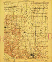
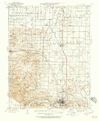
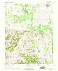
 1924 Pinckneyville1958 Print · USGSPerry County at the height of its rail and coal era is captured here, centered on the bustling junction of Pinckneyville. Genealogists can locate dozens of country schools like St Marys School and Slade School, or trace family mines such as Panther Mine.2 unique versions available
 - 1926 Map of Pinckneyville
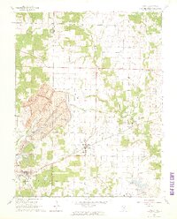
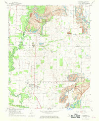
 1926 Pinckneyville1926 Print · USGSPerry County at the height of the mid-twenties coal era shows a bustling landscape of rail-connected towns and rural school districts. Genealogists and historians can trace family locations near Pinckneyville at Carr School, Oak Grove Church, and the Victory Coal Mine.2 unique versions available
 - 1926 Map of Duquoin
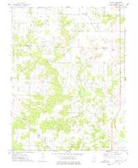
 1926 Duquoin1926 Print · USGSSouthern Illinois coal country is at its industrial peak in the mid-twenties, with thriving rail towns and active collieries. You can trace early 20th-century family roots at Young's Chapel or locate old operations like the Big Ben Mine and Old Keller Mine.3 unique versions available
 - 1936 Map of Herrin
 1936 Herrin1936 Print · USGSSouthern Illinois was defined by its coal-and-rail economy in the 1930s as industrial lines reached deep into the countryside. Trace the family landmarks of this era at Old Duquoin, Buckner Pond, and the Union Hill Church.2 unique versions available
 - 1938 Map of Murphysboro, 1958 Print
 1938 Murphysboro1958 Print · USGSSouthern Illinois in the late thirties is defined here by the busy rail hubs and river bends of the Jackson and Perry county line. Researchers can trace rural lineages through numerous country schoolhouses like Sugar Hill School and Woodward School or old rail junctions at Oraville and Texas Junction.
 - 1949 Map of Paducah
 1949 Paducah1949 Print · USGSThe confluence of the Ohio, Mississippi, Tennessee, and Cumberland rivers at the close of the 1940s reveals a region bound by water and rail. Researchers can trace historic river landings, timberlands in the Shawnee National Forest, and the coal-mining infrastructure around West Frankfort and Herrin.2 unique versions available
 - 1950 Map of Paducah
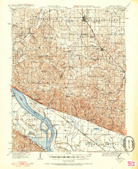
 1950 Paducah1950 Print · USGSThe confluence of the great midwestern rivers defines this mid-century landscape at the intersection of Illinois, Kentucky, and Missouri. Genealogists and historians can trace the rail-and-river economy through the hubs of Paducah, Cairo, and Metropolis or locate family roots near the Wildcat Hills.
 - 1954 Map of Paducah
 1954 Paducah1954 Print · USGSSouthern Illinois and Western Kentucky intersect at the great river confluences during this mid-century era of rail and river industry. Genealogists and historians can trace family roots and commerce through river towns like Cairo, Metropolis, and Golconda, or along the tracks of the Illinois Central Railroad.2 unique versions available
 - 1958 Map of Belleville, 1973 Print
 1958 Belleville1973 Print · USGSSouthern Illinois during the mid-twentieth century reveals a landscape of industrial growth and massive new reservoirs. Genealogists and historians can trace the paths of the Illinois Central RR through towns like Centralia or locate landmarks such as Emerald Mound and the Looking Glass Prairie.3 unique versions available
 - 1961 Map of Paducah
 1961 Paducah1961 Print · USGSThe Lower Ohio Valley at mid-century is a landscape defined by its great rivers and newly formed reservoirs. Researchers can trace the riverfronts of Paducah and Metropolis, or locate smaller settlements like Old Shawneetown and Cave in Rock along the banks.2 unique versions available
 - 1962 Map of Belleville
 1962 Belleville1962 Print · USGSSouthern Illinois in the late fifties reveals a landscape of industrial growth and ancient landmarks before the full expansion of the interstate system. Genealogists can trace family names and rural post offices near Centralia, Salem, and the historic Monks Mound.
 - 1964 Map of Paducah
 1964 Paducah1964 Print · USGSThe river-and-rail corridor of Southern Illinois and Western Kentucky is captured here during the height of the mid-century industrial era. Genealogists and researchers can trace local landmarks across several counties, from the rail yards of Paducah to the waters of Crab Orchard Lake and Kentucky Reservoir.2 unique versions available
 - 1965 Map of Percy, 1966 Print
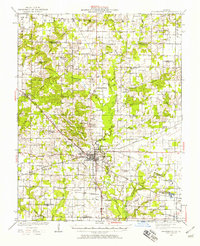
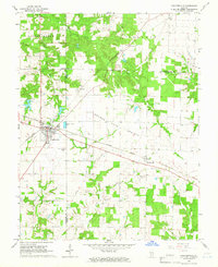
 1965 Percy1966 Print · USGSRandolph and Perry Counties are shown in the mid-1960s, just as coal extraction was reshaping the Southern Illinois landscape. Genealogists and historians can trace the massive Strip Mine near Percy or locate family sites like Weitzel Cem and the Lost Prairie Sch.3 unique versions available
 - 1965 Map of Coulterville, 1966 Print
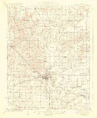
 1965 Coulterville1966 Print · USGSThe Illinois prairie meets the railroad junction in the mid-1960s at the intersection of three counties. Genealogists and rail historians can trace the paths of the Illinois Central through Coulterville or find local landmarks like Bethel Cem and McKinley.2 unique versions available
 - 1968 Map of Elkville, 1969 Print
 1968 Elkville1969 Print · USGSSouthern Illinois coal and rail communities are captured here in the late sixties, showing the transition between rural farmland and industrial mining. Genealogists can locate family burial sites like Old Du Quoin Cem and Greer Cem, or trace the rail corridors through Dowell and Hallidayboro.2 unique versions available
 - 1968 Map of Willisville, 1970 Print
 1968 Willisville1970 Print · USGSWillisville and Campbell Hill sat at the intersection of rail and resource extraction during the late sixties. Genealogists and local historians can trace family burial grounds at St Lukes Cem and Barrow Cem or locate the Gulf Mobile and Ohio rail line.2 unique versions available
 - 1968 Map of Ava, 1970 Print
 1968 Ava1970 Print · USGSSouthwestern Illinois in the late sixties reveals a landscape of coal-rich hills and quiet rail towns along the Gulf Mobile and Ohio tracks. Researchers can trace family history through numerous rural cemeteries like Evergreen Cem or explore the terrain around Sato and Tater Hill.2 unique versions available
 - 1968 Map of Vergennes, 1970 Print
 1968 Vergennes1970 Print · USGSSouthern Illinois at the end of the sixties shows a landscape shaped by coal extraction and the rail lines of the Illinois Central. Genealogists can trace family landmarks like Parrish Cem and Tuthill Cem near the village of Vergennes.
 - 1974 Map of Winkle, 1978 Print
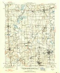
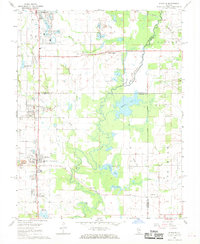
 1974 Winkle1978 Print · USGSPerry County and Washington County are captured in the mid-1970s, showing a rural landscape defined by the Illinois Central Gulf railroad. Researchers can locate family landmarks like Pilot Knob Cem, Bethel Ch, and the small settlement of Winkle.
Showing maps 1-25 of 101
Top cities of Perry County
- Du Quoin historical maps
- Pinckneyville historical maps
- Tamaroa historical maps
- Willisville historical maps
- Cutler historical maps
Frequently asked questions
- What are the different types of historical maps available for Perry County?
- What is the oldest map of Perry County?
- Where can I purchase historical maps of Perry County for my home or office?
- Where can I download high-res historical maps of Perry County?
- Are there historical topographic maps available for Perry County?
- Is there historical aerial imagery available for Perry County?
- Where are historical maps of Perry County sourced from?