Old Maps of Swansea, Illinois
Explore 27 old maps of Swansea, spanning from 1888 to today. These high-resolution historic maps reveal how streets, neighborhoods, landmarks, and natural features evolved over time — perfect for genealogy, metal detecting, research, and local history exploration.
What you can do with these maps:
- See how Swansea changed over time: Compare historical maps to modern-day views to trace roads, homesites, rail lines & more.
- View detailed metadata: Each map includes creators, publishers, year, scale, and archive source.
- Overlay maps with satellite & LiDAR: Visualize the past alongside modern tools to explore terrain & human change.
- Trusted historical sources: Maps sourced from the USGS, Library of Congress, and other archives.
- Access maps your way: View online, download high-res files, or order prints for personal or research use.
Start exploring old maps of Swansea to uncover forgotten places, hidden landmarks, and the deep history beneath your feet.
Swansea, IL maps
(27)- 1888 Map of St. Louis
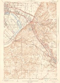
 1888 St. Louis1888 Print · USGSThe Illinois bottomlands across from St. Louis come alive in the late nineteenth century as a massive railroad hub emerging from the river wetlands. Researchers can trace early rail junctions and settlements like French Village, the ancient Monks Mound, and the industrial waterfronts of Brooklyn and East St Louis.
 - 1907 Map of Belleville
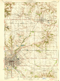
 1907 Belleville1907 Print · USGSSouthwestern Illinois is seen at a height of rail-driven expansion in the early twentieth century. Trace genealogy and land history in Belleville, O'Fallon, and Summerfield along the Vandalia System and other regional lines.3 unique versions available
 - 1931 Map of French Village, 1954 Print
 1931 French Village1954 Print · USGSSt. Clair County's industrial and residential corridors are frozen in time during the early thirties, showing the dense rail networks and coal mining operations of the era. Genealogists can locate family landmarks like Twiss Hill Sch, the Booker T Washington Cemetery, and Gundlach Mines.
 - 1935 Map of French Village
 1935 French Village1935 Print · USGSSt. Clair County's industrial and social landscape in the 1930s is revealed through its dense network of coal mines, electric railways, and emerging suburbs. Trace early settlements and institutions like French Village, St Henry College, and the New St Clair Mine.2 unique versions available
 - 1937 Map of O'Fallon
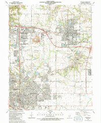
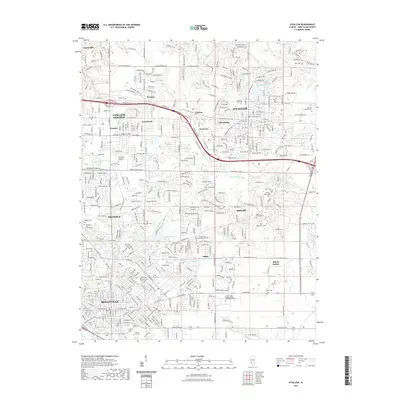
 1937 O'Fallon1937 Print · USGSSt. Clair County's coal and rail landscape is on full display during the late 1930s. Genealogists and historians can trace rail depots like Shiloh Sta, local mines including St Ellen Mine, and numerous country schools such as Whiteside Sch.2 unique versions available
 - 1949 Map of Saint Louis
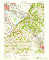
 1949 Saint Louis1949 Print · USGSGreater St. Louis and its surrounding river valleys are captured here just after the war, showing the metropolitan core and the rural Ozark fringe. Researchers can trace the sprawling rail network of the Wabash RR or locate landmarks like Meramec Caverns Airport and Scott Air Force Base.2 unique versions available
 - 1954 Map of French Village, 1959 Print
 1954 French Village1959 Print · USGSSt. Clair County transitions from the industrial floodplain to the bluffs of Belleville and Signal Hill during the mid-fifties. Researchers can trace vanished rural landmarks like Twiss Hill Sch, the early grounds of St Henry College, and the sprawling landscape of Grand Marais State Park.5 unique versions available
 - 1954 Map of O'Fallon, 1959 Print
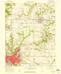 1954 O'Fallon1959 Print · USGSMid-century St. Clair County thrives as an industrial and rail hub connecting Belleville and O'Fallon. Researchers can trace the legacy of the St Louis and O'Fallon Mine or locate family sites at Oak Hill Cem and Milburn Sch.4 unique versions available
 - 1958 Map of Belleville, 1973 Print
 1958 Belleville1973 Print · USGSSouthern Illinois during the mid-twentieth century reveals a landscape of industrial growth and massive new reservoirs. Genealogists and historians can trace the paths of the Illinois Central RR through towns like Centralia or locate landmarks such as Emerald Mound and the Looking Glass Prairie.3 unique versions available
 - 1962 Map of St. Louis
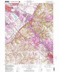
 1962 St. Louis1962 Print · USGSThe mid-century gateway to the west shows the metropolitan expansion of St Louis alongside its critical river confluences. Genealogists and historians can trace the rail corridors of the Missouri Pacific RR and settlements from Fulton to De Soto.
 - 1962 Map of Belleville
 1962 Belleville1962 Print · USGSSouthern Illinois in the late fifties reveals a landscape of industrial growth and ancient landmarks before the full expansion of the interstate system. Genealogists can trace family names and rural post offices near Centralia, Salem, and the historic Monks Mound.
 - 1963 Map of St. Louis, 1970 Print
 1963 St. Louis1970 Print · USGSSt. Louis and its surrounding river valleys are captured here during the peak of mid-century suburban expansion and industrial activity. Trace the historic rail routes of the Norfolk and Western Ry or locate the St Louis Ordnance Plant and early stretches of US Highway 66.4 unique versions available
 - 1966 Map of St. Louis
 1966 St. Louis1966 Print · USGSThe St. Louis metropolitan area and its surrounding river valleys are captured here during the mid-sixties era of suburban growth and industrial strength. Genealogists and historians can trace the foundations of local communities through sites like Old Pioneer Cem, Parks College, and the Jefferson Barracks Military Reservation.
 - 1985 Map of St Louis
 1985 St Louis1985 Print · USGSThe St. Louis metropolitan area and its river confluences are captured here during a period of significant suburban expansion in the 1980s. Genealogists and historians can trace the development of older neighborhoods and landmarks like Jefferson Barracks, Cahokia Mounds State Park, and Washington University.3 unique versions available
 - 1985 Map of Carlyle Lake
 1985 Carlyle Lake1985 Print · USGSSouthwestern Illinois in the mid-eighties shows a landscape of growing commuter suburbs and massive water management projects. Genealogists and historians can locate family plots at Lakeview Memorial Gardens Cem or trace the early footprint of Southern Illinois Univ (Edwardsville).2 unique versions available
 - 1991 Map of O'Fallon
 1991 O'Fallon1991 Print · USGSSt. Clair County experiences significant suburban growth in the early nineties as residential developments expand around traditional industry. Trace family roots and local history through Messenger Cem, the tracks of the Southern Railway, and Shiloh Station.2 unique versions available
 - 1998 Map of French Village, 1999 Print
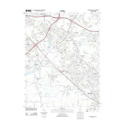
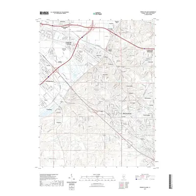
 1998 French Village1999 Print · USGSThe bluffs and bottomlands of St. Clair County are captured here during the late nineties, showing the suburban expansion between East St. Louis and Belleville. Researchers can locate family sites at Union Hill Cem, trace the rail lines of Conrail, or find local landmarks like Cahokia Downs.
 - 2012 Map of O'Fallon, 2012 Print
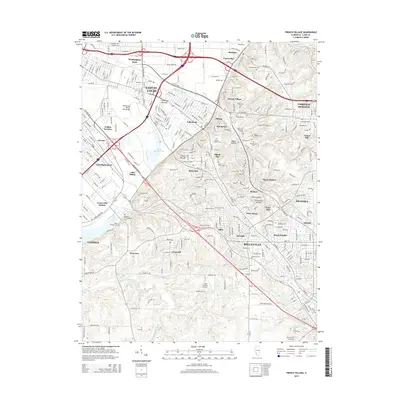
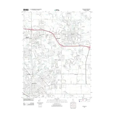 2012 O'Fallon2012 Print · USGSCovers Swansea, including Belleville, O'Fallon, and other nearby areas
 - 2012 Map of French Village, 2012 Print
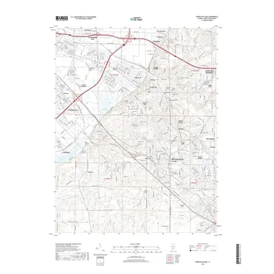
 2012 French Village2012 Print · USGSCovers Swansea, including Belleville, East St. Louis, and other nearby areas
 - 2015 Map of French Village, 2015 Print
 2015 French Village2015 Print · USGSCovers Swansea, including Belleville, East St. Louis, and other nearby areas
 - 2015 Map of O'Fallon, 2015 Print
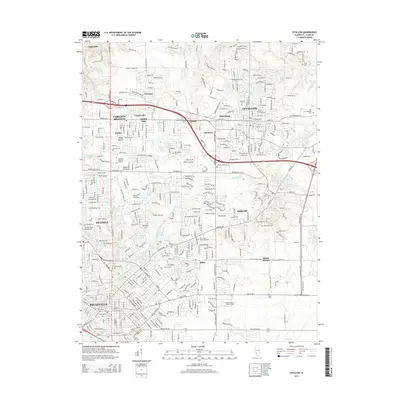 2015 O'Fallon2015 Print · USGSCovers Swansea, including Belleville, O'Fallon, and other nearby areas
 - 2018 Map of French Village, 2018 Print
 2018 French Village2018 Print · USGSCovers Swansea, including Belleville, East St. Louis, and other nearby areas
 - 2018 Map of O'Fallon, 2018 Print
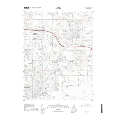 2018 O'Fallon2018 Print · USGSCovers Swansea, including Belleville, O'Fallon, and other nearby areas
 - 2021 Map of O'Fallon, 2021 Print
 2021 O'Fallon2021 Print · USGSCovers Swansea, including Belleville, O'Fallon, and other nearby areas
 - 2021 Map of French Village, 2021 Print
 2021 French Village2021 Print · USGSCovers Swansea, including Belleville, East St. Louis, and other nearby areas
Showing maps 1-25 of 27
Top cities near Swansea
- St. Louis historical maps
- Belleville historical maps
- O'Fallon historical maps
- Granite City historical maps
- Edwardsville historical maps
- Collinsville historical maps
See more
Frequently asked questions
- What are the different types of historical maps available for Swansea?
- What is the oldest map of Swansea?
- Where can I purchase historical maps of Swansea for my home or office?
- Where can I download high-res historical maps of Swansea?
- Are there historical topographic maps available for Swansea?
- Is there historical aerial imagery available for Swansea?
- Where are historical maps of Swansea sourced from?