Old Maps of Whiteside County, Illinois for Hiking & Exploration
Hike through history with 141 historic maps of Whiteside County. Explore old trails, ghost towns, and forgotten backroads — perfect for outdoor adventurers and local explorers.
- Rediscover forgotten places: Map out old mining camps, roads, and footpaths that no longer exist on modern maps.
- Layer with modern tools: Combine with LiDAR or satellite views to plan hikes through historical terrain.
- Made for exploration: Popular among hikers, overlanders, and local history lovers.
Use these maps to find adventure and explore the hidden past of Whiteside County.
Whiteside County, IL maps
(141)- 1891 Map of Clinton
 1891 Clinton1891 Print · USGSThe Mississippi River corridor thrived as a dual-state rail hub in the 1890s, anchored by the riverfront centers of Clinton and Fulton. Researchers can trace the early tracks of the Chicago and Northwestern RR and locate vanished stops like Almont and Argo.
 - 1894 Map of Clinton
 1894 Clinton1894 Print · USGSThe riverfront communities of eastern Iowa and western Illinois are captured here in the late nineteenth century as rail expansion reached its peak. Researchers can trace early street grids in Clinton and Lyons or locate old rail junctions near Garden Plain and Almont.3 unique versions available
 - 1899 Map of Clinton
 1899 Clinton1899 Print · USGSThe Mississippi River valley comes alive in the late 1890s, capturing the river-and-rail economy of Iowa and Illinois before modern channelization. Genealogists and historians can trace early townships and river landings, finding precise locations for Low Moor, Folletts, and Pink Prairie.5 unique versions available
 - 1930 Map of Woodsung
 1930 Woodsung1930 Print · USGSNorthern Illinois at the dawn of the 1930s shows a landscape of tight-knit farming townships linked by the Lincoln Highway. Genealogists and local historians can trace schoolhouse locations like Stone Sch and Gap Grove Sch, or locate family sites near the Prairieville Cem.
 - 1932 Map of Prophetstown
 1932 Prophetstown1932 Print · USGSProphetstown and the Rock River valley are depicted here in the early 1930s, showing a rural landscape crisscrossed by an extensive system of drainage ditches and canals. Researchers can locate dozens of small schools and local landmarks, including Hamilton Grave Sch, the Lyndon Cemetery, and Denrock Station.
 - 1934 Map of Morrison
 1934 Morrison1934 Print · USGSWhiteside County is seen here in the 1930s as a thriving agricultural landscape defined by the Chicago and Northwestern rail line. Researchers can trace rural school districts and family cemeteries such as Union Grove Cemetery, Coleta, and Milledgeville.2 unique versions available
 - 1936 Map of Prophetstown
 1936 Prophetstown1936 Print · USGSWhiteside and Henry counties are shown in the mid-1930s, defined by the Rock River and a dense network of prairie schoolhouses. Trace the Hooppole Yorktown and Tampico RR or find local landmarks like Thunderbolt Hill and St Marys Ch.3 unique versions available
 - 1940 Map of Morrison
 1940 Morrison1940 Print · USGSWhiteside and Carroll counties thrive as a robust agricultural landscape during the late 1930s, defined by the twin engines of the Rock River and major rail lines. Genealogists can locate dozens of country schools like Ideal Sch and old cemeteries including Clyde Cem and Bethel Cem.2 unique versions available
 - 1946 Map of Sterling, 1969 Print
 1946 Sterling1969 Print · USGSThe Rock River corridor in the mid-1940s is captured here, showing the industrial heart of the region alongside its deep agricultural roots. Researchers can find dozens of country schools and cemeteries, including Buffalo Grove Sch, Zion Cem, and Oak Knoll Mem Park Cem.
 - 1948 Map of Sterling
 1948 Sterling1948 Print · USGSMid-century Sterling and Rock Falls are captured here during a time of robust rail and river activity. Genealogists can trace family roots through dozens of rural landmarks, including the Prairieville settlement, West Science Ridge Ch, and Hitt Cem.2 unique versions available
 - 1949 Map of Walnut
 1949 Walnut1949 Print · USGSThe rural landscapes of Bureau and Lee counties are captured in the late 1940s, a time when one-room schools and small rail towns anchored the prairie. Genealogists can trace family landmarks like Bowen Cem, Sturtz Sch, and the community of New Bedford along the Green River.3 unique versions available
 - 1952 Map of Erie, 1953 Print
 1952 Erie1953 Print · USGSWhiteside and Henry counties are mapped here in the early fifties, showing a rural river-bound landscape along the Rock River. Local historians can trace family roots at Pink Prairie Cem or locate the site of the Old Stage Line Monument and Kingsbury Sch.2 unique versions available
 - 1952 Map of Clinton, 1953 Print
 1952 Clinton1953 Print · USGSThe Illinois-Iowa border along the Mississippi River is captured here in the early fifties, showing a landscape defined by industrial rail lines and wildlife refuges. Trace family roots through specific rural landmarks like York Ch, Cottonwood Sch, and Calvary Cem.2 unique versions available
 - 1953 Map of Clinton, 1977 Print
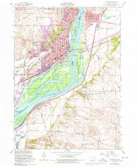 1953 Clinton1977 Print · USGSClinton and the Mississippi River islands are captured here in the 1950s during a period of industrial riverfront activity. Researchers can trace historic schools and cemeteries such as Cedar Creek School, Jane Lamb Memorial Hospital, and St Marys Cemetery across the tri-county area.
 - 1958 Map of Davenport, 1968 Print
 1958 Davenport1968 Print · USGSEastern Iowa and western Illinois thrive along the river during the late fifties, defined by the industrial Quad Cities and a robust rail network. Genealogists can trace family roots through settlements like Oasis and Stanwood or along the Cedar River.2 unique versions available
 - 1958 Map of Aurora, 1969 Print
 1958 Aurora1969 Print · USGSNorthern Illinois in the late fifties shows a landscape of powerful river industry and expanding transport corridors. Genealogists and historians can trace the development of Aurora and Joliet or locate sites like the Elwood Ordnance Plant and Starved Rock.3 unique versions available
 - 1961 Map of Aurora
 1961 Aurora1961 Print · USGSNorthern Illinois at the height of the post-war era reveals a landscape of massive industrial works and thriving river towns. Genealogists and historians can trace the paths of the Lincoln Highway or locate long-standing landmarks like the Green River Ordnance Plant and Starved Rock State Park.
 - 1961 Map of Davenport
 1961 Davenport1961 Print · USGSThe Quad Cities and the eastern Iowa riverlands are captured here in the early sixties, showing the region's transition into a modern industrial and transit hub. Genealogists and historians can trace the paths of major railroads and find river landmarks like Rock Island Arsenal, Huron Island, and the Coralville Reservoir.
 - 1962 Map of Davenport
 1962 Davenport1962 Print · USGSThe Quad Cities and the Mississippi River corridor are shown at their industrial peak just before the interstate era fully transformed the region. Researchers can trace the sprawling rail networks of the Chicago Rock Island and Pacific and find landmarks like the Rock Island Arsenal and Wild Cat Den State Park.
 - 1967 Map of Clinton NW, 1968 Print
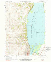 1967 Clinton NW1968 Print · USGSThe Mississippi River bluffs north of Clinton are documented here during the late sixties as industrial and conservation interests shaped the shoreline. Researchers can trace historic family burial sites like Smith Cem or locate the St Irenaeus Sch and Lock and Dam No 13.2 unique versions available
 - 1982 Map of New Bedford
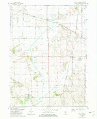 1982 New Bedford1982 Print · USGSThe Illinois prairie of the early 1980s is captured here, showing the rural intersection of Bureau and Whiteside counties. Genealogists can locate family sites near Fairfield Greenville Cem, while the Indian Treaty Boundary offers a glimpse into early land division.
 - 1982 Map of Erie
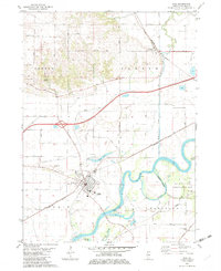 1982 Erie1982 Print · USGSWhiteside County's river-bottom lands are captured here in the early 1980s, centered on the bend of the Rock River. Genealogists and local historians can locate early burial sites like Smack Cem and Sandytown Cem or trace the rural routes connecting Newton Corners and Fenton.
 - 1982 Map of Hooppole
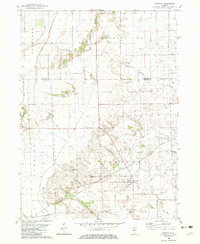 1982 Hooppole1982 Print · USGSNorthern Illinois farmland is captured here in the early eighties, revealing a landscape deeply marked by history and infrastructure. Trace the Old Indian Treaty Boundary and find family landmarks like St Marys Ch and Hooppole.
 - 1982 Map of Tampico
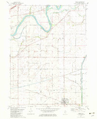 1982 Tampico1982 Print · USGSTampico and the surrounding Whiteside County plains are shown in the early eighties as a landscape of structured drainage and rail. Genealogists and historians can trace family locations near St Marys Cem, the Hennepin Canal State Park Feeder, and the settlement of Olson.
 - 1982 Map of Hahnaman
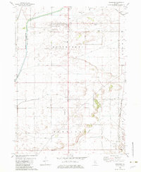 1982 Hahnaman1982 Print · USGSWhiteside County in the early eighties shows an engineered landscape of prairie drainage and rail lines. Researchers can trace family-named roads like Mc Elvee Road and local sites like the Montmorency Sch and the Hennepin Canal Feeder.
Showing maps 1-25 of 141
Top cities of Whiteside County
- Sterling historical maps
- Rock Falls historical maps
- Morrison historical maps
- Fulton historical maps
- Prophetstown historical maps
- Erie historical maps
See more
Frequently asked questions
- What are the different types of historical maps available for Whiteside County?
- What is the oldest map of Whiteside County?
- Where can I purchase historical maps of Whiteside County for my home or office?
- Where can I download high-res historical maps of Whiteside County?
- Are there historical topographic maps available for Whiteside County?
- Is there historical aerial imagery available for Whiteside County?
- Where are historical maps of Whiteside County sourced from?