2020s Maps of Adams County, Indiana
Explore 12 historic maps of Adams County from the 2020s. These maps offer a rare glimpse into what life looked like during the 2020s — showing old roads, neighborhoods, homes, and landmarks that have changed or disappeared over time.
Whether you're researching your family's past, planning a metal detecting trip, or studying how Adams County's landscape evolved across the 2020s, these high-resolution maps are a powerful tool for exploring the history of this region.
- Focus on a specific era: All maps on this page are from the 2020s, giving you a focused view of this time period.
- See what’s changed: Compare century-old streets, trails, and buildings to today's modern landscape using overlays and satellite layers.
- Research with precision: Use these maps for genealogy, historical research, land use analysis, or educational projects.
- View, download, or print: Maps are fully viewable online in high resolution, and can be downloaded or printed for your own records.
Start exploring Adams County's history through authentic maps from the 2020s. This is your window into the past.
Adams County, IN maps
(12)- 2022 Map of Berne, 2022 Print
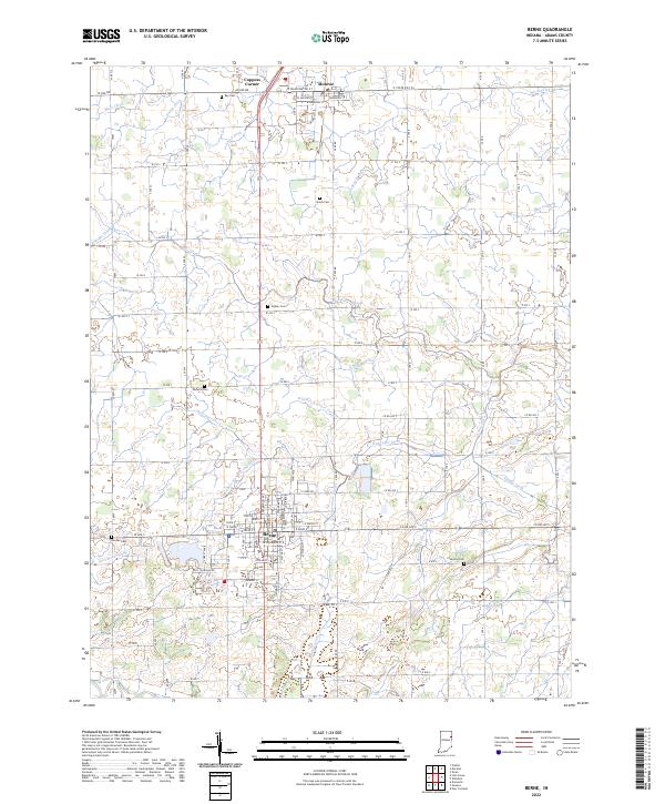 2022 Berne2022 Print · USGSThe rural landscape of Adams County comes alive in this modern survey of Berne and Monroe. Genealogists can trace family heritage through numerous burial grounds like Ray Cem and Graber Cem while following the path of the Wabash River.
 - 2022 Map of Decatur, 2022 Print
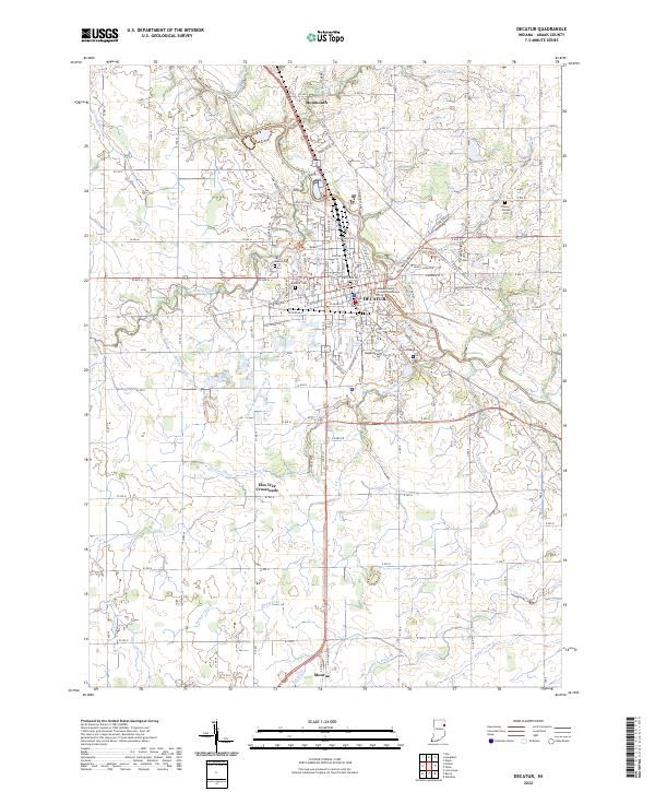 2022 Decatur2022 Print · USGSThe city of Decatur and the Saint Marys River valley are shown here in the 2020s, revealing a landscape defined by historic county infrastructure and modern industry. Researchers can locate the Adams County Courthouse, several local burial grounds like Union Chapel Cem, and outlying points like Elm Tree Crossroads.
 - 2022 Map of Hoagland, 2022 Print
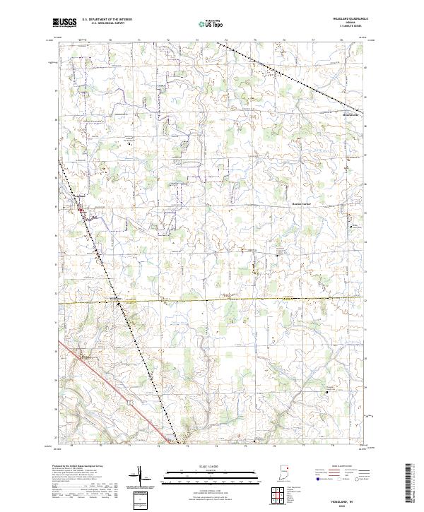 2022 Hoagland2022 Print · USGSEastern Allen County is mapped here in the early 2020s, showing a meticulously drained agricultural landscape. Genealogists can trace family roots at Saint-Johns Lutheran Flat Rock Cem, Alpha Cem, and Pleasant Valley Cem.
 - 2022 Map of Preble, 2022 Print
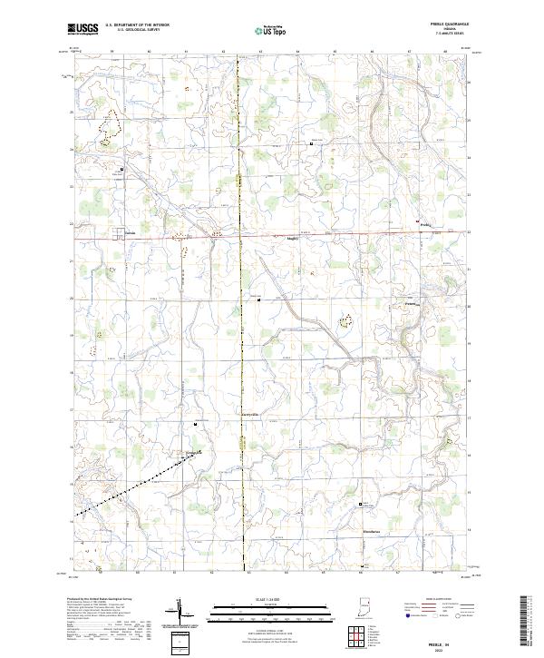 2022 Preble2022 Print · USGSThe rural border of Wells and Adams counties is documented here in the early twenty-first century, showing a landscape defined by industrial agriculture. Researchers can locate established cemeteries like Oakland Cem and trace the paths of long-standing ditches such as Holthouse Ditch near Preble.
 - 2022 Map of Geneva, 2022 Print
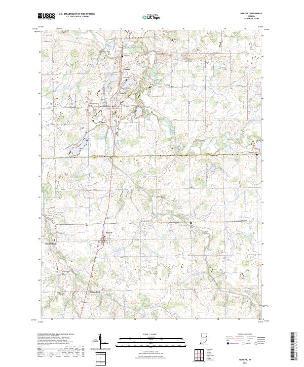 2022 Geneva2022 Print · USGSThe borderlands of Adams and Jay counties are captured here in the early twenty-first century, centered on the historic Geneva and Bryant communities. Researchers can trace rural lineages through numerous local sites including Westlawn Cem, Gravel Hill Cem, and the path of the Wabash River.
 - 2022 Map of Linn Grove, 2022 Print
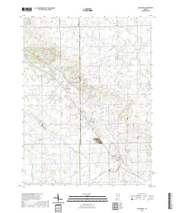 2022 Linn Grove2022 Print · USGSThe rural borderlands of Wells and Adams counties come into focus here, showing the agricultural landscape as it remains in the early 2020s. Researchers can trace family history through several burial sites like Saint Johns Cem and Greenwood Cem, or explore the riverfront at Vera Cruz and Linn Grove.
 - 2022 Map of Dixon, 2022 Print
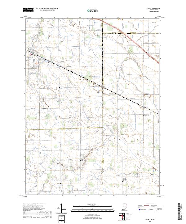 2022 Dixon2022 Print · USGSThe Indiana and Ohio borderlands come alive in this detailed record of rural life and small-town organization. Genealogists can trace family names through numerous sites like Clark Chapel Cem, Bethel Cem, and the village of Monroeville.
 - 2022 Map of Domestic, 2022 Print
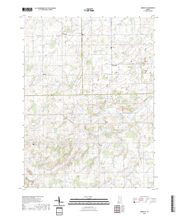 2022 Domestic2022 Print · USGSJay County's rural agricultural landscape and drainage history are on full display in this modern survey of the Indiana countryside. Researchers can trace the heritage of local families at Hartford Cem and Alberson Cem or explore the wetlands near Loblolly Cr.
 - 2022 Map of New Corydon, 2022 Print
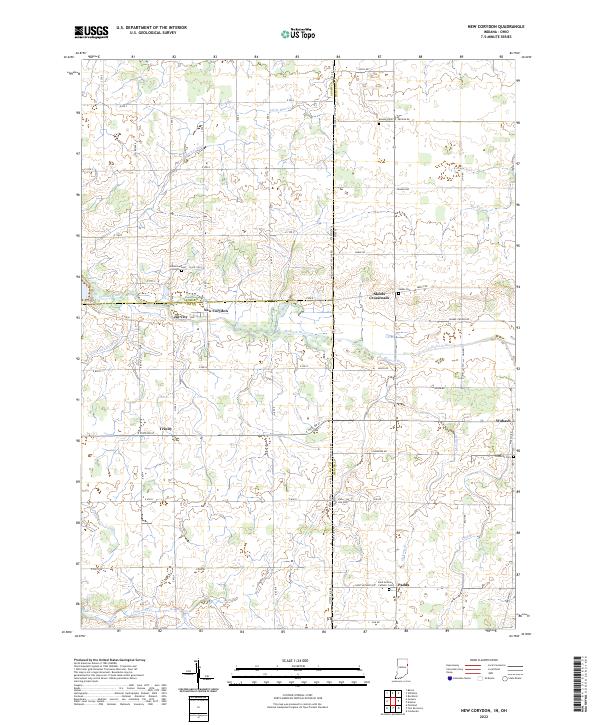 2022 New Corydon2022 Print · USGSThe Indiana-Ohio borderlands come into focus in the early 2020s, showing a landscape shaped by the Wabash River and an extensive network of drainage ditches. Local historians can trace established crossroad settlements like New Corydon and Skeels Crossroads alongside numerous burial sites like Lufborrow Cem.
 - 2022 Map of Poe, 2022 Print
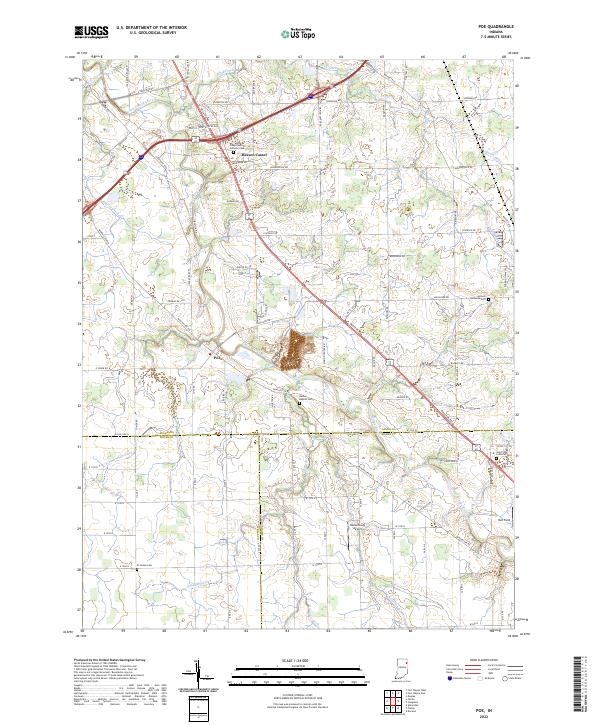 2022 Poe2022 Print · USGSSoutheastern Allen County is revealed here during the early 2020s, showing a landscape defined by the Saint Marys River and long-standing rural communities. Genealogists can locate family landmarks at Bethel Baptist Cem or trace the early settlement at Poe.
 - 2023 Map of Wren, 2023 Print
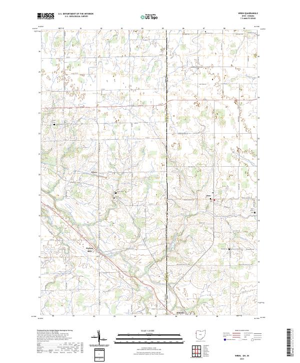 2023 Wren2023 Print · USGSThe Indiana-Ohio state line splits this agricultural landscape during the early 2020s, centered on the Saint Marys River. Researchers can locate several rural burial grounds like Old Mount Tabor Cem and trace the paths of historic hamlets such as Rivare and Pleasant Mills.
 - 2023 Map of Willshire, 2023 Print
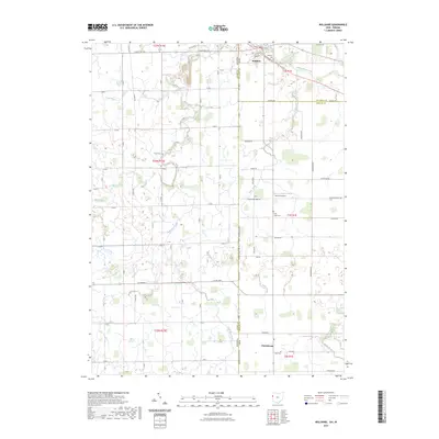 2023 Willshire2023 Print · USGSThe village of Willshire and the surrounding farmland along the Indiana-Ohio border are captured here in the early 2020s. Researchers can pinpoint long-established burial sites like Tricker Cem and Zion Cem or trace the winding course of the Saint Marys River.
End of results
Showing maps 1-12 of 12
Top cities of Adams County
- Decatur historical maps
- Berne historical maps
- Geneva historical maps
- Preble historical maps
- Monroe historical maps
Frequently asked questions
- What are the different types of historical maps available for Adams County?
- What is the oldest map of Adams County?
- Where can I purchase historical maps of Adams County for my home or office?
- Where can I download high-res historical maps of Adams County?
- Are there historical topographic maps available for Adams County?
- Is there historical aerial imagery available for Adams County?
- Where are historical maps of Adams County sourced from?