2020s Maps of Clinton County, Indiana
Explore 14 historic maps of Clinton County from the 2020s. These maps offer a rare glimpse into what life looked like during the 2020s — showing old roads, neighborhoods, homes, and landmarks that have changed or disappeared over time.
Whether you're researching your family's past, planning a metal detecting trip, or studying how Clinton County's landscape evolved across the 2020s, these high-resolution maps are a powerful tool for exploring the history of this region.
- Focus on a specific era: All maps on this page are from the 2020s, giving you a focused view of this time period.
- See what’s changed: Compare century-old streets, trails, and buildings to today's modern landscape using overlays and satellite layers.
- Research with precision: Use these maps for genealogy, historical research, land use analysis, or educational projects.
- View, download, or print: Maps are fully viewable online in high resolution, and can be downloaded or printed for your own records.
Start exploring Clinton County's history through authentic maps from the 2020s. This is your window into the past.
Clinton County, IN maps
(14)- 2022 Map of Frankfort, 2022 Print
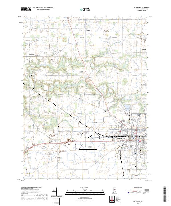 2022 Frankfort2022 Print · USGSFrankfort and its rural surroundings in the early 2020s remain a landscape of agricultural heritage and small-town centers. Researchers can trace family history through several burial grounds, including Providence Cem and Bunnell Cem, or locate the Clinton County Courthouse downtown.
 - 2022 Map of Hillisburg, 2022 Print
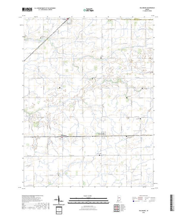 2022 Hillisburg2022 Print · USGSClinton County's rural heartland is documented here in the early twenty-first century, showing the enduring grid of family farms and drainage works. Researchers can locate numerous local burial sites including Old Liberty Cem, Saint Paul Cem, and Stroup Cem.
 - 2022 Map of Pyrmont, 2022 Print
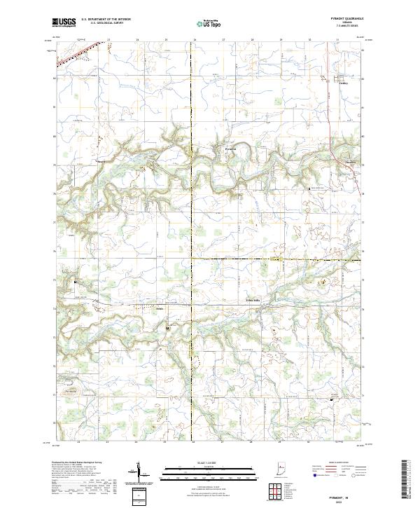 2022 Pyrmont2022 Print · USGSThe rural borderlands of Tippecanoe, Carroll, and Clinton counties come into focus in this contemporary survey. Researchers can trace the heritage of local settlements like Edna Mills and Pyrmont or locate family plots at Swank Cem and Zion Cem.
 - 2022 Map of Kirklin, 2022 Print
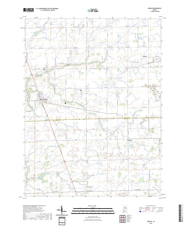 2022 Kirklin2022 Print · USGSThe borderlands of Clinton and Boone counties are shown here in the 2020s, revealing a landscape deeply transformed for modern agriculture. Researchers can trace family roots at Oak Hill Cem or locate the rural crossroads of Pickard and Terhune.
 - 2022 Map of Burlington, 2022 Print
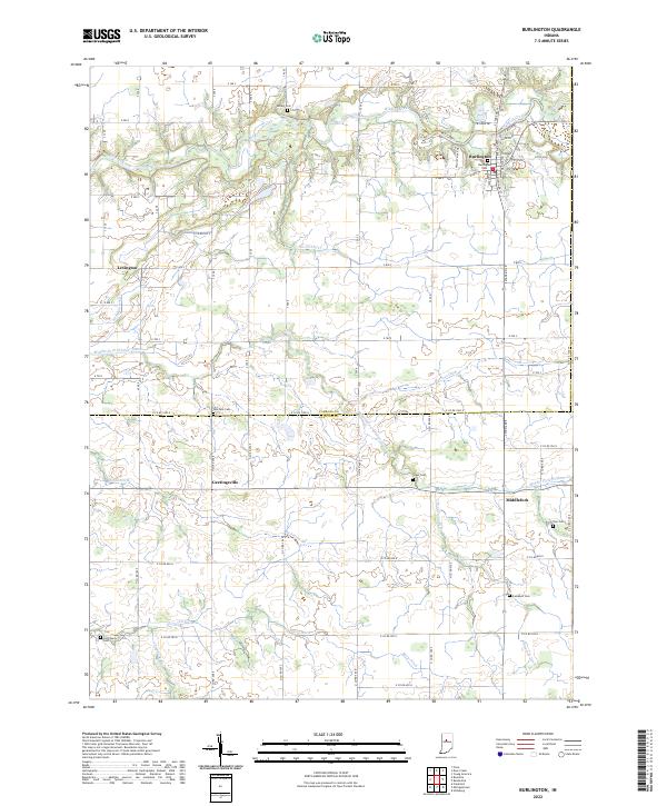 2022 Burlington2022 Print · USGSThe border of Carroll and Clinton counties in the early 2020s remains a landscape of small villages and productive farmland. Genealogists can trace family history through several local burial sites, including Old Chaney Cem, Hye Park Cem, and Burlington Cem.
 - 2022 Map of Thorntown, 2022 Print
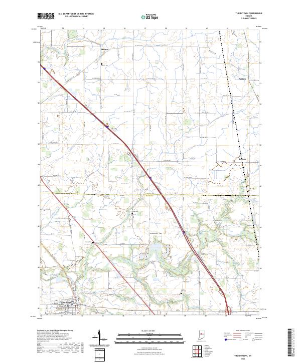 2022 Thorntown2022 Print · USGSThorntown and its surrounding rural hamlets are mapped here in the early 2020s at the intersection of Boone and Clinton Counties. Researchers can locate several family-named burial grounds like Gipson Cem and Manson Cem alongside the waters of Sugar Creek.
 - 2022 Map of Sheridan, 2022 Print
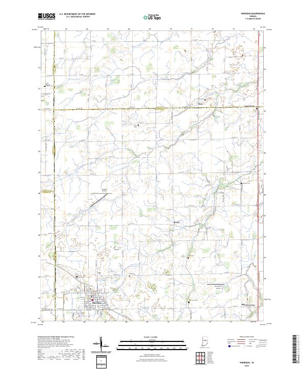 2022 Sheridan2022 Print · USGSCentral Indiana's agricultural landscape is captured here as it appeared in 2022 at the intersection of four counties. Genealogists can trace family connections through numerous rural burial sites like Union Cem, Phillips Cem, and Spicewood Cem near the town of Sheridan.
 - 2022 Map of Kempton, 2022 Print
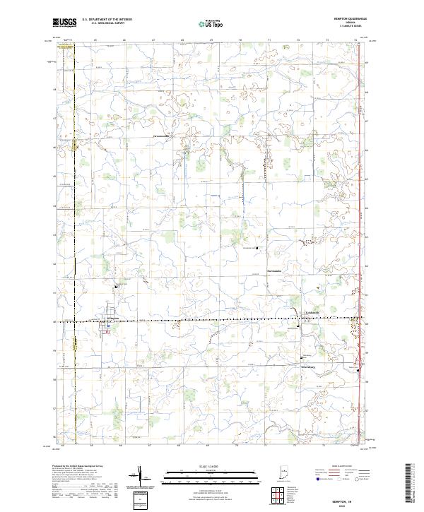 2022 Kempton2022 Print · USGSTipton County farmland near the Clinton and Howard borders shows a landscape defined by its rural settlements and intricate drainage networks. Genealogists can locate several local burial sites including Kempton Cem, Wolford Cem, and Tetersburg Cem.
 - 2022 Map of Michigantown, 2022 Print
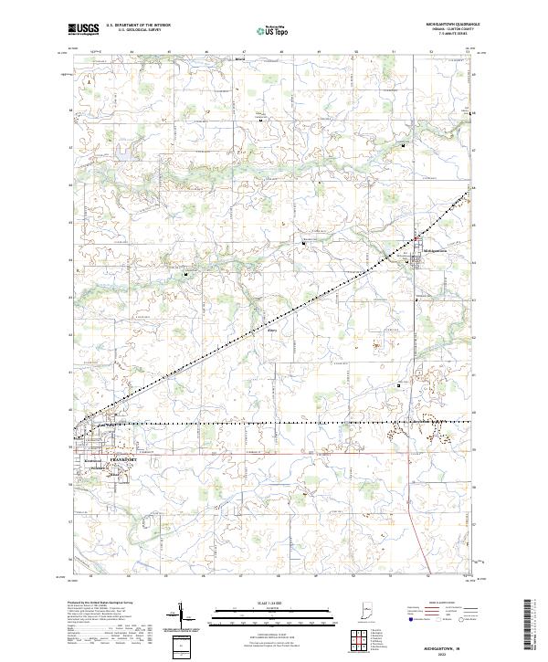 2022 Michigantown2022 Print · USGSClinton County is shown here in the early 2020s, dominated by a dense grid of farm roads and small agricultural settlements. Family historians can locate numerous burial grounds like Old Whiteman Cem and Paris Cem or trace the winding course of Kilmore Creek.
 - 2022 Map of Russiaville, 2022 Print
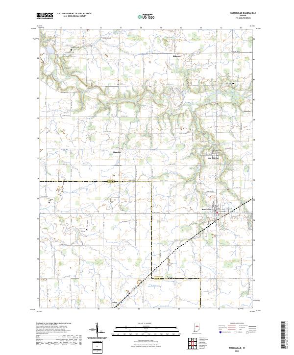 2022 Russiaville2022 Print · USGSCentral Indiana's agricultural heartland is documented here in the early twenty-first century. Genealogists can trace family sites at Old Prophet and Friends Cem, while researchers locate crossroads like Shanghai and New London.
 - 2022 Map of Rossville, 2022 Print
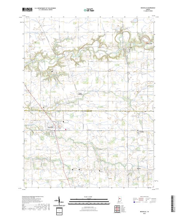 2022 Rossville2022 Print · USGSThe borderlands of Clinton and Carroll counties appear here in the early twenty-first century, showcasing a landscape of fertile farmland and creek valleys. Researchers can trace family history through several rural burial sites like Hufford Cem and Latshaw Cem, or explore the heritage grounds surrounding Adams Mill.
 - 2022 Map of Mechanicsburg, 2022 Print
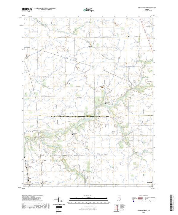 2022 Mechanicsburg2022 Print · USGSClinton and Boone counties are captured in this modern survey of Indiana's rural agricultural landscape. Genealogists and local historians can trace family roots through several legacy burial sites like McIntire Cemetery and Buntin Cemetery, or locate the historic centers of Mechanicsburg and Cyclone.
 - 2022 Map of Colfax, 2022 Print
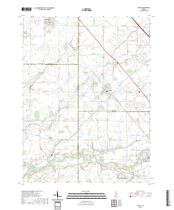 2022 Colfax2022 Print · USGSIndiana's rural heartland is meticulously documented in this survey of the four-county junction area involving Clinton, Montgomery, Boone, and Tippecanoe Counties. Researchers can locate family heritage sites like Shiloh Cem, trace the route of the Big Four Trl, and explore the layout of Colfax.
 - 2022 Map of Mulberry, 2022 Print
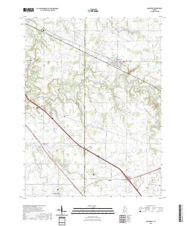 2022 Mulberry2022 Print · USGSClinton and Tippecanoe Counties come together in this modern portrait of Indiana’s agricultural heartland. Researchers can trace historic family burial grounds like Baker Cem and Abbot Cem or locate the small rural settlements of Wyandot and Fickle.
End of results
Showing maps 1-14 of 14
Top cities of Clinton County
- Frankfort historical maps
- Rossville historical maps
- Mulberry historical maps
- Forest historical maps
- Colfax historical maps
- Kirklin historical maps
See more
Frequently asked questions
- What are the different types of historical maps available for Clinton County?
- What is the oldest map of Clinton County?
- Where can I purchase historical maps of Clinton County for my home or office?
- Where can I download high-res historical maps of Clinton County?
- Are there historical topographic maps available for Clinton County?
- Is there historical aerial imagery available for Clinton County?
- Where are historical maps of Clinton County sourced from?