Old Maps of Delaware County, Indiana
Explore 106 old maps of Delaware County, spanning from 1952 to today. These high-resolution historic maps reveal how streets, neighborhoods, landmarks, and natural features evolved over time — perfect for genealogy, metal detecting, research, and local history exploration.
What you can do with these maps:
- See how Delaware County changed over time: Compare historical maps to modern-day views to trace roads, homesites, rail lines & more.
- View detailed metadata: Each map includes creators, publishers, year, scale, and archive source.
- Overlay maps with satellite & LiDAR: Visualize the past alongside modern tools to explore terrain & human change.
- Trusted historical sources: Maps sourced from the USGS, Library of Congress, and other archives.
- Access maps your way: View online, download high-res files, or order prints for personal or research use.
Start exploring old maps of Delaware County to uncover forgotten places, hidden landmarks, and the deep history beneath your feet.
Delaware County, IN maps
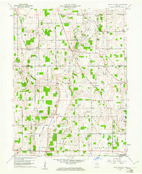
(106)- 1952 Map of Muncie East, 1953 Print
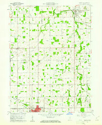
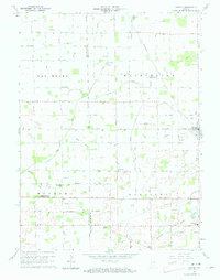
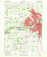
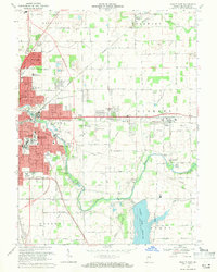
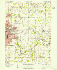 1952 Muncie East1953 Print · USGSMid-century Delaware County comes to life as the city of Muncie expands eastward toward Selma and Smithfield. Genealogists and local historians can trace family roots through numerous sites like White Cem, Pleasant Grove Ch, and Longfellow Sch.2 unique versions available
 - 1952 Map of Farmland, 1953 Print
 1952 Farmland1953 Print · USGSMid-century Randolph County agriculture and rail transit are captured here just as the steam era fully gave way to diesel. Genealogists can trace family footprints through rural landmarks like Stoney Creek Sch, Union Cem, and the riverside settlement of Windsor.
 - 1952 Map of Muncie West, 1953 Print
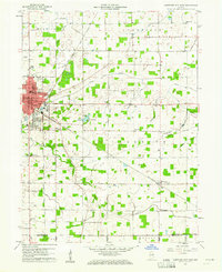
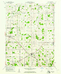
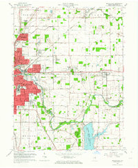
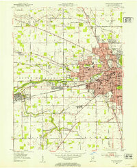 1952 Muncie West1953 Print · USGSMid-century Muncie and western Delaware County are captured here at a time of significant educational and residential growth. Genealogists and local historians can trace the foundations of Ball State Teachers College or locate family plots in Beech Grove Cemetery and McKinley Cem.2 unique versions available
 - 1953 Map of Muncie, 1966 Print
 1953 Muncie1966 Print · USGSIndiana and Ohio borderlands thrive in the early fifties, showing a landscape defined by manufacturing cities and an intensive railroad network. Genealogists can trace family roots across the Indiana-Ohio line through Muncie, Celina, and Portland via the Pennsylvania railroad.5 unique versions available
 - 1956 Map of Muncie
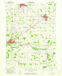
 1956 Muncie1956 Print · USGSEastern Indiana and western Ohio are shown at a peak of rail-driven industry in the mid-fifties. Genealogists and rail historians can trace the paths of the Pennsylvania RR through Muncie or locate landmarks like Lake Saint Marys (Grand Lake Reservoir) and Frances Slocum State Forest.
 - 1960 Map of Gilman
 1960 Gilman1960 Print · USGSThe Indiana countryside near Daleville and Gilman is shown here in the early 1960s, a landscape defined by its river bends and intersecting rail lines. Researchers can trace family sites at Vermillion Meetinghouse, identify old burials at Jones Cem, or locate former rail stops at Reed Station and Moonville.5 unique versions available
 - 1960 Map of Pennville, 1961 Print
 1960 Pennville1961 Print · USGSIndiana's eastern farmland is documented here in the early sixties, showing the vital rail and river networks of Jay and Blackford counties. Researchers can locate family landmarks like Maple Lawn Cem, the crossroads of Ridertown, and the Pennsylvania Railroad corridor.2 unique versions available
 - 1960 Map of Hartford City East, 1961 Print
 1960 Hartford City East1961 Print · USGSBlackford County life in the early sixties is anchored by the eastern expansion of Hartford City and the surrounding townships. Researchers can trace family sites from Personett Cemetery to Millgrove, and find mid-century landmarks like the Drive-in Theater.3 unique versions available
 - 1960 Map of Middletown, 1961 Print
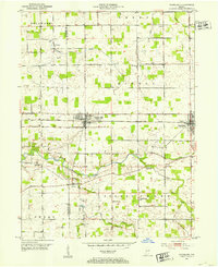
 1960 Middletown1961 Print · USGSThe rural landscapes of Madison, Delaware, and Henry counties are captured here at the dawn of the sixties. Genealogists can trace family names at Bronnenberg Cem or Painter Cem, and locate rural landmarks like the Allen-Bethel Ch and Valley Grove Sch.4 unique versions available
 - 1960 Map of Eaton, 1961 Print
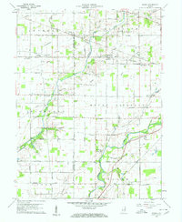
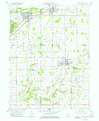
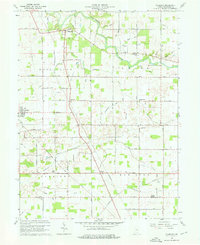
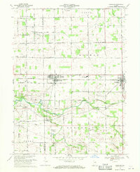
 1960 Eaton1961 Print · USGSDelaware County at the start of the 1960s shows a landscape of established rail lines and emerging mid-century landmarks. Genealogists can trace family names through the Union Cemetery or Godlove Cem, while identifying sites like the Township Sch and Delaware Chapel.3 unique versions available
 - 1960 Map of Mount Pleasant, 1961 Print
 1960 Mount Pleasant1961 Print · USGSIndiana's rural heartland is captured in the early sixties as a network of crossroads settlements and small farmsteads. Local historians can trace the foundations of Mount Pleasant, Luray, and Rogersville alongside historic sites like Buck Creek Ch and Lebanon Cem.4 unique versions available
 - 1960 Map of Wheeling, 1961 Print
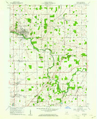
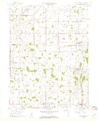
 1960 Wheeling1961 Print · USGSMid-century Delaware County centers on the Mississinewa River as it winds through a landscape of rail-connected farming communities. Researchers can trace family roots through several country churches and cemeteries, including Corinth Ch, Olive Chapel, and Mt Zion Cem.4 unique versions available
 - 1960 Map of Sulphur Springs, 1961 Print
 1960 Sulphur Springs1961 Print · USGSThe crossroads of Delaware and Henry counties are captured here at the dawn of the 1960s, showing a landscape defined by rail and agriculture. Researchers can trace family roots at Sunderland Cemetery or follow the New York Chicago and St Louis RR through Oakville and Springport.4 unique versions available
 - 1960 Map of Gas City, 1961 Print
 1960 Gas City1961 Print · USGSGrant County is shown during a period of steady growth and industrial rail activity in the early sixties. Genealogists and historians can locate family plots at Riverside Cem or trace the early paths of the PENNSYLVANIA and CHESAPEAKE AND OHIO railroads.4 unique versions available
 - 1960 Map of Gaston, 1961 Print
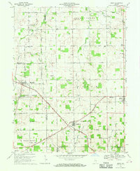
 1960 Gaston1961 Print · USGSThe rural borderlands of Madison and Delaware counties are captured in the early sixties as agricultural life and rail commerce intersect. Researchers can locate family roots and local landmarks like Epworth Ch, Thompson Cem, and the Chesapeake and Ohio railroad.4 unique versions available
 - 1960 Map of Modoc, 1961 Print
 1960 Modoc1961 Print · USGSRandolph and Henry Counties appear here in the early sixties, centered on the vital rail junctions of the eastern Indiana plains. Genealogists and local historians can trace the locations of Bronson, Blountsville, and rural sites like Grace Chapel.
 - 1960 Map of Redkey, 1962 Print
 1960 Redkey1962 Print · USGSEastern Indiana in the early sixties shows a landscape where industrial rail hubs meet the agricultural heartland. Genealogists and local historians can trace family roots through sites like Cherry Grove Sch, Shedville, and the Strong Cem near the Mississinewa River.2 unique versions available
 - 1960 Map of Hartford City West, 1976 Print
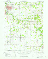
 1960 Hartford City West1976 Print · USGSIndiana's farm and college country comes to life in the late fifties, centered on the growing communities of Hartford City and Upland. Researchers can locate the Purdue University Memorial Farm, the Covered Bridge near Matthews, and several rural landmarks like Shiloh Cem.5 unique versions available
 - 1962 Map of Muncie West, 1964 Print
 1962 Muncie West1964 Print · USGSMid-century Muncie and Yorktown are documented here during a period of rapid residential growth and institutional expansion. Genealogists and local historians can trace family roots through Antioch Ch, Elm Ridge Cemetery, and early additions like Andersonville.
 - 1962 Map of Muncie East, 1964 Print
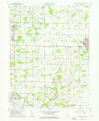
 1962 Muncie East1964 Print · USGSMid-century Muncie and its eastern suburbs are shown here as the city expands toward the newly established Prairie Creek Reservoir. Genealogists and local historians can trace family roots through several rural burial grounds like Mt Tabor Cem and Parker Moore Cem, or locate long-standing landmarks like Reese Airport.
 - 1969 Map of Farmland, 1970 Print
 1969 Farmland1970 Print · USGSRandolph and Delaware counties come into focus during the late sixties, showing the agricultural heartland between Parker and Farmland. Researchers can trace family history through sites like Swindley Cemetery, White River Church, and the Stoney Creek School.
 - 1969 Map of Modoc, 1970 Print
 1969 Modoc1970 Print · USGSRandolph and Henry Counties are captured here in the late sixties, showing a landscape defined by intersecting railroads and rural crossroads. Genealogists and local historians can locate family landmarks like Poplar Run Cem, Union Ch, and the settlement of Blountsville.
 - 1969 Map of Muncie East, 1971 Print
 1969 Muncie East1971 Print · USGSThe eastern reaches of Muncie and its surrounding townships are shown here during a period of steady growth in the late sixties. Researchers can find well-documented family sites including Bortsfield Cem, the County Home, and the former Selma Airfield.3 unique versions available
 - 1969 Map of Muncie West, 1971 Print
 1969 Muncie West1971 Print · USGSMuncie and Yorktown are captured in a period of significant mid-century growth as suburban neighborhoods began to merge with rural townships. Genealogists and local historians can trace the foundations of BALL STATE UNIVERSITY, the sprawling grounds of BEECH GROVE CEMETERY, and the former tracks of the CHESAPEAKE AND OHIO railroad.3 unique versions available
 - 1986 Map of Muncie
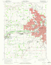
 1986 Muncie1986 Print · USGSEast Central Indiana was a hub of manufacturing and higher education in the mid-eighties. Genealogists and historians can trace the streets of Muncie, locate rural Cem sites, and explore landmarks like Mounds State Park and Taylor Univ.3 unique versions available
Showing maps 1-25 of 106
Top cities of Delaware County
- Muncie historical maps
- Yorktown historical maps
- Daleville historical maps
- Eaton historical maps
- Gaston historical maps
- Selma historical maps
Frequently asked questions
- What are the different types of historical maps available for Delaware County?
- What is the oldest map of Delaware County?
- Where can I purchase historical maps of Delaware County for my home or office?
- Where can I download high-res historical maps of Delaware County?
- Are there historical topographic maps available for Delaware County?
- Is there historical aerial imagery available for Delaware County?
- Where are historical maps of Delaware County sourced from?