
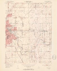
1952 Map of Muncie East
USGS Topo · Published 1953About this map
The White River winds through this 1952 landscape, anchoring the industrial and residential development of eastern Muncie. The city's growth is evident in its expanding neighborhoods like Mayfield and Creston, alongside established institutions such as Longfellow Sch and Heekin Park. This mid-century view captures the area's transition from urban density to rural farmland, where life centered around landmarks like the Delaware Country Club and the Muncie Waterworks.
Find a feature on this map
54 named features on this map. Tap any name to fly to it.
Don’t see what you’re looking for? This feature index may not catch every label — zoom into the map to look around manually.
Map Details
Editions of this 1952 Muncie East Map
2 editions found
Other maps of this area

1952 · Farmland
USGS Topo · 1:24,000

1952 · Muncie West
USGS Topo · 1:24,000

1953 · Muncie
USGS Topo · 1:250,000

1956 · Muncie
USGS Topo · 1:250,000

1960 · Eaton
USGS Topo · 1:24,000

1960 · Mount Pleasant
USGS Topo · 1:24,000

1960 · Wheeling
USGS Topo · 1:24,000

1960 · Sulphur Springs
USGS Topo · 1:24,000
1960 · Modoc
USGS Topo · 1:24,000
1960 · Redkey
USGS Topo · 1:24,000