
1960 Map of Mount Pleasant
USGS Topo · Published 1961About this map
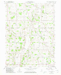
Medford and Mount Pleasant anchor a landscape of agricultural tradition and established community nodes in this early 1960s survey of the Indiana countryside. The map reveals a high density of local landmarks essential for genealogical research, including numerous family-linked burial grounds such as Fairview Cem, Macedonia Cem, and Mt Pleasant Cem. The rural social fabric is further defined by historic congregations at Philadelphia Ch and Harris Chapel, along with the Center Sch near Gates Corner.
Find a feature on this map
51 named features on this map. Tap any name to fly to it.
Don’t see what you’re looking for? This feature index may not catch every label — zoom into the map to look around manually.
Map Details
Editions of this 1960 Mount Pleasant Map
4 editions found
Other maps of this area

1949 · New Castle West
USGS Topo · 1:24,000

1950 · New Castle East
USGS Topo · 1:24,000

1952 · Muncie East
USGS Topo · 1:24,000

1952 · Farmland
USGS Topo · 1:24,000

1952 · Muncie West
USGS Topo · 1:24,000

1953 · Cincinnati
USGS Topo · 1:250,000

1953 · Muncie
USGS Topo · 1:250,000

1956 · Muncie
USGS Topo · 1:250,000

1957 · Cincinnati
USGS Topo · 1:250,000

1960 · New Castle West
USGS Topo · 1:24,000