
1952 Map of Muncie West
USGS Topo · Published 1953About this map
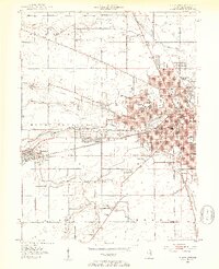
Ball State Teachers College serves as a major anchor in this 1950s depiction of western Muncie, Indiana, where the city's residential expansion meets the surrounding agricultural landscape. The White River flows through the center of the sheet, bordered by local landmarks like Beech Grove Cemetery and Minnetrista Golf Course. This era shows a dense network of neighborhood schools, including Harrison, Garfield, and Roosevelt, reflecting the mid-century growth of the Delaware County seat.
Find a feature on this map
65 named features on this map. Tap any name to fly to it.
Don’t see what you’re looking for? This feature index may not catch every label — zoom into the map to look around manually.
Map Details
Editions of this 1952 Muncie West Map
2 editions found
Other maps of this area

1952 · Muncie East
USGS Topo · 1:24,000

1953 · Muncie
USGS Topo · 1:250,000

1956 · Muncie
USGS Topo · 1:250,000

1960 · Gilman
USGS Topo · 1:24,000

1960 · Middletown
USGS Topo · 1:24,000

1960 · Eaton
USGS Topo · 1:24,000

1960 · Mount Pleasant
USGS Topo · 1:24,000

1960 · Wheeling
USGS Topo · 1:24,000

1960 · Sulphur Springs
USGS Topo · 1:24,000

1960 · Gaston
USGS Topo · 1:24,000