
1960 Map of Gaston
USGS Topo · Published 1961About this map
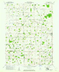
Gaston serves as the primary hub in this mid-century survey of the rural landscape where the border of Madison and Delaware counties meets. The Chesapeake and Ohio railroad cuts diagonally across the northeastern quadrant, reflecting the enduring importance of rail transport to the local agricultural economy. The map reveals a densely settled countryside defined by community landmarks, including the Miami Reserve Christian Camp and the Bethel Home Place for Boys near Bethel. Significant drainage features like Pipe Creek, Killbuck Creek, and the Old Prairie Swamp dictate the local topography, while numerous rural institutions such as Epworth Ch, Zion Ch, and the Thompson Cemetery highlight the social and genealogical fabric of the Van Buren and Washington townships.
Find a feature on this map
31 named features on this map. Tap any name to fly to it.
Don’t see what you’re looking for? This feature index may not catch every label — zoom into the map to look around manually.
Map Details
Editions of this 1960 Gaston Map
4 editions found
Other maps of this area

1952 · Muncie West
USGS Topo · 1:24,000

1953 · Muncie
USGS Topo · 1:250,000

1956 · Muncie
USGS Topo · 1:250,000

1960 · Gilman
USGS Topo · 1:24,000

1960 · Alexandria
USGS Topo · 1:24,000

1960 · Wheeling
USGS Topo · 1:24,000

1960 · Fairmount
USGS Topo · 1:24,000

1960 · Gas City
USGS Topo · 1:24,000

1960 · Anderson North
USGS Topo · 1:24,000

1960 · Hartford City West
USGS Topo · 1:24,000