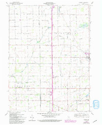
1960 Map of Gaston
USGS Topo · Published 1994About this map
Gaston and Bethel anchor this agricultural region along the border of Madison and Delaware Counties during the early 1960s. The landscape is defined by a dense grid of rural roads and watercourses including Pipe Creek, Killbuck Creek, and the uniquely named Polecat Creek. Local history is preserved in a concentration of country churches and burial grounds, such as Prairie Grove Ch, Epworth Ch, and Walker Cem. The map reflects mid-century community life through specialized sites like the Miami Reserve Christian Camp and the Bethel Home Place for Boys. An interpretive look at the drainage patterns reveals the reclamation of land once known as Old Prairie Swamp, while the presence of a Gas Well suggests the persisting mineral interests beneath the farm fields.
Find a feature on this map
31 named features on this map. Tap any name to fly to it.
Don’t see what you’re looking for? This feature index may not catch every label — zoom into the map to look around manually.
Map Details
Editions of this 1960 Gaston Map
4 editions found
Other maps of this area

1952 · Muncie West
USGS Topo · 1:24,000

1953 · Muncie
USGS Topo · 1:250,000

1956 · Muncie
USGS Topo · 1:250,000

1960 · Gilman
USGS Topo · 1:24,000

1960 · Alexandria
USGS Topo · 1:24,000

1960 · Wheeling
USGS Topo · 1:24,000

1960 · Fairmount
USGS Topo · 1:24,000

1960 · Gas City
USGS Topo · 1:24,000

1960 · Gaston
USGS Topo · 1:24,000

1960 · Anderson North
USGS Topo · 1:24,000