
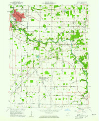
1960 Map of Gas City
USGS Topo · Published 1961About this map
The Mississinewa River meanders across this landscape, connecting the industrial and residential hubs of Gas City and Jonesboro in the northwest. In the early 1960s, the region was defined by a dense network of watercourses and agricultural drainage projects, including the Galatia Ditch and Fowlerton Drain. The rail lines of the Pennsylvania and Chesapeake and Ohio railroads dictate the local geography, serving the smaller communities of Upland, Fowlerton, and Matthews. Local history is preserved in the numerous rural cemeteries and small churches, such as Walnut Creek Cem and Harmony Ch, which anchor the surrounding townships. The presence of several Quarry sites and Gravel Pits along the riverbanks points to the area's active extraction industries during this period, while Sports Lake provides a notable landmark for recreation in Monroe township.
Find a feature on this map
62 named features on this map. Tap any name to fly to it.
Don’t see what you’re looking for? This feature index may not catch every label — zoom into the map to look around manually.
Map Details
Editions of this 1960 Gas City Map
4 editions found
Other maps of this area

1953 · Muncie
USGS Topo · 1:250,000

1956 · Muncie
USGS Topo · 1:250,000

1960 · Alexandria
USGS Topo · 1:24,000

1960 · Wheeling
USGS Topo · 1:24,000

1960 · Fairmount
USGS Topo · 1:24,000

1960 · Gaston
USGS Topo · 1:24,000

1960 · Hartford City West
USGS Topo · 1:24,000

1961 · Marion
USGS Topo · 1:24,000

1962 · Roll
USGS Topo · 1:24,000
1962 · Van Buren
USGS Topo · 1:24,000