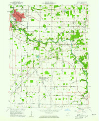
1960 Map of Gas City
USGS Topo · Published 1976About this map
The Mississinewa River carves a winding path through this corner of Grant County, anchoring the neighboring industrial centers of Gas City and Jonesboro. At the start of the 1960s, the area's landscape is defined by the intersection of water and heavy rail, with the Pennsylvania Railroad and Chesapeake and Ohio Railroad cutting across the agricultural terrain. The map captures the organized growth of the city grid in Gas City, home to the local High School and City Hall, while outlying areas like Fowlerton and Matthews maintain their small-town character. Rural life is evidenced by family and community landmarks such as Jefferson Church and Riverside Cemetery. Smaller waterways, including Walnut Creek and Regular Run, feed into the river system, supporting a landscape that balances active quarrying at local Quarries with the recreational space of Sports Lake.
Find a feature on this map
54 named features on this map. Tap any name to fly to it.
Don’t see what you’re looking for? This feature index may not catch every label — zoom into the map to look around manually.
Map Details
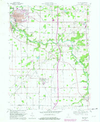
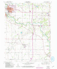
Editions of this 1960 Gas City Map
4 editions found
Other maps of this area

1953 · Muncie
USGS Topo · 1:250,000

1956 · Muncie
USGS Topo · 1:250,000

1960 · Alexandria
USGS Topo · 1:24,000

1960 · Wheeling
USGS Topo · 1:24,000

1960 · Fairmount
USGS Topo · 1:24,000

1960 · Gas City
USGS Topo · 1:24,000

1960 · Gaston
USGS Topo · 1:24,000

1960 · Hartford City West
USGS Topo · 1:24,000

1961 · Marion
USGS Topo · 1:24,000

1962 · Roll
USGS Topo · 1:24,000