
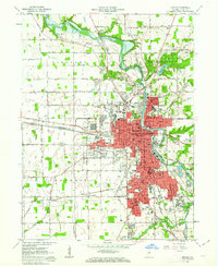
1961 Map of Marion
USGS Topo · Published 1963About this map
Marion serves as a major industrial and rail hub along the winding Mississinewa River in this early 1960s survey. The city's landscape is defined by its extensive educational and civic infrastructure, from Marion College and the General Hospital to a dense network of local schools like McCulloch School and Bennett School. A complex web of transit lines convergence here, including the Pennsylvania and Chicago and St Louis RR, which supported the city's manufacturing core and the Goodman Yards. Outside the urban center, the map reveals a transition to the agricultural surroundings of Grant County, where small settlements such as Michaelsville and Roseburg sit amidst a grid of rural routes like the Slocum Trail. Notable for genealogists, the survey documents several prominent burial grounds, including the Grant Memorial Park and the large IOOF Cemetery.
Find a feature on this map
95 named features on this map. Tap any name to fly to it.
Don’t see what you’re looking for? This feature index may not catch every label — zoom into the map to look around manually.
Map Details
Editions of this 1961 Marion Map
3 editions found
Other maps of this area

1950 · Mount Etna
USGS Topo · 1:24,000

1951 · Mount Etna
USGS Topo · 1:24,000

1953 · La Fontaine
USGS Topo · 1:24,000

1953 · Somerset
USGS Topo · 1:24,000

1953 · Muncie
USGS Topo · 1:250,000

1956 · Muncie
USGS Topo · 1:250,000

1960 · Point Isabel
USGS Topo · 1:24,000

1960 · Fairmount
USGS Topo · 1:24,000

1960 · Gas City
USGS Topo · 1:24,000
1962 · Sweetser
USGS Topo · 1:24,000