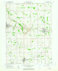
1962 Map of Sweetser
USGS Topo · Published 1963About this map
Swayzee and Sweetser anchor this 1962 landscape in Grant County, where the agricultural grid of central Indiana is defined by a dense network of early rail lines. The Pennsylvania and C & O railroads intersect near Converse and Mier, while the Chicago And ST Louis line serves the southern grain-handling facilities and Storage Bins. Local history is preserved in the placement of rural institutions like Taylors Creek Church, Richland Chapel, and several family and community burial grounds including Thrailkill Cemetery and Rowland Cemetery. Education is centralized at the Oak Hill High School and Swayzee School. The terrain is drained by a system of meandering natural watercourses such as Pipe Creek and Taylor Creek, alongside man-made improvements like Potter Ditch Road and Brown Ditch.
Find a feature on this map
52 named features on this map. Tap any name to fly to it.
Don’t see what you’re looking for? This feature index may not catch every label — zoom into the map to look around manually.
Map Details
Editions of this 1962 Sweetser Map
This is the sole edition of this map. No revisions or reprints were ever made.
Other maps of this area

1953 · La Fontaine
USGS Topo · 1:24,000

1953 · Somerset
USGS Topo · 1:24,000

1953 · Peoria
USGS Topo · 1:24,000

1953 · Muncie
USGS Topo · 1:250,000

1956 · Muncie
USGS Topo · 1:250,000

1960 · Point Isabel
USGS Topo · 1:24,000

1960 · Fairmount
USGS Topo · 1:24,000

1960 · Greentown
USGS Topo · 1:24,000

1961 · Marion
USGS Topo · 1:24,000
1962 · Amboy
USGS Topo · 1:24,000