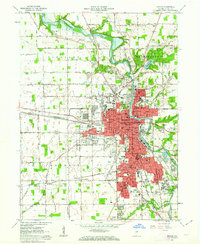
1961 Map of Marion
USGS Topo · Published 1963About this map
The Mississinewa River winds through the heart of Marion, Indiana, in the early 1960s, a period marked by both established industrial infrastructure and the emergence of modern suburban commerce. The city's growth is anchored by institutions like Marion College and General Hospital, while the surrounding landscape transitions from the urban core to smaller settlements like Roseburg and Michaelsville. A dense network of rail lines, including the Pennsylvania Chesapeake and Ohio and the New York Chicago and St Louis, highlights the area's importance as a transportation hub for Grant County.
Find a feature on this map
122 named features on this map. Tap any name to fly to it.
Don’t see what you’re looking for? This feature index may not catch every label — zoom into the map to look around manually.
Map Details
Editions of this 1961 Marion Map
3 editions found
Other maps of this area

1950 · Mount Etna
USGS Topo · 1:24,000

1951 · Mount Etna
USGS Topo · 1:24,000

1953 · La Fontaine
USGS Topo · 1:24,000

1953 · Somerset
USGS Topo · 1:24,000

1953 · Muncie
USGS Topo · 1:250,000

1956 · Muncie
USGS Topo · 1:250,000

1960 · Point Isabel
USGS Topo · 1:24,000

1960 · Fairmount
USGS Topo · 1:24,000

1960 · Gas City
USGS Topo · 1:24,000

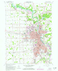
1961 · Marion
USGS Topo · 1:24,000