2020s Maps of Delaware County, Indiana
Explore 16 historic maps of Delaware County from the 2020s. These maps offer a rare glimpse into what life looked like during the 2020s — showing old roads, neighborhoods, homes, and landmarks that have changed or disappeared over time.
Whether you're researching your family's past, planning a metal detecting trip, or studying how Delaware County's landscape evolved across the 2020s, these high-resolution maps are a powerful tool for exploring the history of this region.
- Focus on a specific era: All maps on this page are from the 2020s, giving you a focused view of this time period.
- See what’s changed: Compare century-old streets, trails, and buildings to today's modern landscape using overlays and satellite layers.
- Research with precision: Use these maps for genealogy, historical research, land use analysis, or educational projects.
- View, download, or print: Maps are fully viewable online in high resolution, and can be downloaded or printed for your own records.
Start exploring Delaware County's history through authentic maps from the 2020s. This is your window into the past.
Delaware County, IN maps
(16)- 2022 Map of Redkey, 2022 Print
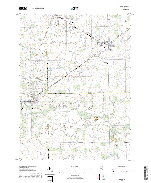 2022 Redkey2022 Print · USGSJay and Delaware counties are documented here in the early 2020s, showing the settled farmland between the Mississinewa River and the towns of Dunkirk and Redkey. Researchers can trace local heritage through several rural cemeteries like Caylor Cem and Cherry Grove Cem.
 - 2022 Map of Modoc, 2022 Print
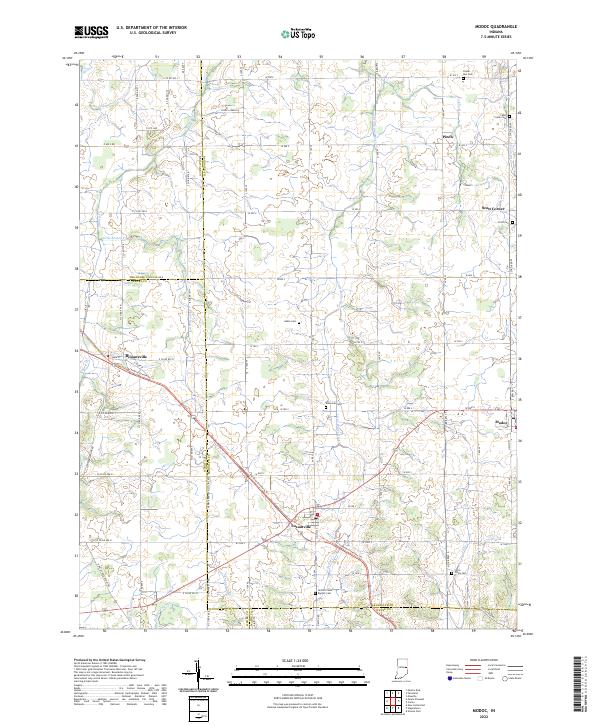 2022 Modoc2022 Print · USGSIndiana's eastern agricultural landscape is captured here during the early twenty-first century, centered on the crossroads of Losantville and Modoc. Researchers can trace local lineage through several burial sites like Nettle Creek Baptist Cem or follow the historic rail-to-trail conversion of the Cardinal Greenway Trl.
 - 2022 Map of Farmland, 2022 Print
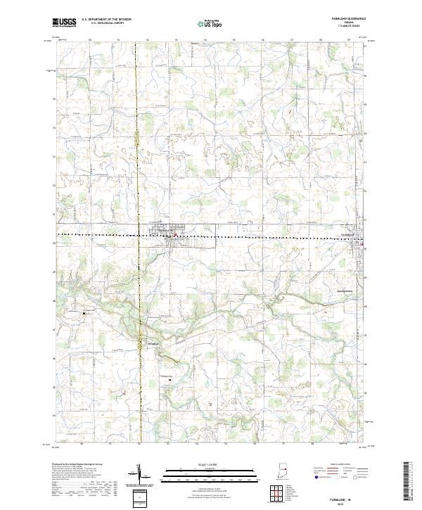 2022 Farmland2022 Print · USGSThis rural Indiana landscape at the Delaware and Randolph county line highlights the agricultural heartland during the early twenty-first century. Genealogists and local historians can trace the positions of Parker City, Windsor, and quiet landmarks like Swingley Cem near the White River.
 - 2022 Map of Pennville, 2022 Print
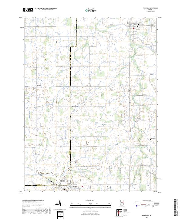 2022 Pennville2022 Print · USGSThe rural borders of Jay and Blackford Counties are revealed in this study of the Indiana heartland during the early twenty-first century. Genealogists can trace family names at sites like Maple Lawn Cem, Mount Tabor Cem, and the Independent Order of Odd Fellows Cem.
 - 2022 Map of Eaton, 2022 Print
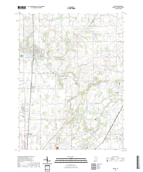 2022 Eaton2022 Print · USGSNorthern Delaware County in the early 2020s shows a landscape of river-bend settlements and deep-rooted farmsteads. Genealogists can locate family sites at Black Cem or Union Cem, and trace the small-town grids of Eaton and Shideler.
 - 2022 Map of Muncie West, 2022 Print
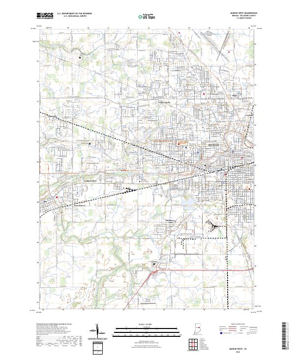 2022 Muncie West2022 Print · USGSDelaware County in the early 2020s shows a landscape defined by collegiate expansion and riverfront settlements. Researchers can trace family history at Nottingham Cemetery or study the growth of Yorktown and Ball State University.
 - 2022 Map of Wheeling, 2022 Print
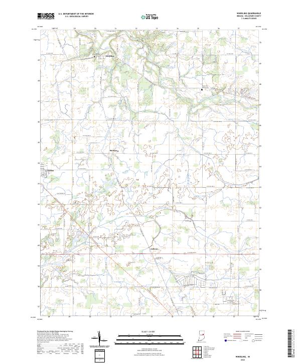 2022 Wheeling2022 Print · USGSDelaware County, Indiana, is captured in this modern survey of the area around the Mississinewa River. Researchers can trace local lineage and land use through features like the Wheeling Cem, Mount Zion Church Cem, and the historic settlement at Stockport.
 - 2022 Map of Sulphur Springs, 2022 Print
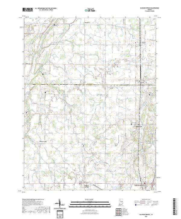 2022 Sulphur Springs2022 Print · USGSHenry and Delaware Counties at the start of the 2020s reveal a landscape of enduring farming villages and family-named watercourses. Trace local heritage through rural landmarks like Bethel Cem, Sulphur Springs, and the small airfield at The Last Resort Airport.
 - 2022 Map of Middletown, 2022 Print
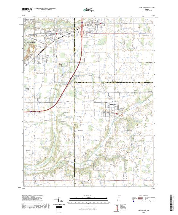 2022 Middletown2022 Print · USGSHenry and Madison counties show a landscape of established small towns and family farmsteads in this recent survey. Genealogists can locate numerous local burial sites like Keesling Cem and Painter Cem, or trace the winding course of Fall Creek.
 - 2022 Map of Gaston, 2022 Print
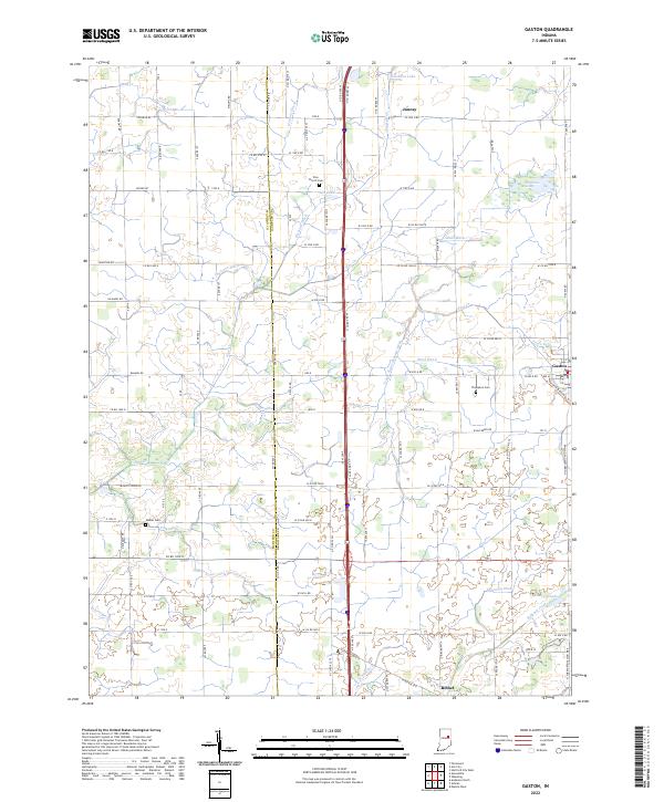 2022 Gaston2022 Print · USGSGaston and the fertile plains of East Central Indiana are captured here at the start of the 2020s. Genealogists and local historians can trace family ties at Zion Church Cem or Walker Cem and follow the routes between Bethel and Janney.
 - 2022 Map of Gilman, 2022 Print
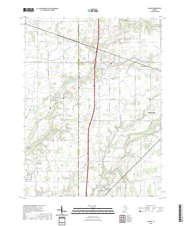 2022 Gilman2022 Print · USGSThe Madison and Delaware county line comes alive in the early 2020s, showing the settled corridors along the White River. Family historians can locate rural landmarks like Moonville Cem and traces of old rail and road networks at Reed Station.
 - 2022 Map of Hartford City East, 2022 Print
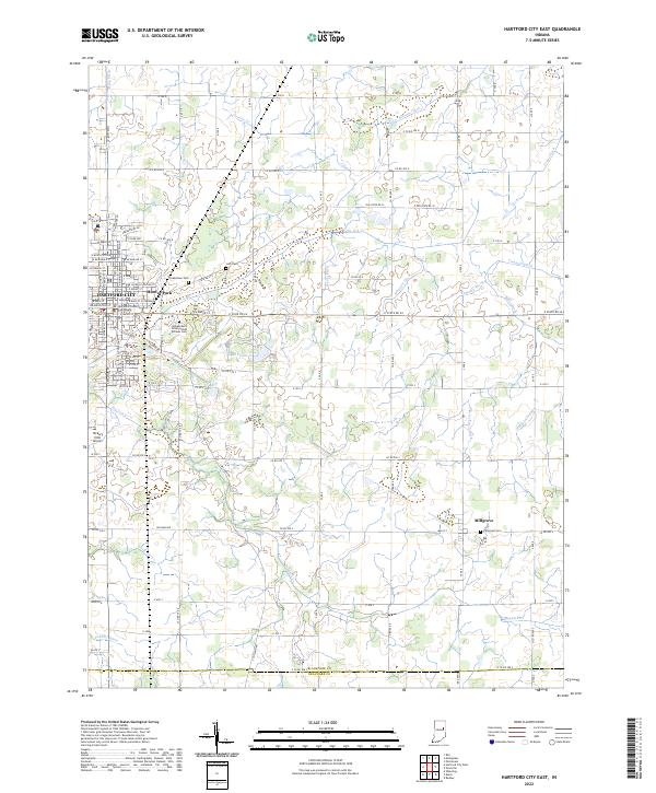 2022 Hartford City East2022 Print · USGSBlackford County agriculture and civic life are captured here in the early twenty-first century. Family historians can trace roots at Greenlawn Cem or find landmarks like the Blackford County Courthouse and Hickory Hills Airport.
 - 2022 Map of Hartford City West, 2022 Print
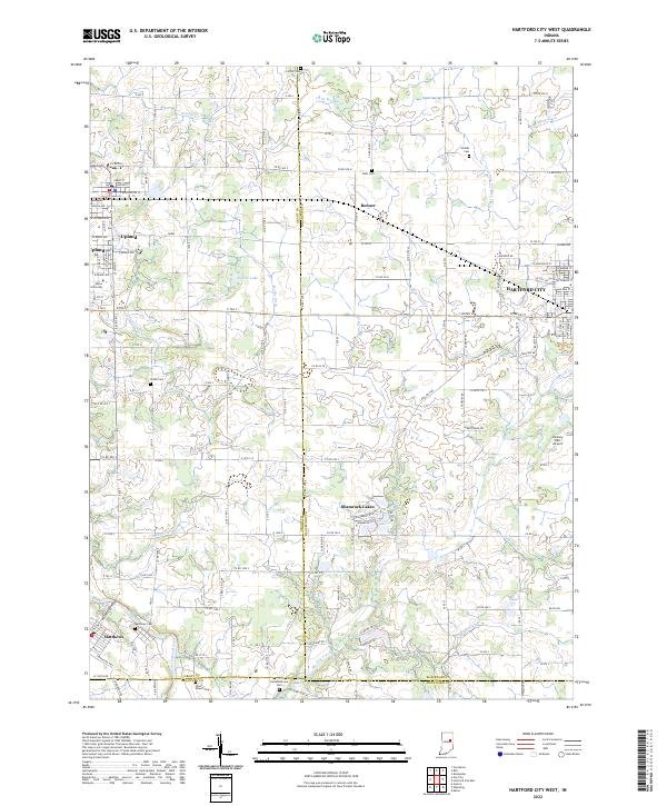 2022 Hartford City West2022 Print · USGSIn the early twenty-first century, this East Central Indiana landscape shows the intersection of higher education at Taylor University and traditional agricultural roots. Researchers can trace rural cemetery sites like Matthews Cem and the complex drainage of Big Lick Creek.
 - 2022 Map of Muncie East, 2022 Print
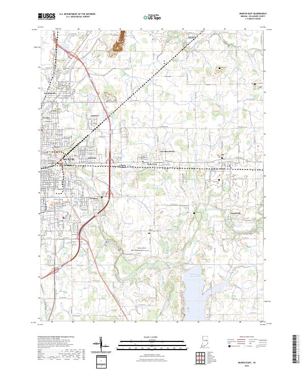 2022 Muncie East2022 Print · USGSEast of Muncie in the early 2020s, the landscape shows a blend of suburban growth and traditional Indiana farmland. Researchers can trace local heritage through sites like Graham National Cem, the Cardinal Greenway Trl, and the Prairie Creek Reservoir.
 - 2022 Map of Gas City, 2022 Print
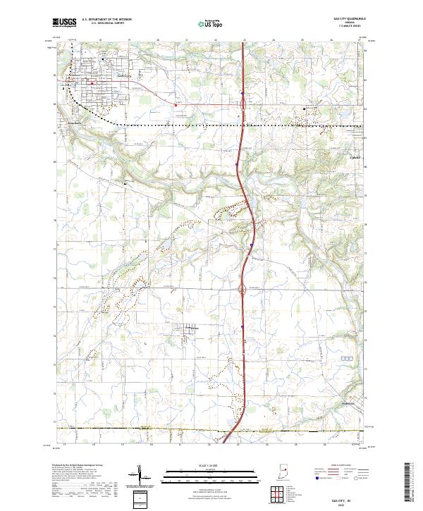 2022 Gas City2022 Print · USGSGrant County and its neighbors show a landscape of river-bend towns and prairie drainage at the start of the 2020s. Researchers can trace historic cemeteries like Jefferson Cem and the routes of old thoroughfares such as Wheeling Pike near Fowlerton.
 - 2022 Map of Mount Pleasant, 2022 Print
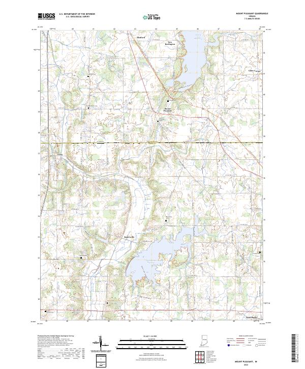 2022 Mount Pleasant2022 Print · USGSHenry and Delaware County farmland is shown in the 2020s, dominated by the waters of Summit Lake Reservoir and Prairie Creek Reservoir. Researchers can trace the Cardinal Greenway Trl past historic points like Rogersville and Mount Pleasant Cem.
End of results
Showing maps 1-16 of 16
Top cities of Delaware County
- Muncie historical maps
- Yorktown historical maps
- Daleville historical maps
- Eaton historical maps
- Gaston historical maps
- Selma historical maps
Frequently asked questions
- What are the different types of historical maps available for Delaware County?
- What is the oldest map of Delaware County?
- Where can I purchase historical maps of Delaware County for my home or office?
- Where can I download high-res historical maps of Delaware County?
- Are there historical topographic maps available for Delaware County?
- Is there historical aerial imagery available for Delaware County?
- Where are historical maps of Delaware County sourced from?