Old Maps of Fox, Indiana for Academic Research
Study the evolution of Fox with 10 high-resolution historic maps. Whether you're teaching, researching, or modeling changes in land use, these maps provide essential visual documentation of urban, environmental, and geographic change.
- Analyze long-term change: Track patterns in development, transportation, and natural features.
- Ideal for environmental or urban studies: Support academic projects with primary historical map data.
- Use in the classroom or lab: Educators and researchers rely on these maps to bring historical context to life.
These maps are a powerful tool for teaching, research, and visualizing how Fox has changed over the decades.
Fox, IN maps
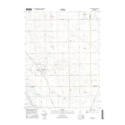
(10)- 1953 Map of La Fontaine, 1954 Print
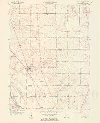 1953 La Fontaine1954 Print · USGSMid-century Wabash and Grant Counties come to life as small-town Indiana centers around the New York Central rail line. Genealogists can trace family roots through numerous burial sites like America Cem, Hale Cem, and the Boundary Line Ch.2 unique versions available
 - 1953 Map of Muncie, 1966 Print
 1953 Muncie1966 Print · USGSIndiana and Ohio borderlands thrive in the early fifties, showing a landscape defined by manufacturing cities and an intensive railroad network. Genealogists can trace family roots across the Indiana-Ohio line through Muncie, Celina, and Portland via the Pennsylvania railroad.5 unique versions available
 - 1956 Map of Muncie
 1956 Muncie1956 Print · USGSEastern Indiana and western Ohio are shown at a peak of rail-driven industry in the mid-fifties. Genealogists and rail historians can trace the paths of the Pennsylvania RR through Muncie or locate landmarks like Lake Saint Marys (Grand Lake Reservoir) and Frances Slocum State Forest.
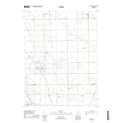
 - 1969 Map of La Fontaine, 1972 Print
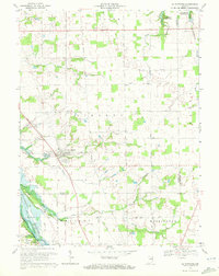 1969 La Fontaine1972 Print · USGSThe rural borderlands of Wabash and Grant counties are captured here in the late sixties as modern reservoirs began to shape the landscape. Local historians can trace family plots at Boundary Line Cem and Gardner Cem or follow the path of the Penn Central through La Fontaine.2 unique versions available
 - 1986 Map of Wabash
 1986 Wabash1986 Print · USGSThe Wabash Valley and surrounding Indiana farm country are captured here in the mid-eighties, showing a landscape reshaped by major reservoirs. Genealogists and local historians can trace the paths of the Old Indian Trail and the industrial reach of the Conrail line through towns like Lagro and Warren.2 unique versions available
 - 2010 Map of La Fontaine, 2010 Print
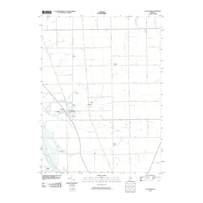 2010 La Fontaine2010 Print · USGSCovers Fox, including La Fontaine, America, and other nearby areas
 - 2013 Map of La Fontaine, 2013 Print
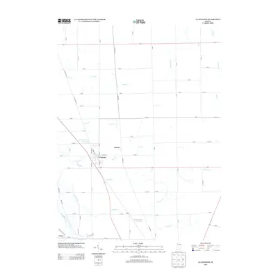 2013 La Fontaine2013 Print · USGSCovers Fox, including La Fontaine, America, and other nearby areas
 - 2016 Map of La Fontaine, 2016 Print
 2016 La Fontaine2016 Print · USGSCovers Fox, including La Fontaine, America, and other nearby areas
 - 2019 Map of La Fontaine, 2019 Print
 2019 La Fontaine2019 Print · USGSCovers Fox, including La Fontaine, America, and other nearby areas
 - 2022 Map of La Fontaine, 2022 Print
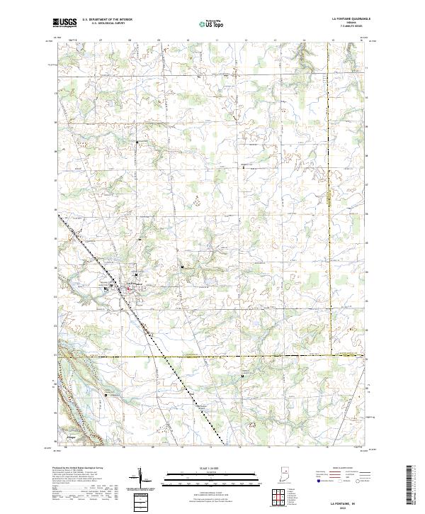 2022 La Fontaine2022 Print · USGSThe rural borderlands of Wabash and Grant counties are captured in this recent survey, showcasing the established farmsteads and historic burials of the region. Genealogists can trace family sites at Miami Indian Cem and Hale Cem, or locate the crossroads of La Fontaine.
End of results
Showing maps 1-10 of 10
Top cities near Fox
- Marion historical maps
- Huntington historical maps
- Wabash historical maps
- Gas City historical maps
- Upland historical maps
- Fairmount historical maps
See more
Frequently asked questions
- What are the different types of historical maps available for Fox?
- What is the oldest map of Fox?
- Where can I purchase historical maps of Fox for my home or office?
- Where can I download high-res historical maps of Fox?
- Are there historical topographic maps available for Fox?
- Is there historical aerial imagery available for Fox?
- Where are historical maps of Fox sourced from?