2020s Maps of Marion, Indiana
Explore 3 historic maps of Marion from the 2020s. These maps offer a rare glimpse into what life looked like during the 2020s — showing old roads, neighborhoods, homes, and landmarks that have changed or disappeared over time.
Whether you're researching your family's past, planning a metal detecting trip, or studying how Marion's landscape evolved across the 2020s, these high-resolution maps are a powerful tool for exploring the history of this region.
- Focus on a specific era: All maps on this page are from the 2020s, giving you a focused view of this time period.
- See what’s changed: Compare century-old streets, trails, and buildings to today's modern landscape using overlays and satellite layers.
- Research with precision: Use these maps for genealogy, historical research, land use analysis, or educational projects.
- View, download, or print: Maps are fully viewable online in high resolution, and can be downloaded or printed for your own records.
Start exploring Marion's history through authentic maps from the 2020s. This is your window into the past.
Marion, IN maps
(3)- 2022 Map of Fairmount, 2022 Print
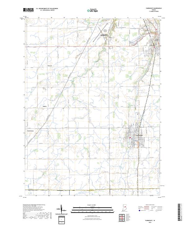 2022 Fairmount2022 Print · USGSFairmount and the surrounding Grant County countryside are shown here at the start of the 2020s, revealing a landscape defined by agricultural grids and small town centers. Researchers can trace family sites near Fairmount, Jonesboro, and Hackleman or locate burials at Park Cem.
 - 2022 Map of Van Buren, 2022 Print
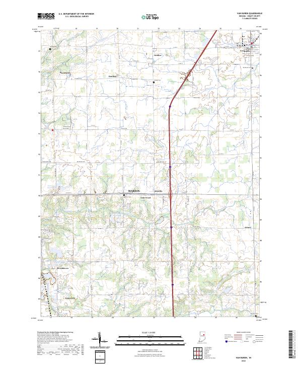 2022 Van Buren2022 Print · USGSGrant County is captured in this recent survey, showing a landscape of fertile Indiana farmland and small crossroads communities. Genealogists and local historians can trace family roots through several landmarks including Van Buren Cem, Landess, and the settlement at Arcana.
 - 2022 Map of Marion, 2022 Print
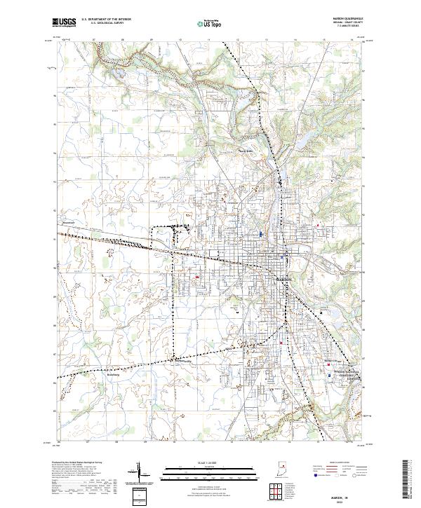 2022 Marion2022 Print · USGSGrant County is shown in detail during a period of modern growth, centered on the urban core of Marion and the Mississinewa River. Researchers can trace local heritage through landmarks like the Marion National Cem, the Grant County Courthouse, and the campus of Indiana Wesleyan University.
End of results
Showing maps 1-3 of 3
Top cities near Marion
- Gas City historical maps
- Upland historical maps
- Fairmount historical maps
- Sims historical maps
- Jonesboro historical maps
- Warren historical maps
See more
Top neighborhoods of Marion
- Dooville historical maps
- Home Corner historical maps
- Lake Wood historical maps
- Westwood Square historical maps
Frequently asked questions
- What are the different types of historical maps available for Marion?
- What is the oldest map of Marion?
- Where can I purchase historical maps of Marion for my home or office?
- Where can I download high-res historical maps of Marion?
- Are there historical topographic maps available for Marion?
- Is there historical aerial imagery available for Marion?
- Where are historical maps of Marion sourced from?