1960s Maps of The Bluffs at Flat Fork, Hamilton County
Explore 2 historic maps of The Bluffs at Flat Fork from the 1960s. These maps offer a rare glimpse into what life looked like during the 1960s — showing old roads, neighborhoods, homes, and landmarks that have changed or disappeared over time.
Whether you're researching your family's past, planning a metal detecting trip, or studying how The Bluffs at Flat Fork's landscape evolved across the 1960s, these high-resolution maps are a powerful tool for exploring the history of this region.
- Focus on a specific era: All maps on this page are from the 1960s, giving you a focused view of this time period.
- See what’s changed: Compare century-old streets, trails, and buildings to today's modern landscape using overlays and satellite layers.
- Research with precision: Use these maps for genealogy, historical research, land use analysis, or educational projects.
- View, download, or print: Maps are fully viewable online in high resolution, and can be downloaded or printed for your own records.
Start exploring The Bluffs at Flat Fork's history through authentic maps from the 1960s. This is your window into the past.
The Bluffs at Flat Fork, Hamilton County maps
(2)- 1962 Map of Mc Cordsville, 1963 Print
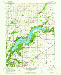 1962 Mc Cordsville1963 Print · USGSThe Geist Reservoir area undergoes a mid-century transformation where rural crossroads meet new lakeside developments. Researchers can trace ancestral sites at Arnett Cem or the rail history of McCordsville along the New York Central line.3 unique versions available
 - 1962 Map of Ingalls, 1963 Print
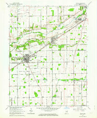 1962 Ingalls1963 Print · USGSAs the mid-century suburban shift began to reach central Indiana, this area saw traditional farming intersect with growing communities and institutional landmarks. Genealogists can trace family names through sites like Hiday Cem, Beech Grove Ch, and the State Reformatory.3 unique versions available
End of results
Showing maps 1-2 of 2
Frequently asked questions
- What are the different types of historical maps available for The Bluffs at Flat Fork?
- What is the oldest map of The Bluffs at Flat Fork?
- Where can I purchase historical maps of The Bluffs at Flat Fork for my home or office?
- Where can I download high-res historical maps of The Bluffs at Flat Fork?
- Are there historical topographic maps available for The Bluffs at Flat Fork?
- Is there historical aerial imagery available for The Bluffs at Flat Fork?
- Where are historical maps of The Bluffs at Flat Fork sourced from?