1990s Maps of Galloways Station, Indiana
Explore 2 historic maps of Galloways Station from the 1990s. These maps offer a rare glimpse into what life looked like during the 1990s — showing old roads, neighborhoods, homes, and landmarks that have changed or disappeared over time.
Whether you're researching your family's past, planning a metal detecting trip, or studying how Galloways Station's landscape evolved across the 1990s, these high-resolution maps are a powerful tool for exploring the history of this region.
- Focus on a specific era: All maps on this page are from the 1990s, giving you a focused view of this time period.
- See what’s changed: Compare century-old streets, trails, and buildings to today's modern landscape using overlays and satellite layers.
- Research with precision: Use these maps for genealogy, historical research, land use analysis, or educational projects.
- View, download, or print: Maps are fully viewable online in high resolution, and can be downloaded or printed for your own records.
Start exploring Galloways Station's history through authentic maps from the 1990s. This is your window into the past.
Galloways Station, IN maps
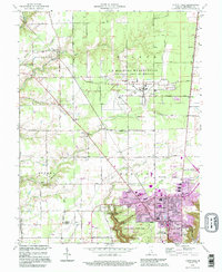
(2)- 1990 Map of Madison, 1991 Print
 1990 Madison1991 Print · USGSThe Ohio River valley and the southern Indiana plains are documented here in the final decade of the twentieth century. Genealogists and historians can trace family-named crossroads and established rail towns like Dudleytown, Austin, and Crothersville along the P C RR line.
 - 1992 Map of Clifty Falls, 1995 Print
 1992 Clifty Falls1995 Print · USGSJefferson County in the early 1990s reveals a unique landscape shaped by military operations and dramatic river bluffs. Researchers can trace family sites like Higbie Cem and Liberty Ch or explore the massive Jefferson Proving Ground.
End of results
Showing maps 1-2 of 2
Top cities near Galloways Station
- Madison historical maps
- North Vernon historical maps
- Hanover historical maps
- Lexington historical maps
- Versailles historical maps
- Lancaster historical maps
See more
Frequently asked questions
- What are the different types of historical maps available for Galloways Station?
- What is the oldest map of Galloways Station?
- Where can I purchase historical maps of Galloways Station for my home or office?
- Where can I download high-res historical maps of Galloways Station?
- Are there historical topographic maps available for Galloways Station?
- Is there historical aerial imagery available for Galloways Station?
- Where are historical maps of Galloways Station sourced from?